
PIX4D API
Download OpenAPI specification:
This document describes how to get started with the PIX4Dengine Cloud REST API, which provides third-party applications access to the Pix4D cloud service. It allows a PIX4Dengine Cloud client to access his/her data on the cloud and perform a range of operations on them.
- For end-to-end security, HTTPS is used in all the APIs
- The base URL for API endpoints is: https://cloud.pix4d.com
- Each REST API call needs to be authenticated. See Authentication below
- The communication format is expected to be JSON, unless otherwise stated
To register the application and start using the PIX4Dengine Cloud REST API, you will need to acquire a PIX4Dengine Cloud license. Please contact us at https://www.pix4d.com/enterprise/#contact to request one.
Once the license has been issued, a client_id/client_secret pair representing your application is needed. This pair will be used to authenticate.
Note that as its name suggests, client_secret is a password identifying the client application and should therefore be handled securely.
Role-Based Access to API Credentials
Not all organization members can generate API credentials. The following organization roles have permission to generate new client_id/client_secret pairs:
- Owner.
- Manager.
- Editor.
The following roles cannot generate API credentials:
- Organization reader.
- Member, with manager, editor, or reader access to a subset of resources in the organization.
Steps to Generate API Credentials
In order to generate client_id/client_secret, please follow these steps:
Log in to https://cloud.pix4d.com with your Pix4D account.
Go to your Organization dashboard through https://account.pix4d.com, choosing your Organization and going to the Dashboard.
In the Access credentials section, the list of existing keys is displayed (it will be empty the first time a user logs in):

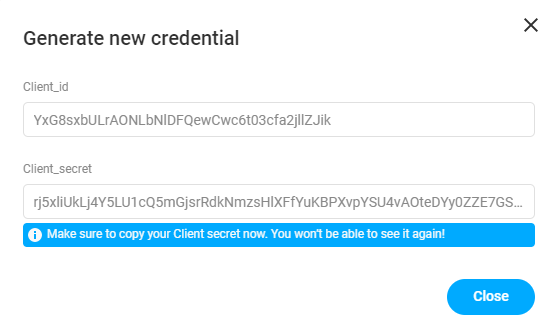
- Click on Generate new credentials and a popup will be displayed with the name of the organization the credentials will be attached to:

- Click on Generate credentials, and a new pair of credentials will be generated. Make sure they are copied, as they will not be displayed again:
In order to disable existing credentials, they have to be deleted by clicking on Delete.
Equipped with the API client_id/client_secret, the first step is to retrieve an authentication token. An authentication token identifies both the application connecting to the API and the Pix4D user this application is connecting on behalf of.
This token must then be passed along with every single request that the application makes to the API. It is passed in the HTTP Authorization header, like so:
Authorization: Bearer <ACCESS_TOKEN>
The PIX4Dengine Cloud REST API uses OAuth 2.0, the industry standard for connecting apps and accounts. OAuth 2.0 supports several "authentication flows" to retrieve an authentication token. Pix4D supports several of them that are each used for a specific purpose, but for PIX4Dengine Cloud customers, only one is relevant: "Client Credentials"
Using this flow, an API client application can get access to its own Pix4D user account (and only that account). With this method, authentication is straightforward and only requires the application's client_id/client_secret pair.
The client must send the following HTTP POST request to https://cloud.pix4d.com/oauth2/token/ with a payload containing:
grant_type: client_credentialsclient_id: the client ID of the application that was given to you by your Pix4D contactclient_secret: the client_secret of the application that was given to you by your Pix4D contacttoken_format: jwt
example:
curl --request POST \
  -d "grant_type=client_credentials&token_format=jwt&client_id=YuB7fu…&client_secret=GMSVvt8dF…" \
  https://cloud.pix4d.com/oauth2/token/
Token content
The response you receive when performing the authentication request above has the following content (In JSON):
access_token: the token value that you will have to join in all your requeststoken_type: for Pix4D, this is always a Bearer tokenexpires_in: the number of seconds the token is valid for. After this number of seconds, API requests using this token will get rejected, and you will need to request a new token through the authentication procedure againscope: describe what the token is valid for. In this case, it's always "read" and "write" since you get full access to your own account
{
  "access_token": "<ACCESS_TOKEN>",
  "expires_in": 172800,
  "token_type": "Bearer",
  "scope": "read:cloud write:cloud"
}
The access token is a typical JWT, with the standard claims (sub, iat, exp etc).
However, it also contains a pix4d.com/org claim, that gives you the UUID of the Organization your
credentials are attached to.
The JWT can be verified against the PIX4D public key available here: https://cloud.pix4d.com/static/public_keys/jwt_sig.pub.
Refreshing the token
When the token expires, you simply need to perform the above authentication procedure again to get a fresh token.
In this guide, you will discover how to get a token, upload a new project, get it processed, and access the results.
API Access
You need a PIX4Dengine Cloud license to authenticate and get access to the API. Please contact your Pix4D reseller to start a trial if you don't have a license already. More information is available on PIX4Dengine Cloud on our product page.
With this license comes your authentication information, Client ID, and Client Secret Key, which are the two values you need in this guide.
Terminal tooling
This guide can be completed from the Terminal using basic tooling:
curlcommand line is used to call the API; it should be included in your OS or docker imageaws-cliis used to upload and download the data; you can get it directly from AWS: https://aws.amazon.com/cli/
Photos to process
We will use a set of photos to be processed in this guide. If you don't have a good dataset at your disposal, feel free to download one of our sample datasets, for example, the building dataset. Select "Download" then "Input Images" from the UI. We consider you are unzipping the archive in ./photos in this guide.
We are using the OAuth2 Client Credentials flow to generate an access token. Using the Client ID and Client Secret provided with your PIX4Dengine Cloud license, you can get an Access Token using the following curl command:
export PIX4D_CLIENT_ID=__YOUR_CLIENT_ID__
export PIX4D_CLIENT_SECRET=__YOUR_CLIENT_SECRET_KEY__
curl --request POST \
  --url https://cloud.pix4d.com/oauth2/token/ \
  --form client_id=$PIX4D_CLIENT_ID \
  --form client_secret=$PIX4D_CLIENT_SECRET \
  --form grant_type=client_credentials \
  --form token_type=access_token \
  --form token_format=jwt
The response body is a JSON document containing an access_token attribute:
{
  "access_token": "<__PIX4D_ACCESS_TOKEN__>",
  "expires_in": 172800,
  "token_type": "Bearer",
  "scope": "read:cloud write:cloud"
}
For the following example, we will reference the token as PIX4D_ACCESS_TOKEN.
export PIX4D_ACCESS_TOKEN=__PIX4D_ACCESS_TOKEN__
You can learn more about authentication in the reference documentation (see Authentication).
It is strongly recommended to override your HTTP tool's User-Agent header to declare your software name and version.
If there is a bad actor trying to access PIX4Dcloud having this correctly set allows us to not block your application, but to firewall the bad actor, to ensure a level of service.
When using a library for your programming language of choice, it will normally set a default value, which is usually the library name. This should be overwritten, as any other client using this will present with the same value and not allow us to discriminate traffic effectively.
Let's start by creating a project. The only required parameter is the project name, which can be passed as a JSON payload in the request body.
curl --request POST \
  --url https://cloud.pix4d.com/project/api/v3/projects/ \
  --header "Authorization: Bearer ${PIX4D_ACCESS_TOKEN}" \
  --header "Content-Type: application/json" \
  --data '{"name": "My first project"}'
The response will be a 201 CREATED and the response body will include the project details. Please keep note of the project id and important AWS S3 properties that we will use later.
This is an extract of the interesting JSON properties
{
  "id": 877866,
  "bucket_name": "prod-pix4d-cloud-default",
  "s3_base_path": "user-123123123121312/project-877866"
}
export PROJECT_ID=<THE PROJECT ID>
export S3_BUCKET=prod-pix4d-cloud-default
export S3_BASE_PATH="user-123123123121312/project-877866"
It is recommended to use the shell AWS CLI or the python boto3 library but other tools can work as well. First, we need to retrieve the AWS S3 credentials associated with this project:
curl --url https://cloud.pix4d.com/project/api/v3/projects/$PROJECT_ID/s3_credentials/ \
  --header "Authorization: Bearer ${PIX4D_ACCESS_TOKEN}" \
  --header "Content-Type: application/json"
The answer contains all the S3 information we need, at least the access_key, secret_key, and the session_token.
{
  "access_key": "ASIATOCJLBKSU2CVJIHR",
  "secret_key": "5OGGBSvn8Sesdu8l...<remainder of secret key>",
  "session_token": "FwoGZXIvYX...<remainder of security token>",
  "expiration": "2021-05-10T21:55:47Z",
  "bucket": "prod-pix4d-cloud-default",
  "key": "user-199a56ab-7ac6-d6d1-4778-5b4d338fc9de/project-883349",
  "server_time": "2021-05-19T09:55:47.357641+00:00",
  "region": "us-east-1",
  "is_bucket_accelerated": true,
  "endpoint_override": "s3-accelerate.amazonaws.com"
}
We can store the S3 credentials in our environment so that they will get picked up by the AWS CLI tool.
export AWS_ACCESS_KEY_ID=ASIATOCJLBKSU2CVJIHR
export AWS_SECRET_ACCESS_KEY='5OGGBSvn8Sesdu8l...<remainder of secret key>'
export AWS_SESSION_TOKEN='FwoGZXIvYX...<remainder of security token>'
export AWS_REGION='us-east-1'
export AWS_S3_USE_ACCELERATE_ENDPOINT=true
Make sure to prefix all your desired destination locations with the path returned in the credentials call. This is the only place for which write access is granted. Make sure that the files are proper images and their names include an extension supported by Pix4D.
Provided your images are located in a folder located at $HOME/images, and that it contains only images, you can run the command:
aws s3 cp ./images/ "s3://${S3_BUCKET}/${S3_BASE_PATH}/" --recursive
If your folder contains multiple images, you need to upload them one by one, which may require the use of a script.
aws s3 cp $HOME/images/ "s3://${S3_BUCKET}/${S3_BASE_PATH}/" --recursive
You then need to register the images in the PIX4Dengine Cloud API so that they will be processed. It is possible to upload files that are not project inputs, and it is not possible to know which files are meant as input. It is therefore required to register each S3 uploaded file in the API. Register the uploaded files you uploaded (single API call):
curl --request POST --url https://cloud.pix4d.com/project/api/v3/projects/$PROJECT_ID/inputs/bulk_register/ \
  --header "Authorization: Bearer ${PIX4D_ACCESS_TOKEN}" \
  --header "Content-Type: application/json" \
  --data "{
      \"input_file_keys\": [
        \"${S3_BASE_PATH}/P0350035.JPG\",
        \"${S3_BASE_PATH}/P0360036.JPG\",
        \"${S3_BASE_PATH}/P0370037.JPG\",
        \"${S3_BASE_PATH}/P0380038.JPG\",
        \"${S3_BASE_PATH}/P0390039.JPG\",
        \"${S3_BASE_PATH}/P0400040.JPG\",
        \"${S3_BASE_PATH}/P0410041.JPG\",
        \"${S3_BASE_PATH}/P0420042.JPG\",
        \"${S3_BASE_PATH}/P0430043.JPG\",
        \"${S3_BASE_PATH}/P0440044.JPG\"
      ]
    }"
The response should confirm that the various images have been registered amongst other data.
{ "nb_images_registered": 10 }
You are now ready to start processing your project:
curl --request POST --url https://cloud.pix4d.com/project/api/v3/projects/$PROJECT_ID/start_processing/ \
  --header "Authorization: Bearer ${PIX4D_ACCESS_TOKEN}" \
  --header "Content-Type: application/json"
curl --url https://cloud.pix4d.com/project/api/v3/projects/$PROJECT_ID/ \
  --header "Authorization: Bearer ${PIX4D_ACCESS_TOKEN}" \
  --header "Content-Type: application/json"
A response can look like:
{
  "id": 883349,
  "name": "My first project",
  "display_name": "My first project",
  "project_group_id": null,
  "is_demo": false,
  "is_geolocalized": true,
  "create_date": "2021-05-19T11:53:39.504849+02:00",
  "public_status": "PROCESSING",
  "display_detailed_status": "Waiting for processing",
  "error_reason": "",
  "user_display_name": "Jhon Doe",
  "project_thumb": "<__URL__>",
  "detail_url": "https://cloud.pix4d.com/project/api/v3/projects/883349/",
  "acquisition_date": "2021-05-19T11:53:38.973075+02:00",
  "project_type": "pro",
  "image_count": 10,
  "last_datetime_processing_started": "2021-05-19T10:58:10.514800Z",
  "last_datetime_processing_ended": null,
  "bucket_name": "prod-pix4d-cloud-default",
  "s3_bucket_region": "us-east-1",
  "s3_base_path": "user-188a56ab-7ac6-d6d1-4778-5b4d338fc9de/project-883349",
  "never_delete": false,
  "under_trial": false,
  "uuid": "239ae97821d54f98975bc0afa2fcc72f",
  "coordinate_system": "",
  "outputs": {
    "mesh": { "texture_res": {} },
    "images": {
      "project_thumb": {
        "status": "processed",
        "name": "project_thumb.jpg",
        "s3_key": "user-188a56ab-7ac6-d6d1-4778-5b4d338fc9de/project-883349/thumb/project_thumb.jpg",
        "s3_bucket": "prod-pix4d-cloud-default"
      },
      "reflectance": {}
    },
    "map": { "layers": {}, "bounds": { "sw": [0, 0], "ne": [0, 0] } },
    "bundles": {
      "inputs": {
        "status": "requestable",
        "request_url": "https://cloud.pix4d.com/project/api/v3/projects/883349/inputs/zip/"
      }
    },
    "reports": {}
  },
  "min_zoom": -1,
  "max_zoom": -1,
  "proj_pipeline": ""
}
Once the status changes from PROCESSING to DONE, the project's main outputs are ready to be retrieved.
Once the project is processed, by querying its details, it is possible to:
- Get its PIX4Dcloud visualization page
- Get its PIX4Dcloud public page link (read-only)
- Get any asset that was produced (in the form of an S3 link to the asset to be downloaded)
This guide describes all of the different ways to process a project with PIX4Dengine Cloud API. Once the project has been created, in order to process it, the following endpoint must be called:
POST on https://cloud.pix4d.com/project/api/v3/projects/{id}/start_processing/ See the full documentation for this endpoint.
The body request includes:
{
  "tags": ["string"]
}
Depending on the type of processing, not all of the parameters in the request body are required. There are different types of processing:
- Nadir images (3d-maps)
- Flat terrain
- Oblique images
Unless explicitly specified, processing types are mutually exclusive.
- Mobile processing
- Building reconstruction projects
A faster processing pipeline for nadir datasets with the newest algorithms that yields better results and has better management of coordinate systems. It supports vertical coordinate systems over an ellipsoid, geoid model, or user-defined constant geoid undulation. This pipeline also produces a 3D mesh with improved visualization in the PIX4Dcloud viewer.
This is the default pipeline if nothing is specified.
It can produce the following outputs:
- Orthophoto
- DSM
- Point cloud
- 3D mesh
Similarly to the other pipelines, it can be selected by using nadir (or equivalently 3d-maps) in the tags parameter of the processing options payload:
{
  "tags": [
    "nadir"
  ]
}
Flat terrain
Enable specific settings for a particularly flat scene, such as a field with few to no vertical structures, such as trees or buildings. To enable those settings, use the flat tag in addition to the above nadir one in the tags parameters of the processing options payload:
{
  "tags": [
    "nadir",
    "flat"
  ]
}
Note that this tag is only valid for nadir processing pipelines (meaning together with nadir or 3d-maps tags), oblique nor building processing pipelines.
A faster processing pipeline for oblique datasets with the newest algorithms that yields better results and has better management of coordinate system (e.g. it supports vertical coordinate systems: ellipsoidal, geoid or user-defined constant geoid undulation). This pipeline also produces a 3D mesh with improved visualization in the PIX4Dcloud viewer.
It can produce the following outputs:
- Orthophoto
- DSM
- Point cloud
- 3D mesh
Similarly to the other pipelines, it can be selected by using oblique in the tags parameter of the processing options payload:
{
  "tags": [
    "oblique"
  ]
}
The API provides a third processing pipeline for images (and depth data optionally) captured by the PIX4Dcatch. This photogrammetric pipeline is optimized for this type of data and produces better and faster results. It can be used with images, or if your mobile device is equipped with a LiDAR scanner, the pipeline will use both images and depth data in the process. The outputs generated after processing are Orthophoto, DSM, point cloud, and 3D mesh. This pipeline is automatically selected when using images captured with Pix4Dcatch.
The LiDAR scanner captures depth information during the image acquisition. These LiDAR points will compensate for the lack of 3D points over reflective and low-texture surfaces.
More information on combining photogrammetry and LiDAR can be found in this article: https://www.pix4d.com/blog/lidar-photogrammetry
For images captured from oblique flights around targets with featureless facades, such as walls of a uniform color and texture, the building reconstruction pipeline can provide higher-quality results than standard processing would otherwise.
This pipeline can be selected by passing building in the tags parameter:
{
  "tags": [
    "building"
  ]
}
Limitations
- Only RGB cameras and nadir flights are supported. See the full list of supported cameras
- The outputs generated are: Orthophoto, DSM, and log file (no point cloud or 3D mesh is generated)
- It is not possible to define specific processing options. The computation will always use the default parameters and will produce an ortho and DSM with a default resolution
- If the pipeline is used in areas with a lot of height changes (urban areas for example), artifacts in the ortho might appear
In the event of processing failure, an error code* and reason are given in the project details API response. Error codes are intended to be machine-readable, while error reasons are human-readable messages to aid in debugging.
The following table describes the possible error codes and their corresponding reasons:
| Code | Reason | Potential Mitigation |
|---|---|---|
| 10001 | An unexpected error occurred. | |
| 10002 | Processing exceeded allotted time. | |
| 10003 | Processing exceeded available resources. | |
| 10101 | Failed to create cameras. More information will be available in the processing log. | Refer to the processing log for additional details. |
| 10201 | Failed to calibrate a sufficient number of cameras. | Verify the image quality and overlap. |
| 10402 | Point cloud generation failed. | Verify the image quality and overlap. |
| 10410 | Processing failed. | |
| 10411 | Failed to densify sparse point cloud. | Verify the quality of the calibration. |
| 10501 | 3D textured mesh generation failed. | Ensure that the dense point cloud consists of a single block. |
| 10601 | The input data is not valid. | |
| 10611 | The selected output CRS is not isometric. | Use a valid isometric CRS. |
| 10612 | The selected output CRS is not projected or arbitrary. | Use a valid projected or arbitrary CRS. |
| 10613 | An output CRS cannot be defined without a horizontal CRS component. | Use a valid CRS with an horizontal component. |
| 10614 | A geoid model or geoid height cannot be specified without a CRS vertical component. | Remove the geoid model or add a vertical component to the CRS. |
| 10615 | A geoid height cannot be specified with a geoid model. | Remove the geoid height or add a geoid model to the CRS. |
Here we will guide you through creating a "Site" to group Projects into a timeline view.
The primary use case for this is to group Projects of the same location, created over a time period, for example to track a building construction project.
In the Cloud Frontend you can compare these projects easily to see the differences between any of the processed assets in both 2D and 3D views.
POST on *https://cloud.pix4d.com/project/api/v3/project-groups/
specifying a name and setting the project_group_type to bim.
curl --request POST --url https://cloud.pix4d.com/project/api/v3/project_groups/ \
  --header "Authorization: Bearer ${PIX4D_ACCESS_TOKEN}" \
  --header "Content-Type: application/json"
  --data '{"name": "Construction site 123", "project_group_type": "bim"}`
This will return the information about the Site (ProjectGroup) you have created, including it's id.
{
  "name": "Construction site 123",
  "id": 112233,
  ...
}
To assign a Project to a Site you can PUT the project into the project_group (a.k.a Site) using
the move_batch endpoint. You will need to supply the Organization's uuid in the owner_uuid field.
Note: using the PATCH method on the Project detail endpoint (project/api/v3/projects/<id>/) to move projects
is deprecated and will be removed at some point in Q3 2025.
curl --request PUT \
  --url https://cloud.pix4d.com/common/api/v4/drive/move_batch/ \
  --header "Authorization: Bearer ${PIX4D_ACCESS_TOKEN}" \
  --header 'content-type: application/json' \
  --data '{
  "owner_uuid": "58101312-de35-4a22-a951-943eba20a041",
  "source_nodes": [
    {
      "type": "project",
      "uuid": "0c26579b-f2ad-4dfb-a253-a4c43dbbbf53"
    }
  ],
  "target_type": "project_group",
  "target_uuid": "50df7f65-f480-4fcc-9f86-32d8d7724689"
}'
To un-assign a Project from a Site you can PUT the project into the organization (or even a folder) using
the move_batch endpoint. You will need to supply the Organization's uuid in the owner_uuid field.
Note: using the PATCH method on the Project detail endpoint (project/api/v3/projects/<id>/) to move projects
is deprecated and will be removed at some point in Q3 2025.
curl --request PUT \
  --url https://cloud.pix4d.com/common/api/v4/drive/move_batch/ \
  --header "Authorization: Bearer ${PIX4D_ACCESS_TOKEN}" \
  --header 'content-type: application/json' \
  --data '{
  "owner_uuid": "58101312-de35-4a22-a951-943eba20a041",
  "source_nodes": [
    {
      "type": "project",
      "uuid": "0c26579b-f2ad-4dfb-a253-a4c43dbbbf53"
    }
  ],
  "target_type": "organization",
  "target_uuid": "58101312-de35-4a22-a951-943eba20a041"
}'
The images which are uploaded for processing can have two different coordinate systems:
- WGS84
The image tags include latitude, longitude and ellipsoidal height with respect to WGS84 and will be taken automatically by the software. In that case, the input coordinate system is set to WGS84.
- Arbitrary
The images do not have any geolocation and then the input coordinate system is set to arbitrary.
Any other input coordinate system is not supported.
It is the coordinate system to which the outputs will refer to.
Default output coordinate system
When nothing is specified, the output coordinate system is set up by default:
If the input coordinate system is WGS84, the default output coordinate system will be WGS84 / UTM XX. XX or the UTM zone depends on the position of the images
If the input coordinate system is arbitrary, the output coordinate system will also be arbitrary
User-defined output coordinate system
It is possible to define an output coordinate system when the project is created:
POST on https://cloud.pix4d.com/project/api/v3/projects/
One of the parameters of the request body is coordinate_system which can be either:
- a full WKT string representing the coordinate system (can be an arbitrary one)
- a valid EPSG code, given in the format EPSG:2056 (only projected coordinate systems are supported)
- In order to get the result in an arbitrary system, the WKT string can include either:
- the value ARBITRARY_METERS that will produce the result in an arbitrary default coordinate system in meters
- the value ARBITRARY_FEET that will produce the result in an arbitrary default coordinate system in feet
- the value ARBITRARY_US_FEET that will produce the result in an arbitrary default coordinate system in US survey feet
{
  "coordinate_system": "string"
}
- Vertical Input coordinate system
The vertical input coordinate system will be ellipsoidal
- Vertical output coordinate system
The vertical output coordinate system will always be EGM 96 Geoid.
spatialreference.org hosts a database of EPSG registered coordinate systems which should cover most needs related to horizontal CS. For example, to select the Swiss coordinate system CH1903, one would search for it on the database and export in OGC WKT format to get the WKT string as expected by PIX4D:
PROJCS["CH1903 / LV03",
    GEOGCS["CH1903",
        DATUM["CH1903",
            SPHEROID["Bessel 1841",6377397.155,299.1528128,
                AUTHORITY["EPSG","7004"]],
            AUTHORITY["EPSG","6149"]],
        PRIMEM["Greenwich",0,
            AUTHORITY["EPSG","8901"]],
        UNIT["degree",0.0174532925199433,
            AUTHORITY["EPSG","9122"]],
        AUTHORITY["EPSG","4149"]],
    PROJECTION["Hotine_Oblique_Mercator_Azimuth_Center"],
    PARAMETER["latitude_of_center",46.9524055555556],
    PARAMETER["longitude_of_center",7.43958333333333],
    PARAMETER["azimuth",90],
    PARAMETER["rectified_grid_angle",90],
    PARAMETER["scale_factor",1],
    PARAMETER["false_easting",600000],
    PARAMETER["false_northing",200000],
    UNIT["metre",1,
        AUTHORITY["EPSG","9001"]],
    AXIS["Easting",EAST],
    AXIS["Northing",NORTH],
    AUTHORITY["EPSG","21781"]]
Coordinate systems must comply with the WKT standards:
- Geographic horizontal system e.g. WGS84, in this case the WKT starts with GEOGCS
- Projected horizontal system e.g. WGS84 / UTM zone 32, in this case the WKT starts with PROJCS
- Arbitrary horizontal system, in this case the WKT starts with LOCAL_CS
Learn how to use Ground Control Points (GCP) or Manual Tie Points (MTP) and Check Points in the computation.
A Ground Control Point (GCP) is a characteristic point which coordinates are known. The coordinates have been measured with traditional surveying methods or have been obtained by other sources (LiDAR, older maps of the area, Web Map Service). GCPs are used to georeference a project and reduce the noise.
A Manual Tie Point (MTP) is a characteristic point for which the coordinates are not known, but which is visible and accurately identifiable from several images, e.g. the corner of a wall. This is used to help the photogrammetry process to join the images in the scene.
Ground Control Points (GCPs)
The use of GCPs is possible with all PIX4D engines.
Once the project has been created and before processing it, it is possible to pass GCP coordinates which will be used in the computation:
POST on /project/api/v3/projects/{id}/gcp/register ({id} is the project ID)
Request body is as follows:
{
  "gcps": [
    {
        "name": "GCP_123",
        "point_type": "CHECKPOINT",
        "x": 1.23,
        "y": 45.2,
        "z": 445.87,
        "xy_accuracy": 0.02,
        "z_accuracy": 0.02
    },
    {...}
  ]
}
- "name": It must be unique for each of the points
- "point_type": It can be either "CHECKPOINT" or "GCP". This article explains the difference between both
- "x","y","z": Coordinates of the point. They have to refer to the output coordinate system of the project and in the same units as the output coordinate system. Geographical coordinates are not supported
- "xy_accuracy","z_accuracy": The planimetric and altimetric accuracy of the GCPs or Check Points
Important
The coordinates of a GCP are:
- "x" : Coordinate in East direction (or West in some specific coordinate systems as in the example below)
- "y" : Coordinate in North direction (or South in some specific coordinate systems as in the example below)
- "z" : The altitude with respect to the ellipsoid of the geoid
Although most coordinate system are defined as above, there are some cases where the orientations of the axes are different. As an example, a coordinate system in Japan and another one in South Africa:
- JGD2011 / Japan Plane Rectangular CS VI : The "x" coordinate is pointing to the North and the "y" is pointing to the East. In this case, the x,y coordinates have to be flipped so that the "x" in the body requests points to the East and the "y" points to North.
- Cape / Lo17 : The "x" coordinate is pointing to the South and the "y" is pointing to the West. In this case, the x,y coordinates have to be flipped so that the "x" in the body requets points to the West and the "y" points to South.
More information about GCPs
Manual Tie Points (MTPs)
MTPs can be created similarly to GCPs, but omitting the georeferencing, and through a different endpoint:
POST on /project/api/v3/projects/{id}/mtp/ ({id} is the project ID)
Request body is as follows:
{
  "mtps": [
    {
        "name": "MTP_456",
        "is_checkpoint": false,
    },
    {...}
  ]
}
- "name": It must be unique for each of the points in the project.
- "is_checkpoint": Similar to the GCP
point_type. This article explains the difference between both.
GCP and MTP Marks
Once the GCP or MTP data has been registered, it is necessary to also pass the marks of each GCP/MTP, in other words the pixel coordinates of the GCPs/MTPs in each of the images.
For GCP and MTP Marks the gcp field is used for the name of the GCP or MTP.
POST on /project/api/v3/projects/{id}/mark/register/ ({id} is the project ID)
Request body is as follows:
{
  "marks": [
    {
      "gcp": "GCP_123",
      "photo": "user-123/project-354/my_file.jpg",
      "x": 1.23,
      "y": 45.2,
    },
    {...}
  ]
}
- "gcp": Name of the GCP/MTP registered in the previous step
- "photo" : Photo
s3_keywhere the GCP/MTP has been marked (each GCP/MTP must be marked in at least two photos) - "x" and "y" : Pixel coordinates (units are pixels) of the mark in the Photo
In order to mark the GCP/MTP in the images, it is possible to use PIX4Dmatic or other third party applications.
This guide describes the specific case of using Pix4D AutoGCP to automatically mark GCPs and process a project with PIX4Dengine Cloud API.
This allows you to simply upload GCP coordinates and images, and the system will take care of marking GCP targets in the images. If you have manually generated the marks data then see this article on how to use that data directly.
Creating the project and uploading images is the same as in other examples.
For information on how to optimally set out your marks on your survey site see this article.
This is the same as in other examples.
You must also set the coordinate_system when creating the project.
This should be the same coordinate system as your GCPs.
This is as described in the GCPs
Call the start processing endpoint as with all processing.
Processing with AutoGCP will take some extra time, due to the extra compute required to analyse and mark the GCPs on the input images.
This feature allows the user to define a region of interest, which means no reconstructions will be created outside the defined area when processing a project with PIX4Dengine Cloud API.
Once the project has been created, in order to define the region of interest, the following endpoint must be called:
POST on https://cloud.pix4d.com/project/api/v3/projects/{id}/processing_options/ See the full documentation for this endpoint.
The body request includes:
{
  "area": {
    "plane": {
      "vertices3d": [
        [
          "float",
          "float",
          "float"
        ],
        [
          "float",
          "float",
          "float"
        ],
        [
          "float",
          "float",
          "float"
        ],
        [
          "float",
          "float",
          "float"
        ]
      ],
      "outer_boundary": [
        "int",
        "int",
        "int",
        "int"
      ],
    },
    "thickness": "float"
  }
}
The only required field to set a region of interest is the plane, which consists of:
- The
vertices3ddefines a list of 3D locations in WGS 84. For now, the altitude orzvalue of the location is not considered and the areas defined will be applied only in the 2D plane. - The
outer_boundarydefines the order each location stored invertices3dmust be considered when drawing the area.
There is also an optional field available inside plane named inner_boundaries to define areas inside the main area (defined with the outer_boundary) to be excluded from processing.
Finally, the thickness field is defined as a limit distance from the plane in the normal direction. If not specified, it is assumed to be infinite (usual case when limiting the region of interest).
- Standard region of interest
{
  "area": {
    "plane": {
      "vertices3d": [
        [
          3.248295746230309,
          43.415212850276255,
          0
        ],
        [
          3.2484144251306066,
          43.41525557252694,
          0
        ],
        [
          3.248465887662594,
          43.415162880462645,
          0
        ],
        [
          3.2483382815883806,
          43.415126642785765,
          0
        ]
      ],
      "outer_boundary": [
        0,
        1,
        2,
        3
      ]
    }
  }
}
- Region of interest with inner excluded zones
{
  "area": {
    "plane": {
      "vertices3d": [
        [
          3.248295746230309,
          43.415212850276255,
          0
        ],
        [
          3.2484144251306066,
          43.41525557252694,
          0
        ],
        [
          3.248465887662594,
          43.415162880462645,
          0
        ],
        [
          3.2483382815883806,
          43.415126642785765,
          0
        ],
        [
          3.248345633378664,
          43.415194540731015,
          0
        ],
        [
          3.248360336959232,
          43.415163261911765,
          0
        ],
        [
          3.248417050769994,
          43.41518500450734,
          0
        ]
      ],
      "outer_boundary": [
        0,
        1,
        2,
        3
      ],
      "inner_boundaries": [
        [
          4,
          5,
          6
        ]
      ]
    }
  }
}
A volume can be computed for a given project available on PIX4Dcloud and it is computed between a base surface boundary and the terrain surface.
The base surface boundary is given as a set of vertex coordinates and defines the base plane for the volume calculation.
Before running this computation, make sure that:
- Project is in a
PROCESSEDstate - DSM exists for the project
To compute the volume, send a POST request to https://api.webgis.pix4d.com/v1/project/{id}/volumes/.
The payload body fields are contained in the list below.
The payload must be in the same coordinate system and the same units as the project.
| Parameter | Type |
|---|---|
| base_surface | String |
| coordinates | Array[Array[Number]] |
| custom_elevation | Number |
Base surface
This parameter allows to select the base plane for the volume calculation. Accepted values are:
- average
- custom
- fitPlane
- triangulated
- highest
- lowest
When using custom, the custom_elevation parameter is required (see below).
More information about the different base surfaces at Menu View > Volumes > Sidebar > Objects
Coordinates
Each set of coordinates refers to a vertex of the boundary and they must be given with respect to the output project coordinate system and in the same units as the projects (meters, feet or US foot).
custom_elevation
Optional. The elevation MUST be provided when the base_surface is set to custom. If custom_elevation is provided, only X,Y vertex coordinates are needed, the Z is the custom_elevation.
units
Optional. If not provided, the preferred units will be used to calculate the volume
Accepted values are:
m(Metres)yd(Yards)ydUS(US Survey Yards)
The response parameters will be in the same coordinate system and same units and the same units as the project. If the project is in meters, the volume will be computed in m³. If the project is in feet or US foot, the volume will be computed in yd³.
| Parameter | Type |
|---|---|
| cut | Number |
| cut_error | Number |
| fill | Number |
| fill_error | Number |
cut
The volume that is above the volume base. The volume is measured between the volume base and the surface defined by the DSM.
cut_error
Error estimation of the cut volume.
fill
The volume that is below the volume base. The volume is measured between the volume base and the surface defined by the DSM.
fill_error
Error estimation of the fill volume.
HTTP status code 200 - OK
If the request is successful, the body includes volumes and error estimations. The order of the response body fields doesn’t matter and is not guaranteed.
{
  "cut": Number,
  "cut_error": Number,
  "fill": Number,
  "fill_error": Number
}
HTTP status code 504 - Gateway Timeout
{
  "message": "Network error communicating with endpoint"
}
| Cause | Likely a networking issue either in the API Gateway, or any server that failed to route the request properly to the next point |
| Solution | Resend the request |
{
  "message": "Endpoint request timed out"
}
| Cause | The request took more than 29 seconds to compute. One of the reasons might be that too many vertices to describe the polygon boundary are sent |
| Solution | Reduce the number of the polygon vertices |
HTTP status code 404 - Not found
{
  "title": "404 Not Found"
}
| Cause | The project doesn’t exist |
| Solution | Check that the project exists |
HTTP status code 400 - Bad request
{
  "title": "No COG DSM found for this project"
}
| Cause | The project doesn’t have a DSM. There may also be a delay between registering a DSM and the volume calculation being available, as PIX4Dcloud creates the COG DSM |
| Solution | Check that the project has a DSM. Allow some time for the system to register the DSM and create the COG DSM |
{
  "title": "The polygon doesn't overlap the dataset"
}
| Cause | The vertices of the defined polygon lie outside the DSM |
{
  "title": "Invalid Polygon"
}
| Cause | The interpolation of elevations inside the polygon boundary failed |
{
  "title": "Too much data requested"
}
| Cause | The DSM doesn’t have a high enough overview level, as a result it is not possible to extract the maximum amount of data that is defined by the API |
| Solution | A possible solution could be to reduce the size of the area for which the volume needs to be computed. If it is not a suitable solution or the issue persists contact the Support |
For a complete demonstration of a volume computation, see this Jupiter Notebook.
The following examples show the request body to POST to https://api.webgis.pix4d.com/v1/project/{id}/volumes/
Calculate a volume with a triangulated base surface
{
  "base_surface": "triangulated",
  "coordinates": [
    [328726.692, 4688271.030, 159.725],
    [328728.351, 4688298.208, 150.376],
    [328750.527, 4688289.860, 150.250],
    [328744.430, 4688271.645, 150.056]
  ]
}
Calculate a volume with a custom base surface
{
  "base_surface": "triangulated",
  "coordinates": [
    [419430.327, 3469059.806],
    [419429.338, 3469056.812],
    [419431.319, 3469060.816],
    [419433.329, 3469058.803]
  ],
  "custom_elevation": 40.52
}
Note: The coordinates of the vertices are given with respect to the output project coordinate system and in the same units as the projects (meters, feet or US foot).
Use PIX4Dcatch to capture your scene.
Once the capture is complete, select "Export all data" to generate the ZIP file.
Create your project
This is the same as in other examples.
Upload the ZIP file
Instead of uploading images, upload the ZIP file exported from PIX4Dcatch to S3.
aws s3 cp inputs.zip "s3://${S3_BUCKET}/${S3_BASE_PATH}/"
Then, register the ZIP file in place of the images.
curl --request POST \
  --header "Authorization: Bearer ${PIX4D_ACCESS_TOKEN}" \
  --header "Content-Type: application/json" \
  --data \
    "{
      \"input_file_keys\": [
        \"${S3_BASE_PATH}/inputs.zip\"
      ]
    }" \
  https://cloud.pix4d.com/project/api/v3/projects/$PROJECT_ID/inputs/bulk_register/
- Finally, continue the flow to start processing
The ZIP file exported from PIX4Dcatch will be compatible with PIX4Dcloud.
If you need to modify the ZIP file's contents however, there are certain things you should be aware of.
- It must contain a file at the root level called
manifest.json - This file must provide a semantic description of all the files in the ZIP archive, except
manifest.jsonitself - The
manifest.jsonmust conform to the JSON schema
Optionally you could also pass the list of GCPs and Marks in the zip contents with respect to the JSON schema defined for it.
The input_control_points.json file must be compliant to below rules.
- The zip bundle is completely self-consistent. It means all the Images and GCPs referenced by the Marks must be present in the zip itself.
- The
idfor each GCP must be unique. - The CRS passed in the GCPs list:
- Only EPSG format is supported
- The
definitionproperty in the CRS should have:- A string in the format
Authority:code+codewhere the first code is for a 2D CRS and the second one if for a vertical CRS (e.g.EPSG:4326+5773). - A string in the form
Authority:code+Auhority:codewhere the first code is for a 2D CRS and the second one if for a vertical CRS (e.g.EPSG:4326+EPSG:5773). - A string in the form
Authority:codewhere the code is for a 2D or 3D CRS (e.g.EPSG:4326).
- A string in the format
- In CRS, optional
geoid_heightcan be passed. Please note thatgeoidis not supported in the current schema. - All GCPs must contain the same CRS
- If the output CRS is not already set, the GCP CRS will be used as the output CRS
- If the output CRS is already set using the processing_options endpoint, the GCP coordinates will be transformed in to the output CRS
- If the output CRS is already set in the project
coordinate_systems, it will give an validation error.
If any of these requirements are not met then your project will not process and will be marked as errored.
The example of the zip file layout will look like:
├── input_control_points.json
├── logs
│   ├── log.json
│   └── test
│       └── abc.txt
├── manifest.json
├── new_sample
│   └── new
│       └── sample_image4.jpg
├── sample
│   └── sample_image3.jpg
├── sample_image1.jpg
└── sample_image2.jpg
The manifest.json from this zip file will contain:
{
    "inputs": [
        "sample_image1.jpg",
        "sample_image2.jpg",
        "sample/sample_image3.jpg",
        "new_sample/new/sample_image4.jpg"
    ],
    "log_files": [
        "logs/log.json",
        "logs/test/abc.txt"
    ],
    "input_control_points": "input_control_points.json"
}
and the input_control_points.json from this zip file will have the list of all GCPs and the Marks as below.
{
    "format": "application/opf-input-control-points+json",
    "version": "0.2",
    "gcps": [
        {
            "id": "gcp0",
            "geolocation": {
                "crs": {
                    "definition": "EPSG:4265+EPSG:5214",
                    "geoid_height": 14
                },
                "coordinates": [
                    1,
                    2,
                    3
                ],
                "sigmas": [
                    5,
                    5,
                    10
                ]
            },
            "marks": [
                {
                    "photo": "sample_image1.jpg",
                    "position_px": [
                        458,
                        668
                    ],
                    "accuracy": 1.0
                }
            ],
            "is_checkpoint": true
        }
    ],
    "mtps": []
}
Once the project has been processed, a user can retrieve various data which are stored on the servers.
- Single files: any output, report, or input image can be requested individually
- ZIP files: All of the input images and available outputs and reports can be requested together in a ZIP file
1. Get "s3_key" and "s3_bucket" of the file which you want to retrieve
- Possible outputs and reports
GET on https://cloud.pix4d.com/project/api/v3/projects/{id}/outputs/
The response body will include the s3_key and s3_bucket of all of the output types. An example bellow shows the output point_cloud :
{
  "result_type": "point_cloud",
  "output_type": "point_cloud",
  "availability": "done",
  "s3_key": "user-123123123123123123123123/project-741581/test_3dmaps/2_densification/point_cloud/test_3dmaps_group1_densified_point_cloud.las",
  "s3_bucket": "prod-pix4d-cloud-default",
  "s3_region": "us-east-1",
  "output_id": 147817230
}
A list of the main outputs which can be obtained is shown below:
| Result type | Output type | Description |
|---|---|---|
| ortho | ortho | Transparent orthomosaic in TIFF format |
| ortho | ortho_rgba_bundle | ZIP file containing transparent orthomosaic in TIFF format, .prj and .tfw files |
| ortho | ortho_rgb | Opaque orthomosaic in TIFF format |
| ortho | ortho_rgb_bundle | ZIP file containing opaque orthomosaic in TIFF format, .prj and .tfw files |
| ortho | ortho_cloud_optimized | Ortho in Cloud-Optimized Geotiff format |
| ortho | ortho_cloud_optimized_display | Ortho in Cloud-Optimized GeoTIFF format in Web Mercator CRS |
| dsm | dsm | Digital Surface Model (DSM) in TIFF format |
| dsm | dsm_cloud_optimized | DSM in Cloud-Optimized Geotiff format |
| dsm | dsm_cloud_optimized_display | DSM in Cloud-Optimized GeoTIFF format in Web Mercator CRS |
| point_cloud | point_cloud | Generated point cloud in LAS or LAZ format |
| point_cloud_slpk | point_cloud_slpk | Generated point cloud in SLPK format |
| 3d_mesh_obj | 3d_mesh_obj_zip | ZIP file containing .obj, .mtl, and .jpg files |
| 3d_mesh_obj | 3d_mesh_fbx | 3Dmesh in FBX format |
| 3d_mesh_obj | b3dm_js | 3Dmesh in Cesium format (index file) |
| 3d_mesh_slpk | 3d_mesh_slpk | 3Dmesh in SLPK format |
| ndvi | ndvi | Generated NDVI layer in TIFF format |
| quality_report | quality_report | PDF file with information about the process |
| xml_quality_report | xml_quality_report | Quality Report in XML format |
| mapper_log | mapper_log | Log file of the process in text format |
| opf_project | opf_project | OPF project document |
Notes: Depending on the processing options and type of processing used, some outputs might not be generated.
- Input images
GET on https://cloud.pix4d.com/project/api/v3/projects/{id}/photos/
The response body will include the s3_key and s3_bucket of all of the input images. An example bellow shows the image IMG_4082.JPG:
{
  "id": 165965565,
  "s3_key": "user-105e0ece-f221-467e-bab0-de5fbf004b61/project-741581/images/IMG_4082.JPG",
  "thumbs_s3_key": {
    "legacy_png_512": "user-105e0ece-f221-467e-bab0-de5fbf004b61/project-741581/photo_thumbnails/images/IMG_4082_thumb.png"
  },
  "s3_bucket": "prod-pix4d-cloud-default",
  "width": 4000,
  "height": 3000,
  "excluded_from_mapper": null
}
2. Get the files from AWS S3
It is recommended to use the shell AWS CLI or the python boto3 library but other tools can work as well. First, retrieve the AWS S3 credentials associated with this project:
GET on https://cloud.pix4d.com/project/api/v3/projects/{ID}/s3_credentials/
The response contains all the S3 information we need, at least the access_key, secret_key and the session_token.
{
  "access_key": "ASIATOCJLBKSU2CVJIHR",
  "secret_key": "5OGGBSvn8Sesdu8l...<remainder of the secret key>",
  "session_token": "FwoGZXIvYX...<remainder of security token>",
  "expiration": "2021-05-10T21:55:47Z",
  "bucket": "prod-pix4d-cloud-default",
  "key": "user-199a56ab-7ac6-d6d1-4778-5b4d338fc9de/project-883349",
  "server_time": "2021-05-19T09:55:47.357641+00:00",
  "region": "us-east-1",
  "is_bucket_accelerated": true,
  "endpoint_override": "s3-accelerate.amazonaws.com"
}
The S3 credentials can be stored in our environment, so that they will get picked up by the AWS CLI tool.
export AWS_ACCESS_KEY_ID=ASIATOCJLBKSU2CVJIHR
export AWS_SECRET_ACCESS_KEY='5OGGBSvn8Sesdu8l...<remainder of the secret key>'
export AWS_SESSION_TOKEN='AQoDYXdzEJr...<remainder of security token>'
export AWS_REGION='us-east-1'
export AWS_S3_USE_ACCELERATE_ENDPOINT=true
Once the credentials have been set, the copy command can be run to get an specific file using its unique "s3_key" and "s3_bucket":
aws s3 cp s3://${S3_BUCKET}/${S3_KEY} ./
As an example, in order to get the point cloud from the example above, install AWS CLI and run the following:
aws s3 cp s3://prod-pix4d-cloud-default/user-123123123123123123123123/project-741581/test_3dmaps/2_densification/point_cloud/test_3dmaps_group1_densified_point_cloud.laz ./
It would copy the test_3dmaps_group1_densified_point_cloud.laz file from AWS S3 to your working directory.
This is the Open Photogrammetry Format from processing the project on PIX4Dcloud.
This can be read by PIX4Dmatic, and also using tooling such as pyopf.
The output type opf_project points to the project.opf top level file. This file then references all the
other files in the project with relative paths, allowing you to download them as needed, using the same
S3 credentials for a Project as in the above examples.
Once you have downloaded the project.opf you can use pyopf to discover the files it references:
from pyopf import io
from pyopf import project as opf
from pyopf import resolve

index_file = "/some/directory/structure/project.opf"
pix4d_project: opf.Project = io.load(index_file)
references = [resource.uri for item in pix4d_project.items for resource in item.resources]
objects = resolve.resolve(pix4d_project)
images = [camera.uri for camera_list in objects.camera_list_objs for camera in camera_list.cameras]

print("Prepend the following with your Project S3 prefix and download them:")
print(objects)
print(images)
Notes:
- This is only available for non-deprecated photogrammetry pipelines, and only for projects processed after April 2025.
You can then open the project.opf in PIX4Dmatic or perform further analysis on the OPF documents.
Input images
GET on https://cloud.pix4d.com/project/api/v3/projects/{id}/inputs/zip/
An email will be sent containing a URL to download a ZIP file with all of the input images.
Outputs
GET on https://cloud.pix4d.com/project/api/v3/projects/{id}/outputs/zip/
An email will be sent containing a URL to download a ZIP file with all of the outputs.
It is possible to upload 2D assets generated by PIX4D or third party software, for display in PIX4Dcloud, but only if some strict criteria on the properties of these files is followed.
In the PIX4Dengine Cloud API assets can be predominantly thought of as being one of:
- Downloadable
- Visualizable
The difference is generally that the Downloadable assets are in a format for continuing the client's workflow in a third party software (QGIS/BIM etc) and generally a single file. Whereas the Visualizable assets are in a level-of-detail format, often containing multiple files, and designed for viewing in PIX4Dcloud.
Each of the different assets are described by a different output_type. PIX4D will generally not
verify that the contents of the Output have the desired properties as this can be complex,
resource intensive and expensive, it is up to the integrator to provide the correct data.
When working with data produced by PIX4D products (PIX4Dengine Cloud/PIX4Dcloud/PIX4Dmatic etc) the data will be pushed to PIX4Dcloud in both formats.
In the case of 2D assets this primarily means GeoTIFFs.
There are various flavours of open public GeoTIFF specifications that PIX4D utilises to ensure a good user experience when viewing and also compatibility when exporting to third party software.
Due to backwards compatibility, we allow uploading only the downloadable GeoTIFF that we then post-process to make it visualizable. However, we only allow limited processing resources for this action, so the maximum file size that we can handle is limited, and the processing will be aborted if the file is too large or the data too complex.
For GeoTIFFs this means that the GeoTIFF (ortho or DSM) is in the coordinate reference system specified in the Project.
If you are providing the GeoTIFF, ensure that you create the Project with the same coordinate reference system.
Since this is not displayed, but simply made available for users to download, we do not check the data contained within.
Output types for these are:
dsmortho
This is used by PIX4Dcloud's interface to display the 2D view.
The file must be a Cloud Optimised GeoTIFF (COG), and must be in the Web Mercator coordinate reference system, so that is can be displayed over our base maps without being transformed.
There are open source tools, such as GDAL, that can be used to convert GeoTIFFs in the Project coordinate reference system into COGs in Web Mercator.
Output types for these are:
dsm_cloud_optimized_displayortho_cloud_optimized_display
To allow for uploading (almost) unlimited file sizes for display and download, we require that you register the output types in the same request, which allows the system to understand that these are two representations of the same underlying data, and do not require additional processing.
Once you have uploaded the files to the Project's S3, you can register the S3 keys with the Project's Output API:
POST project/api/v3/project/{id}/outputs/bulk_register/

{
  "outputs": [
    {
      "output": "projedt-1111/dir1/dir2/my_ortho.tiff",
      "output_type": "ortho"
    },
    {
      "output": "project-1111/dir3/dir4/ortho_cog.tiff",
      "output_type": "ortho_cloud_optimized_display"
    }
  ]
}
This feature allows embeding the editor in a iframe, (both 2D and 3D view). Please contact your sales representative to enable this feature. The user must specify the domain(s) where the PIX4Dcloud editor iframe will be embedded.
The feature works only with shared sites and datasets (information about share links can be found in this support article). It means that first, it is necessary to generate a token for your project (dataset) or project group (site).
Read-Only Token Permission
Example request:
curl --request POST \
 --header 'Content-Type: application/json' \
 --header 'Accept: application/json' \
 --header 'Authorization: **SECRET**' \
 --data \
    '{ \
      "enabled": true, \
      "write": false, \
      "type": "Project", \
      "type_id": 1234 \
    }' \
  https://cloud.pix4d.com/common/api/v3/permission-token/
Example response:
{
  "token": "d8dfbe6d-93b1-4bca-af40-5c469e3530da",
  "enabled": true,
  "write": false,
  "type": "Project",
  "type_id": 1234,
  "creation_date": "2021-06-25T10:17:06.734910+02:00"
}
Read and Write Token Permission
Example request:
curl --request POST \
 --header 'Content-Type: application/json' \
 --header 'Accept: application/json' \
 --header 'Authorization: **SECRET**' \
 --data \
    '{ \
      "enabled": true, \
      "type": "Project", \
      "type_id": 1234 \
    }' \
  https://cloud.pix4d.com/common/api/v3/permission-token/
Example response:
{
  "token": "05a114e1-804f-4e6c-a094-5d3eb80d2119",
  "enabled": true,
  "write": true,
  "type": "Project",
  "type_id": 1234,
  "creation_date": "2021-06-25T10:17:06.734910+02:00"
}
The generated token will have a shape of an uuid v4 (xxxxxxxx-xxxx-xxxx-xxxx-xxxxxxxxxxxx)
Note: Revoking (disabling) the share link, will also disable your embedded editor. To do that, set 'enabled' to 'false'
curl --request PATCH \
 --header 'Content-Type: application/json' \
 --header 'Accept: application/json' \
 --header 'Authorization: **SECRET**' \
 --data \
    '{ \
      "enabled": false, \
      "type": "Project", \
      "type_id": 1234 \
  }' \
  https://cloud.pix4d.com/common/api/v3/permission-token/
Embedding should be done through an iframe tag (HTML iframe tag)
As an example:
<iframe
  src="https://embed.pix4d.com/cloud/default/dataset/256164/map?shareToken=b77fa15a-14ff-4c6e-b7eb-da05bad16bb2&lang=fr&theme=light"
  referrerpolicy="strict-origin-when-cross-origin"

  allow="geolocation"
  frameborder="0"
  width="100%"
  height="100%"
  allowfullscreen
></iframe>
Required Properties
srcan embed url to your site/dataset. In “URL templates” section you’ll learn how to build different urls for your usersreferrerpolicy="strict-origin-when-cross-origin"it’s a minimal permission that lets us determine if white label is allowed to be displayed in the domain
Optional Properties
allow="geolocation" in order to let users use the geolocation feature of the editor.
frameborder, width, height recommended setup to make the editor seem seamless.
1. Single datasets
https://embed.pix4d.com/cloud/default/dataset/:dataset_id:/:view?:?shareToken={share_token}
dataset_id id of the dataset
view? optional parameter that can be either map or model.
- if nothing is passed, then we will decide which view is the best for that particular dataset
- map forces map view
- model forces model view
share_token the generated share token in the “Manage share link” step
2. Site
https://embed.pix4d.com/cloud/default/site/:site_id:/dataset/:dataset_id:/:view?:?shareToken=:share_token
site_id: id of the site
dataset_id: id of the dataset
view?: optional parameter that can be either map or model.
- if nothing is passed, then we will decide which view is the best for that particular dataset
mapforces map viewmodelforces model view.share_tokenthe generated share token in the “Manage share link” step
By defining additional query parameters, you can also define language and a theme
theme can be either light or dark. By default it’s dark.
lang en-US or ja or ko or it or es. By default it’s en-US.
For example, to get the embedded editor in french with them set to light, it would be:
https://embed.pix4d.com/cloud/default/dataset/256164/map?shareToken=b77fa15a-14ff-4c6e-b7eb-da05bad16bb2&lang=fr&theme=light
To test your local website before publishing to your domain, you can run up a server that is on
any port and known locally to your machine as localhost.
For example, if you have the iframe HTML code from the example above in an index.html file,
then could run the python command to bring up a minimal webserver:
python -m http.server 8000
Then in your local web browser navigate to localhost:8000/index.html you can test the embed view.
Opening the index.html file without going through a webserver on localhost will fail with a
403: You are not authorized to access this website due to the Referer header not specifying an
allowed domain.
Only localhost:* is available to new clients to test.
If you wish to deploy it to your own domain you must reach out to your Sales representative in PIX4D and supply the domain names you plan to host the embed on (for example domains for staging and production systems, so you can test before deploying), otherwise you will receive a 403 error.
The Annotation API allows for programmatic management of annotations, this allows the API to user to do the following operations:
Creating annotations
curl --location --request POST 'https://api.webgis.pix4d.com/v1/annotations/' \
--header 'Authorization: Bearer <insert JWT here>'
--header 'Content-Type: application/json' \
--data-raw '{
  "annotations": [
    {
      "entity_type": "Project",
      "entity_id": 123456,
      "properties": {
        "name": "My annotation",
        "color": "#FFFFFF80",
        "description": "My first annotation"
      },
      "geometry": {
        "coordinates": [
          2.38,
          57.322,
          0
        ],
        "type": "Point"
      }
    },
    {
      "entity_type": "Project",
      "entity_id": 123456,
      "properties": {
        "name": "My annotation",
        "color": "#FFFFFF80",
        "description": "My second annotation"
      },
      "geometry": {
        "coordinates": [
          3.49,
          68.433,
          0
        ],
        "type": "Point"
      }
    }
  ]
}'
The successful response will have 201 CREATED code and return annotation id in the body. E.g.
A successful response will have a status of 201 CREATED and a body similar to what is listed below.
{
  "annotations": [
    {
      "annotation_id": "Project_123456_62063898-531b-4389-93f9-ed5126338ff3",
      "success": true
    },
    {
      "annotation_id": "Project_697180_82f70b94-773c-47db-80dd-5576e569548f",
      "success": true
    }
  ]
}
The example above will have created two point in the project coordinate system, to visualise the annotation go to Pix4dCloud.
List annotations
curl --location --request GET 'https://api.webgis.pix4d.com/v1/annotations/?entity_type=Project&entity_id=697180' \
--header 'Authorization: Bearer <INSERT_JWT_HERE>'
A successful response will look something like this:
{
  "results": [
    {
      "version": "1.0",
      "entity_id": 697180,
      "entity_type": "Project""id": "Project_697180_31c1e01d-39a9-4926-9054-87934cee3c69",
      "created": "2022-05-17T08:16:49.669183+00:00",
      "modified": "2022-05-17T08:16:49.669186+00:00",
      "tags": [ ...
      ],
      "geometry": { ...
      },
      "properties": {
        "visible": true,
        "camera_position": [ ...
        ]
                "description": "Description",
        "volume": { ...
        },
        "color_fill": "#00224488",
        "name": "Annotation 0",
        "color": "#00224488"
      },
      "extension": { ...
      },
    },
    {
      "version": "1.0",
      "entity_id": 697180,
      "entity_type": "Project""id": "Project_697180_4c8ac186-5427-46b5-8347-c1ee374fd10f",
      "created": "2022-05-17T08:16:49.670391+00:00",
      "modified": "2022-05-17T08:16:49.670393+00:00",
      "tags": [ ...
      ],
      "geometry": { ...
      },
      "properties": {
        "visible": true,
        "camera_position": [ ...
        ],
        "description": "Description",
        "volume": { ...
        },
      },
      "extension": { ...
      }
    },
  ]
}
Deleting annotations
curl --location --request DELETE 'https://api.webgis.pix4d.com/v1/annotations/' \
--header 'Authorization: Bearer <INSERT JWT HERE>' \
--header 'Content-Type: application/json' \
--data-raw \
'{
  "annotations": [
    "Project_123456_12345678-1234-1234-1234-123456789abc",
    "Project_654321_fedcba98-fedc-fedc-fedc-fedcba987654",
  ]
}'
A successful response will look something like this:
{
  "annotations": [
    {
      "success": true,
      "annotation_id": "Project_123456_12345678-1234-1234-1234-123456789abc",
    },
    {
      "success": true,
      "annotation_id": "Project_654321_fedcba98-fedc-fedc-fedc-fedcba987654",
    }
  ]
}
Here we will guide you through using Folders to organize your Datasets (Projects) and Sites (ProjectGroups), then moving resources within the organization, and finally navigating the resulting "resource tree" by listing or searching content.
Folders can be used, not only to organize content, but also to organize permissions as access to a Folder (also Projects and Project Groups) can be limited to certain users.
POST to *https://cloud.pix4d.com/common/api/v4/folders/
specifying a name and a parent using parent_type and parent_uuid. parent_type must be one of organization
or folder...
curl --request POST \
  --url https://cloud.pix4d.com/common/api/v4/folders/ \
  --header "Authorization: Bearer ${PIX4D_ACCESS_TOKEN}" \
  --header "Content-Type: application/json"
  --data '{
    "name": "Customer ABC",
    "parent_uuid": "f6dfd584-c4a2-43ae-9e61-672b7d1f5058",
    "parent_type": "organization"
  }'
This will return the information about the Folder you have created, including it's uuid.
{
  "uuid": "65f7d6ab-2e46-4b30-8a3a-38fdaf54307a",
  "name": "Customer ABC"
}
To rename a Folder you can PATCH it to update the name field.
curl --request PATCH \
  --url https://cloud.pix4d.com/common/api/v4/folders/65f7d6ab-2e46-4b30-8a3a-38fdaf54307a/ \
  --header "Authorization: Bearer ${PIX4D_ACCESS_TOKEN}" \
  --header 'content-type: application/json' \
  --data '{
    "name": "Customer ABC Ltd"
  }'
The return value confirms the updated name.
{
  "name": "Customer ABC Ltd"
}
To remove a Folder you can DELETE. The Folder will be deleted along with all its descendants in the resource
tree.
curl --request DELETE \
  --url https://cloud.pix4d.com/common/api/v4/folders/65f7d6ab-2e46-4b30-8a3a-38fdaf54307a/ \
  --header "Authorization: Bearer ${PIX4D_ACCESS_TOKEN}"
To create a Project (or Project Group) inside a Folder, simply add a parent_type and parent_uuid to the body of the
request.
curl --request POST \
  --url https://cloud.pix4d.com/project/api/v3/projects/ \
  --header "Authorization: Bearer ${PIX4D_ACCESS_TOKEN}" \
  --header 'content-type: application/json' \
  --data '{
    "name": "Project 6",
    "parent_uuid": "65f7d6ab-2e46-4b30-8a3a-38fdaf54307a",
    "parent_type": "folder"
  }'
Once you have created Folders within your organization you may want to move existing Projects and Project Groups (or other Folders) into them. To do this you can POST to https://cloud.pix4d.com/common/api/v4/drive/move_batch/
curl --request PUT \
  --url https://cloud.pix4d.com/common/api/v4/drive/move_batch/ \
  --header "Authorization: Bearer ${PIX4D_ACCESS_TOKEN}" \
  --header 'content-type: application/json' \
  --data '{
  "owner_uuid": "58101312-de35-4a22-a951-943eba20a041",
  "source_nodes": [
    {
      "type": "project_group",
      "uuid": "d9c5bec2-e11f-4371-8640-3d1534e8e3b2"
    },
    {
      "type": "folder",
      "uuid": "bee32b9e-360c-404b-81d3-7a44ff88eb66"
    },
    {
      "type": "project",
      "uuid": "1ec0ba95-b16a-4ee5-9353-511ae7e46778"
    }
  ],
  "target_type": "folder",
  "target_uuid": "65f7d6ab-2e46-4b30-8a3a-38fdaf54307a"
}'
Now you have Projects and Project Groups arranged within Folders, you will find it useful to list these resources according to their location. The list endpoint of the Drive allows you to list resources within a given Folder or those at the "root" of the organization.
curl --request GET \
  --url 'https://cloud.pix4d.com/common/api/v4/drive/folder/e8f6731b-dc00-4e27-afb9-2740fb76c843/' \
  --header "Authorization: Bearer ${PIX4D_ACCESS_TOKEN}"
The paginated response will look like this:
{
  "count": 4,
  "next": null,
  "previous": null,
  "results": [
    {
      "legacy_id": 97389,
      "uuid": "72cd5e09-38a6-4490-b8e7-97486f01e45d",
      "type": "folder",
      "date": "2025-02-21T13:45:24.978372+01:00",
      "name": "Vancouver",
      "metadata": null
    },
    {
      "legacy_id": 97388,
      "uuid": "a2c58c0f-861f-4240-b646-f35290fc81eb",
      "type": "folder",
      "date": "2025-02-21T13:45:00.906934+01:00",
      "name": "Toronto",
      "metadata": null
    },
    {
      "legacy_id": 440328,
      "uuid": "50df7f65-f480-4fcc-9f86-32d8d7724689",
      "type": "project_group",
      "date": "2025-03-06T17:25:46.890181+01:00",
      "name": "Credit counter",
      "metadata": null
    },
    {
      "legacy_id": 1005051,
      "uuid": "0c26579b-f2ad-4dfb-a253-a4c43dbbbf53",
      "type": "project",
      "date": "2025-03-06T17:23:43.384397+01:00",
      "name": "CreditCounter",
      "metadata": null
    }
  ]
}
You can also search for resources within an Organization whose name matches a string.
curl --request GET \
  --url 'https://cloud.pix4d.com/common/api/v4/drive/organization/58101312-de35-4a22-a951-943eba20a041/search/?q=inside' \
  --header "Authorization: Bearer ${PIX4D_ACCESS_TOKEN}"
The paginated response is the same format as for the list endpoint:
{
  "count": 3,
  "next": null,
  "previous": null,
  "results": [
    {
      "legacy_id": 97389,
      "uuid": "72cd5e09-38a6-4490-b8e7-97486f01e45d",
      "type": "folder",
      "date": "2025-02-21T13:45:24.978372+01:00",
      "name": "Vancouver",
      "metadata": null
    },
    {
      "legacy_id": 438767,
      "uuid": "baf79c5a-c402-45c9-9bf8-411eed93507c",
      "type": "project_group",
      "date": "2025-02-21T13:46:02.684781+01:00",
      "name": "Vancouver 2",
      "metadata": null
    },
    {
      "legacy_id": 438766,
      "uuid": "65a6914f-8db8-4ba3-ac31-4d5e388beee3",
      "type": "project_group",
      "date": "2025-02-21T13:45:52.247435+01:00",
      "name": "Vancouver 1",
      "metadata": null
    }
  ]
}
Given a particular resource (identified by its type and uuid), you can also retrieve its "path" in the resource tree, which can be used to build breadcrumbs.
curl --request GET \
  --url https://cloud.pix4d.com/common/api/v4/drive/project_group/baf79c5a-c402-45c9-9bf8-411eed93507c/path/ \
  --header "Authorization: Bearer ${PIX4D_ACCESS_TOKEN}"
A successful response will be in the following format:
{
  "path": [
    {
      "uuid": "baf79c5a-c402-45c9-9bf8-411eed93507c",
      "type": "project_group",
      "name": "Vancouver 2"
    },
    {
      "uuid": "72cd5e09-38a6-4490-b8e7-97486f01e45d",
      "type": "folder",
      "name": "Vancouver"
    },
    {
      "uuid": "0cda2c1a-e52f-4c54-aec6-e827d09c232a",
      "type": "folder",
      "name": "Canada"
    }
  ],
  "owner": {
    "type": "organization",
    "uuid": "58101312-de35-4a22-a951-943eba20a041",
    "name": "Customer ABC Ltd"
  },
  "more_ancestors": false
}
PIX4D supports Webhooks to allow notification about certain state changes for simpler integration with your applications.
Our webhooks provide real-time, event-driven notifications. When a subscribed event occurs we POST a secure, signed request to a customer-supplied HTTPS endpoint. No polling is required, and multiple endpoints can be configured for maximum flexibility.
Configuration
Each webhook is defined at the organization level through the following parameters:
- Endpoint URL (HTTPS only)
- Topics to subscribe to (currently only one topic is available: project.status.changed, the most useful to monitor project status)
- [Optional] secret(s) for request verification
- [Optional] label for internal reference
Multiple webhooks per organization are supported, enabling patterns such as:
- A single endpoint that receives all events and routes internally by topic (directly using the request header data, no need to deserialize the body for example)
- One endpoint per topic
- Redundant endpoints for the same topic
- Multiple PIX4D Organizations routing to the same endpoint, disambiguated by the Organization UUID encoded in the webhook URL (e.g. your server accepts events on https://webhooks.example.com/{pix4d-org-uuid}/ and you configure the webhooks for each PIX4D organization with it's concrete Organization UUID in the URL).
Activation & Authorization
Once created and validated against the organization’s license, the webhook becomes active. All future events for that organization are delivered automatically.
The Webhooks management API is described in this section for create/update/delete.
Request Details
Headers
| Header | Description |
|---|---|
X-Pix4d-Webhook-Id |
unique webhook identifier |
X-Pix4d-Webhook-Topic |
event topic |
X-Pix4d-Webhook-Version |
API version |
X-Pix4d-Webhook-Invocation-Id |
unique invocation identifier |
X-Pix4d-Webhook-Invocation-Timestamp |
UTC timestamp |
X-Pix4d-Webhook-Invocation-Signature |
HMAC-SHA256 signature when secrets are provided (prefixed with the algorithm name, and comma separated for each secret) |
Signature Verification
When secrets are supplied, we append one signature header per secret. Customers can verify authenticity by re-computing the HMAC-SHA256 hash of the timestamp + payload using their stored secret.
Body
A JSON payload containing all data relevant to the event (e.g., object type, object UUID, status).
Topic: project.status.changed
Example:
{
  "status": "PROCESSING",
  "target_id": "28fa79ea-f89f-49b2-abd3-8c78236e1885",
  "target_type": "Project"
}
Schema:
{
  "$schema": "https://json-schema.org/draft/2020-12/schema",
  "title": "Topics: [project.status.changed]",
  "type": "object",
  "properties": {
    "status": {
      "enum": ["CREATED","DELETED","DONE","ERROR","PROCESSING","UPLOADED","WAITING_FOR_CAPACITY"]
    },
    "target_id": {
      "type": "string",
      "format": "uuid"
    },
    "target_type": {
      "enum": ["Project"]
    }
  },
  "required": [
    "status",
    "target_id",
    "target_type"
  ]
}
Topics: project.parent.changed, project_group.parent.changed, folder.parent.changed
Example:
{
  "target_id": "abb19daf-be28-4058-ab46-3dfb2c59256e",
  "target_type": "Project",
  "previous_parent_id": "4a0b2d35-cb3e-4ad1-9eff-ef6c1b4694cc",
  "previous_parent_type": "Organization",
  "current_parent_id": "2896e0fa-ca62-4db3-877a-67bd308a5a11",
  "current_parent_type": "Folder"
}
Schema:
{
  "$schema": "https://json-schema.org/draft/2020-12/schema",
  "title": "Topics: [project.parent.changed, project_group.parent.changed, folder.parent.changed]",
  "type": "object",
  "properties": {
    "target_id": {
      "type": "string",
      "format": "uuid"
    },
    "target_type": {
      "enum": ["Folder","Project","ProjectGroup"]
    },
    "previous_parent_id": {
      "type": "string",
      "format": "uuid"
    },
    "previous_parent_type": {
      "enum": ["Folder","Organization","ProjectGroup"]
    },
    "current_parent_id": {
      "type": "string",
      "format": "uuid"
    },
    "current_parent_type": {
      "enum": ["Folder","Organization","ProjectGroup"]
    }
  },
  "required": [
    "target_id",
    "target_type",
    "previous_parent_id",
    "previous_parent_type",
    "current_parent_id",
    "current_parent_type"
  ]
}
Monitoring
Each webhook retains the last invocation’s:
- UUID
- HTTP response code received
- Timestamp of the call
These values can be queried to confirm delivery or diagnose issues.
Example implementation
NOTE: This code serves only as an example demonstration, it is not "production ready".
import hashlib
import hmac
import json
from unittest.mock import Mock

from requests import Request


def is_signature_valid(signature: str, payload: str) -> bool:
    """
    Verify a signature of a webhook call from PIX4D Cloud.
    """

    # Your webhook tokens (you can set multiple for secret rotation)
    WEBHOOK_SECRET = "top-secret"

    algorithm, reference_hash = signature.split("=")

    if algorithm != "SHA256":
        return False

    computed_hash = hmac.new(
        key=WEBHOOK_SECRET.encode(), msg=payload.encode(), digestmod=hashlib.sha256
    ).hexdigest()

    return computed_hash == reference_hash


def get_mock_request() -> Request:
    """Mocking the PIX4D Webhook call"""
    p4d_request = Mock(spec=Request)
    p4d_request.method = "POST"
    p4d_request.url = "<your-backend-address>"
    p4d_request.headers = {
        "x-pix4d-webhook-invocation-timestamp": "1773154319",
        "x-pix4d-webhook-invocation-signature": "SHA256=ef2bad0bcb62ca8eeac55dbaf364705462804ede9366d599d2e04dae86220fde",
        "x-pix4d-webhook-invocation-id": "4a74757c-7578-4b2e-aea5-2d14f7ed6edd",
        "x-pix4d-webhook-id": "047927a6-576e-4a70-87af-bba1bc09dd68",
        "x-pix4d-webhook-version": "1",
        "x-pix4d-webhook-topic": "project.status.changed",
        "content-type": "application/json",
    }
    raw_data = '{"status": "PROCESSING", "target_id": "c721ed46-dcbe-442f-a108-9d9811caa611", "target_type": "Project"}'
    p4d_request.body = raw_data
    p4d_request.text = raw_data
    p4d_request.status_code = 200
    return p4d_request


# YOUR BACKEND CODE EXAMPLE
def handle_request(request: Request) -> None:
    data = json.loads(request.text)
    # (Optional: validate signature for security)
    signatures = request.headers["x-pix4d-webhook-invocation-signature"].split(",")
    timestamp = request.headers["x-pix4d-webhook-invocation-timestamp"]
    payload = f"{timestamp}:{json.dumps(data)}"

    valid_signature = False
    for signature in signatures:
        if is_signature_valid(signature, payload):
            valid_signature = True
            break
    if not valid_signature:
        raise Exception("Webhook call signature verification failed")

    # Use webhook data
    topic = request.headers.get("x-pix4d-webhook-topic")

    if topic == "project.status.changed":
        # Deserialization the project.status.changed payload
        resource_type = data["target_type"]
        resource_id = data["target_id"]
        project_status = data["status"]
        print(f"The status of {resource_type} {resource_id} is {project_status}")


handle_request(get_mock_request())
List projects
List projects the user can access.
Details
A public_status field is provided to clients. It can take the values CREATED,
UPLOADED, PROCESSING, DONE, ERROR.
A more detailed status can be found in the display_detailed_status field, but is
only for display, not for logic control as it reflects an internal status the name
and flow of which might change.
Filtering
It is possible to filter projects returned using query parameters:
public_statusto include a statuspublic_status_excludeto exclude a statusidto include a project idid_excludeto exclude a project idnameto include a namename_excludeto exclude a namedisplay_nameto include a display namedisplay_name_excludeto exclude a display nameproject_group_uuidto include projects in a project group
Multiple values can be used by providing the parameter multiple times with different values. If multiple parameters are used then a project has to match a value for every specified parameter in order to be returned (i.e. parameters are ANDed together).
Response
There are 2 ways to serialize a project;
- A simple serializer that returns project basic information and is fast
- A detailed serializer that returns detailed information, including some sub-objects, but that takes longer to compute.
By default, the list REST action uses the simple serializer while retrieve uses the
detailed one. You can override the serializer used by passing a serializer query
parameter with value simple or detailed.
Authorizations:
query Parameters
| page | integer A page number within the paginated result set. |
| page_size | integer Number of results to return per page. |
| project_group_uuid | Array of strings <uuid> [ items <uuid > ] Multiple values may be separated by commas. |
Responses
Response samples
- 200
{- "count": 123,
- "results": [
- {
- "embed_urls": {
- "property1": "string",
- "property2": "string"
}, - "error_reason": "string",
- "error_code": 0,
- "last_datetime_processing_started": "2019-08-24T14:15:22Z",
- "last_datetime_processing_ended": "2019-08-24T14:15:22Z",
- "s3_bucket_region": "string",
- "never_delete": true,
- "under_trial": true,
- "source": "string",
- "owner_uuid": "string",
- "credits": 0,
- "crs": {
- "definition": "string",
- "geoid_height": 0.1,
- "extensions": null,
- "identifier": "string",
- "name": "string",
- "type": "string",
- "units": {
- "property1": null,
- "property2": null
}, - "axes": {
- "property1": null,
- "property2": null
}, - "epsg": 0,
- "esri": 0,
- "wkt1": "string",
- "wkt2": "string",
- "proj_pipeline_to_wgs84": "string",
- "area_of_use": null
}, - "public_share_token": "c827b6b5-2f34-47ee-824e-a48b2ab6b708",
- "public_status": "string",
- "detail_url": "string",
- "image_count": 0,
- "public_url": "string",
- "acquisition_date": "2019-08-24T14:15:22Z",
- "is_geolocalized": true,
- "s3_base_path": "string",
- "display_name": "string",
- "id": 0,
- "uuid": "095be615-a8ad-4c33-8e9c-c7612fbf6c9f",
- "user_display_name": "string",
- "created_by": "string",
- "project_type": "pro",
- "project_group_id": 0,
- "create_date": "2019-08-24T14:15:22Z",
- "name": "string",
- "bucket_name": "string",
- "project_thumb": "string",
- "front_end_public_group_url": "string",
- "front_end_public_url": "string",
- "is_demo": true,
- "display_detailed_status": "string",
- "coordinate_system": "string"
}
]
}Create an empty project
Create an empty project.
name is a mandatory parameter and is limited to 100 characters (cannot contain slashes,
must not start with a dash and cannot end with whitespace).
project_type and acquisition_date are optional.
project_type can take the following values : pro, bim, model, ag.
If project_type is not provided it defaults to the preferred solution of the user as
defined in his profile
billing_model is one of CLOUD_STANDARD or ENGINE_CLOUD.
ENGINE_CLOUDis accepted only if the project is created through a public API interface on an account that has an ENGINE_CLOUD licenseCLOUD_STANDARDis accepted only if the user has a valid license with cloud allowance
Will return a 400 if the billing model is unknown or invalid for the user.
If acquisition_date is not provided (in iso-8601 format), it will default to the current
time
The coordinate system is compliant with Open Photogrammetry Format specification (OPF).
If passed, coordinate_system is either:
- a WKT string version 2 (it includes WKT string version 1)
- A string in the form Authority:code where the code is for a 2D or 3D CRS (e.g.:
EPSG:21781) - A string in the format Authority:code+code where the first code is for a 2D CRS and the second one if for a vertical CRS (e.g. EPSG:2056+5728 )
- A string in the form Authority:code+Authority:code where the first code is for a 2D CRS and the second one if for a vertical CRS.
In addition the following values are accepted for arbitrary coordinate systems:
- the value
ARBITRARY_METERSfor the software to use an arbitrary default coordinate system in meters - the value
ARBITRARY_FEETfor the software to use an arbitrary default coordinate system in feet - the value
ARBITRARY_US_FEETfor the software to use an arbitrary default coordinate system in us survey feet
If coordinate_system is passed, two optionals fields can be added:
coordinate_system_geoid_heightas Float to define the constant geoid height over the underlying ellipsoid in the units of the vertical CRS axis.coordinate_system_extensionsas JSON object with extension-specific objects. (for more information: https://pix4d.github.io/opf-spec/specification/control_points.html#crs)
Will return with a 400 error code if the coordinate_system is invalid.
Unsupported cases:
- Geographical coordinate systems (example: EPSG 4326)
- Non isometric coordinate systems (all axes must be in the same unit of measurement)
In addition please note that to process with PIX4Dmapper:
- the coordinate system has to be compatible with WKT1.
- the coordinate system should not have a vertical component.
Organization Management users should specify the 'parent' of the project by passing:
parent_type: one of: organization, project_group or folder.- organization to create a project in the drive root of an organization.
- folder and project_group are used to create projects in a specific folder or project group.
parent_uuid: The uuid of the parent.
processing_email_notification an optional parameter, it defaults to true, setting it
to false will disable all email notifications related to project processing events
(e.g. start of processing, end of processing etc.).
Authorizations:
Request Body schema: required
| name required | string [ 1 .. 100 ] characters |
| project_type | string (SolutionEnum) Enum: "pro" "bim" "ag" "model" "inspection"
|
| acquisition_date | string <date-time> |
| project_group_id | integer or null |
| billing_model | string (BillingModelEnum) Enum: "CLOUD_STANDARD" "ENGINE_CLOUD" "CRANE" "INSPECT"
|
| parent_id | string |
| owner_uuid | string or null <uuid> |
(OwnerTypeCe4Enum (string or null)) or (BlankEnum (any or null)) or (NullEnum (any or null)) | |
| processing_email_notification | boolean |
| parent_uuid | string <uuid> |
| parent_type | string (ProjectCreatorParentTypeEnum) Enum: "organization" "user" "project_group" "folder"
|
| coordinate_system | string or null |
| coordinate_system_geoid_height | number or null <double> |
| coordinate_system_extensions | any or null |
Responses
Request samples
- Payload
{- "name": "string",
- "project_type": "pro",
- "acquisition_date": "2019-08-24T14:15:22Z",
- "project_group_id": 0,
- "billing_model": "CLOUD_STANDARD",
- "parent_id": "string",
- "owner_uuid": "a528e82a-c54a-4046-8831-44d7f9028f54",
- "owner_type": "ORG_GRP",
- "processing_email_notification": true,
- "parent_uuid": "77932ac3-028b-48fa-aaa9-4d11b1d1236a",
- "parent_type": "organization",
- "coordinate_system": "string",
- "coordinate_system_geoid_height": 0.1,
- "coordinate_system_extensions": null
}Response samples
- 201
{- "id": 0,
- "name": "string",
- "project_type": "pro",
- "acquisition_date": "2019-08-24T14:15:22Z",
- "project_group_id": 0,
- "billing_model": "CLOUD_STANDARD",
- "parent_id": "string",
- "owner_uuid": "a528e82a-c54a-4046-8831-44d7f9028f54",
- "owner_type": "ORG_GRP",
- "proj_pipeline": "string",
- "processing_email_notification": true,
- "parent_uuid": "77932ac3-028b-48fa-aaa9-4d11b1d1236a",
- "parent_type": "organization",
- "coordinate_system": "string",
- "crs": {
- "definition": "string",
- "geoid_height": 0.1,
- "extensions": null,
- "identifier": "string",
- "name": "string",
- "type": "string",
- "units": {
- "property1": null,
- "property2": null
}, - "axes": {
- "property1": null,
- "property2": null
}, - "epsg": 0,
- "esri": 0,
- "wkt1": "string",
- "wkt2": "string",
- "proj_pipeline_to_wgs84": "string",
- "area_of_use": null
}
}Get a project
Get a project.
User required to have access to the project.
A public_status field is provided to clients. It can take the values CREATED,
UPLOADED, PROCESSING, DONE, ERROR.
A more detailed status can be found in the display_detailed_status field, but is
only for display, not for logic control as it reflects an internal status the name
and flow of which might change.
There are 2 ways to serialize a project;
- A simple serializer that returns project basic information and is fast
- A detailed serializer that returns detailed information, including some sub-objects, but that takes longer to compute.
By default, the list REST action uses the simple serializer while retrieve use the
detailed one. You can override the serializer used by passing a serializer query
parameter with value simple or detailed.
Notes
- The
min_zoomandmax_zoomproperties found in the object are deprecated. Please rather use themin_zoomandmax_zoomproperties that are provided for each of the map layers. - The
display_user_nameis an empty string when theowner_uuidrepresents an organization rather than an individual user. See the RESTful API documentation forPOST /project/api/v3/projects/for more details aboutowner_uuid.
Authorizations:
path Parameters
| id required | integer A unique integer value identifying this project. |
Responses
Response samples
- 200
{- "embed_urls": {
- "property1": "string",
- "property2": "string"
}, - "error_reason": "string",
- "error_code": 0,
- "last_datetime_processing_started": "2019-08-24T14:15:22Z",
- "last_datetime_processing_ended": "2019-08-24T14:15:22Z",
- "s3_bucket_region": "string",
- "never_delete": true,
- "under_trial": true,
- "source": "string",
- "owner_uuid": "string",
- "credits": 0,
- "crs": {
- "definition": "string",
- "geoid_height": 0.1,
- "extensions": null,
- "identifier": "string",
- "name": "string",
- "type": "string",
- "units": {
- "property1": null,
- "property2": null
}, - "axes": {
- "property1": null,
- "property2": null
}, - "epsg": 0,
- "esri": 0,
- "wkt1": "string",
- "wkt2": "string",
- "proj_pipeline_to_wgs84": "string",
- "area_of_use": null
}, - "public_share_token": "c827b6b5-2f34-47ee-824e-a48b2ab6b708",
- "public_status": "string",
- "detail_url": "string",
- "image_count": 0,
- "public_url": "string",
- "acquisition_date": "2019-08-24T14:15:22Z",
- "is_geolocalized": true,
- "s3_base_path": "string",
- "display_name": "string",
- "id": 0,
- "uuid": "095be615-a8ad-4c33-8e9c-c7612fbf6c9f",
- "user_display_name": "string",
- "created_by": "string",
- "project_type": "pro",
- "project_group_id": 0,
- "create_date": "2019-08-24T14:15:22Z",
- "name": "string",
- "bucket_name": "string",
- "project_thumb": "string",
- "front_end_public_group_url": "string",
- "front_end_public_url": "string",
- "is_demo": true,
- "display_detailed_status": "string",
- "coordinate_system": "string",
- "outputs": {
- "mesh": {
- "draco": {
- "status": "requestable",
- "name": "string",
- "s3_key": "string",
- "s3_bucket": "string",
- "error_reason": "string"
}, - "fbx": {
- "status": "requestable",
- "name": "string",
- "s3_key": "string",
- "s3_bucket": "string",
- "error_reason": "string"
}, - "mtl": {
- "status": "requestable",
- "name": "string",
- "s3_key": "string",
- "s3_bucket": "string",
- "error_reason": "string"
}, - "obj": {
- "status": "requestable",
- "name": "string",
- "s3_key": "string",
- "s3_bucket": "string",
- "error_reason": "string"
}, - "obj_zip": {
- "status": "requestable",
- "name": "string",
- "s3_key": "string",
- "s3_bucket": "string",
- "error_reason": "string"
}, - "texture": {
- "status": "requestable",
- "name": "string",
- "s3_key": "string",
- "s3_bucket": "string",
- "error_reason": "string"
}, - "texture_res": {
- "property1": {
- "status": "requestable",
- "name": "string",
- "s3_key": "string",
- "s3_bucket": "string",
- "error_reason": "string"
}, - "property2": {
- "status": "requestable",
- "name": "string",
- "s3_key": "string",
- "s3_bucket": "string",
- "error_reason": "string"
}
}, - "mesh_thumb": {
- "status": "requestable",
- "name": "string",
- "s3_key": "string",
- "s3_bucket": "string",
- "error_reason": "string"
}, - "b3dm_js": {
- "status": "requestable",
- "name": "string",
- "s3_key": "string",
- "s3_bucket": "string",
- "error_reason": "string"
}, - "b3dm_js_identity": {
- "status": "requestable",
- "name": "string",
- "s3_key": "string",
- "s3_bucket": "string",
- "error_reason": "string"
}, - "cloud": {
- "status": "requestable",
- "name": "string",
- "s3_key": "string",
- "s3_bucket": "string",
- "error_reason": "string"
}, - "potree": {
- "status": "requestable",
- "name": "string",
- "s3_key": "string",
- "s3_bucket": "string",
- "error_reason": "string"
}, - "potree_v2": {
- "status": "requestable",
- "name": "string",
- "s3_key": "string",
- "s3_bucket": "string",
- "error_reason": "string"
}
}, - "images": {
- "dsm": {
- "status": "requestable",
- "name": "string",
- "s3_key": "string",
- "s3_bucket": "string",
- "error_reason": "string"
}, - "dsm_preview": {
- "status": "requestable",
- "name": "string",
- "s3_key": "string",
- "s3_bucket": "string",
- "error_reason": "string"
}, - "dsm_thumb": {
- "status": "requestable",
- "name": "string",
- "s3_key": "string",
- "s3_bucket": "string",
- "error_reason": "string"
}, - "ndvi": {
- "status": "requestable",
- "name": "string",
- "s3_key": "string",
- "s3_bucket": "string",
- "error_reason": "string"
}, - "orthomosaic": {
- "status": "requestable",
- "name": "string",
- "s3_key": "string",
- "s3_bucket": "string",
- "error_reason": "string"
}, - "orthomosaic_thumb": {
- "status": "requestable",
- "name": "string",
- "s3_key": "string",
- "s3_bucket": "string",
- "error_reason": "string"
}, - "project_thumb": {
- "status": "requestable",
- "name": "string",
- "s3_key": "string",
- "s3_bucket": "string",
- "error_reason": "string"
}, - "reflectance": {
- "green": {
- "status": "requestable",
- "name": "string",
- "s3_key": "string",
- "s3_bucket": "string",
- "error_reason": "string"
}, - "nir": {
- "status": "requestable",
- "name": "string",
- "s3_key": "string",
- "s3_bucket": "string",
- "error_reason": "string"
}, - "red": {
- "status": "requestable",
- "name": "string",
- "s3_key": "string",
- "s3_bucket": "string",
- "error_reason": "string"
}, - "reg": {
- "status": "requestable",
- "name": "string",
- "s3_key": "string",
- "s3_bucket": "string",
- "error_reason": "string"
}
}
}, - "map": {
- "layers": {
- "ortho": {
- "min": 0.1,
- "max": 0.1,
- "status": "requestable",
- "s3_bucket": "string",
- "s3_template_key": "string",
- "bounds": {
- "ne": [
- 0.1,
- 0.1
], - "sw": [
- 0.1,
- 0.1
]
}, - "min_zoom": 0,
- "max_zoom": 0,
- "error_reason": "string"
}, - "dsm": {
- "min": 0.1,
- "max": 0.1,
- "status": "requestable",
- "s3_bucket": "string",
- "s3_template_key": "string",
- "bounds": {
- "ne": [
- 0.1,
- 0.1
], - "sw": [
- 0.1,
- 0.1
]
}, - "min_zoom": 0,
- "max_zoom": 0,
- "error_reason": "string"
}, - "ndvi": {
- "min": 0.1,
- "max": 0.1,
- "status": "requestable",
- "s3_bucket": "string",
- "s3_template_key": "string",
- "bounds": {
- "ne": [
- 0.1,
- 0.1
], - "sw": [
- 0.1,
- 0.1
]
}, - "min_zoom": 0,
- "max_zoom": 0,
- "error_reason": "string"
}
}, - "bounds": {
- "ne": [
- 0.1,
- 0.1
], - "sw": [
- 0.1,
- 0.1
]
}
}, - "bundles": {
}, - "reports": {
- "calibrated_camera_parameters": {
- "status": "requestable",
- "name": "string",
- "s3_key": "string",
- "s3_bucket": "string",
- "error_reason": "string"
}, - "calibrated_camera_parameters_json": {
- "status": "requestable",
- "name": "string",
- "s3_key": "string",
- "s3_bucket": "string",
- "error_reason": "string"
}, - "calibrated_external_camera_parameters": {
- "status": "requestable",
- "name": "string",
- "s3_key": "string",
- "s3_bucket": "string",
- "error_reason": "string"
}, - "cell_tower_analytics": {
- "status": "requestable",
- "name": "string",
- "s3_key": "string",
- "s3_bucket": "string",
- "error_reason": "string"
}, - "quality_gcp": {
- "status": "requestable",
- "name": "string",
- "s3_key": "string",
- "s3_bucket": "string",
- "error_reason": "string"
}, - "quality_html": {
- "status": "requestable",
- "name": "string",
- "s3_key": "string",
- "s3_bucket": "string",
- "error_reason": "string"
}, - "inspection_report_json": {
- "status": "requestable",
- "name": "string",
- "s3_key": "string",
- "s3_bucket": "string",
- "error_reason": "string"
}, - "inspection_report_pdf": {
- "status": "requestable",
- "name": "string",
- "s3_key": "string",
- "s3_bucket": "string",
- "error_reason": "string"
}, - "project_report_json": {
- "status": "requestable",
- "name": "string",
- "s3_key": "string",
- "s3_bucket": "string",
- "error_reason": "string"
}, - "project_report_pdf": {
- "status": "requestable",
- "name": "string",
- "s3_key": "string",
- "s3_bucket": "string",
- "error_reason": "string"
}, - "i_construction": {
- "status": "requestable",
- "name": "string",
- "s3_key": "string",
- "s3_bucket": "string",
- "error_reason": "string"
}, - "log": {
- "status": "requestable",
- "name": "string",
- "s3_key": "string",
- "s3_bucket": "string",
- "error_reason": "string"
}, - "quality": {
- "status": "requestable",
- "name": "string",
- "s3_key": "string",
- "s3_bucket": "string",
- "error_reason": "string"
}, - "quality_xml": {
- "status": "requestable",
- "name": "string",
- "s3_key": "string",
- "s3_bucket": "string",
- "error_reason": "string"
}, - "quality_pdf": {
- "status": "requestable",
- "name": "string",
- "s3_key": "string",
- "s3_bucket": "string",
- "error_reason": "string"
}
}, - "gaussian_splatting": {
- "potree_v2": {
- "status": "requestable",
- "name": "string",
- "s3_key": "string",
- "s3_bucket": "string",
- "error_reason": "string"
}
}, - "offset_3d_xyz": [
- 0.1,
- 0.1,
- 0.1
]
}, - "min_zoom": -2147483648,
- "max_zoom": -2147483648,
- "proj_pipeline": "string"
}Update a project
Update the project.
The following attributes will be updated:
- display_name
- project_group_id
- is_geolocalized
- acquisition_date
- public_share_token
- s3_base_path
- never_delete
- owner_uuid
- coordinate_system
- coordinate_system_geoid_height
- coordinate_system_extensions
- min_zoom
- max_zoom
The coordinate system is compliant with Open Photogrammetry Format specification (OPF).
If passed, coordinate_system is either:
- a WKT string version 2 (it includes WKT string version 1)
- A string in the form Authority:code where the code is for a 2D or 3D CRS (e.g.:
EPSG:21781) - A string in the format Authority:code+code where the first code is for a 2D CRS and the second one if for a vertical CRS (e.g. EPSG:2056+5728 )
- A string in the form Authority:code+Authority:code where the first code is for a 2D CRS and the second one if for a vertical CRS.
In addition the following values are accepted for arbitrary coordinate systems:
- the value
ARBITRARY_METERSfor the software to use an arbitrary default coordinate system in meters - the value
ARBITRARY_FEETfor the software to use an arbitrary default coordinate system in feet - the value
ARBITRARY_US_FEETfor the software to use an arbitrary default coordinate system in us survey feet
If coordinate_system is passed, two optionals fields can be added:
coordinate_system_geoid_heightas Float to define the constant geoid height over the underlying ellipsoid in the units of the vertical CRS axis.coordinate_system_extensionsas JSON object with extension-specific objects. (for more information: https://pix4d.github.io/opf-spec/specification/control_points.html#crs)
Will return with a 400 error code if the coordinate_system is invalid.
Unsupported cases:
- Geographical coordinate systems (example: EPSG 4326)
- Non isometric coordinate systems (all axes must be in the same unit of measurement)
In addition please note that to process with PIX4Dmapper:
- the coordinate system has to be compatible with WKT1.
- the coordinate system should not have a vertical component.
Authorizations:
path Parameters
| id required | integer A unique integer value identifying this project. |
Request Body schema:
| never_delete | boolean |
| owner_uuid | string non-empty |
| acquisition_date | string <date-time> |
| is_geolocalized | boolean |
| s3_base_path | string |
| display_name | string [ 1 .. 100 ] characters |
| project_group_id | integer or null |
| coordinate_system | string or null |
| coordinate_system_geoid_height | number or null <double> |
| coordinate_system_extensions | any or null |
| min_zoom | integer [ -2147483648 .. 2147483647 ] |
| max_zoom | integer [ -2147483648 .. 2147483647 ] |
Responses
Request samples
- Payload
{- "never_delete": true,
- "owner_uuid": "string",
- "acquisition_date": "2019-08-24T14:15:22Z",
- "is_geolocalized": true,
- "s3_base_path": "string",
- "display_name": "string",
- "project_group_id": 0,
- "coordinate_system": "string",
- "coordinate_system_geoid_height": 0.1,
- "coordinate_system_extensions": null,
- "min_zoom": -2147483648,
- "max_zoom": -2147483648
}Response samples
- 200
{- "embed_urls": {
- "property1": "string",
- "property2": "string"
}, - "error_reason": "string",
- "error_code": 0,
- "last_datetime_processing_started": "2019-08-24T14:15:22Z",
- "last_datetime_processing_ended": "2019-08-24T14:15:22Z",
- "s3_bucket_region": "string",
- "never_delete": true,
- "under_trial": true,
- "source": "string",
- "owner_uuid": "string",
- "credits": 0,
- "crs": {
- "definition": "string",
- "geoid_height": 0.1,
- "extensions": null,
- "identifier": "string",
- "name": "string",
- "type": "string",
- "units": {
- "property1": null,
- "property2": null
}, - "axes": {
- "property1": null,
- "property2": null
}, - "epsg": 0,
- "esri": 0,
- "wkt1": "string",
- "wkt2": "string",
- "proj_pipeline_to_wgs84": "string",
- "area_of_use": null
}, - "public_share_token": "c827b6b5-2f34-47ee-824e-a48b2ab6b708",
- "public_status": "string",
- "detail_url": "string",
- "image_count": 0,
- "public_url": "string",
- "acquisition_date": "2019-08-24T14:15:22Z",
- "is_geolocalized": true,
- "s3_base_path": "string",
- "display_name": "string",
- "id": 0,
- "uuid": "095be615-a8ad-4c33-8e9c-c7612fbf6c9f",
- "user_display_name": "string",
- "created_by": "string",
- "project_type": "pro",
- "project_group_id": 0,
- "create_date": "2019-08-24T14:15:22Z",
- "name": "string",
- "bucket_name": "string",
- "project_thumb": "string",
- "front_end_public_group_url": "string",
- "front_end_public_url": "string",
- "is_demo": true,
- "display_detailed_status": "string",
- "coordinate_system": "string",
- "outputs": {
- "mesh": {
- "draco": {
- "status": "requestable",
- "name": "string",
- "s3_key": "string",
- "s3_bucket": "string",
- "error_reason": "string"
}, - "fbx": {
- "status": "requestable",
- "name": "string",
- "s3_key": "string",
- "s3_bucket": "string",
- "error_reason": "string"
}, - "mtl": {
- "status": "requestable",
- "name": "string",
- "s3_key": "string",
- "s3_bucket": "string",
- "error_reason": "string"
}, - "obj": {
- "status": "requestable",
- "name": "string",
- "s3_key": "string",
- "s3_bucket": "string",
- "error_reason": "string"
}, - "obj_zip": {
- "status": "requestable",
- "name": "string",
- "s3_key": "string",
- "s3_bucket": "string",
- "error_reason": "string"
}, - "texture": {
- "status": "requestable",
- "name": "string",
- "s3_key": "string",
- "s3_bucket": "string",
- "error_reason": "string"
}, - "texture_res": {
- "property1": {
- "status": "requestable",
- "name": "string",
- "s3_key": "string",
- "s3_bucket": "string",
- "error_reason": "string"
}, - "property2": {
- "status": "requestable",
- "name": "string",
- "s3_key": "string",
- "s3_bucket": "string",
- "error_reason": "string"
}
}, - "mesh_thumb": {
- "status": "requestable",
- "name": "string",
- "s3_key": "string",
- "s3_bucket": "string",
- "error_reason": "string"
}, - "b3dm_js": {
- "status": "requestable",
- "name": "string",
- "s3_key": "string",
- "s3_bucket": "string",
- "error_reason": "string"
}, - "b3dm_js_identity": {
- "status": "requestable",
- "name": "string",
- "s3_key": "string",
- "s3_bucket": "string",
- "error_reason": "string"
}, - "cloud": {
- "status": "requestable",
- "name": "string",
- "s3_key": "string",
- "s3_bucket": "string",
- "error_reason": "string"
}, - "potree": {
- "status": "requestable",
- "name": "string",
- "s3_key": "string",
- "s3_bucket": "string",
- "error_reason": "string"
}, - "potree_v2": {
- "status": "requestable",
- "name": "string",
- "s3_key": "string",
- "s3_bucket": "string",
- "error_reason": "string"
}
}, - "images": {
- "dsm": {
- "status": "requestable",
- "name": "string",
- "s3_key": "string",
- "s3_bucket": "string",
- "error_reason": "string"
}, - "dsm_preview": {
- "status": "requestable",
- "name": "string",
- "s3_key": "string",
- "s3_bucket": "string",
- "error_reason": "string"
}, - "dsm_thumb": {
- "status": "requestable",
- "name": "string",
- "s3_key": "string",
- "s3_bucket": "string",
- "error_reason": "string"
}, - "ndvi": {
- "status": "requestable",
- "name": "string",
- "s3_key": "string",
- "s3_bucket": "string",
- "error_reason": "string"
}, - "orthomosaic": {
- "status": "requestable",
- "name": "string",
- "s3_key": "string",
- "s3_bucket": "string",
- "error_reason": "string"
}, - "orthomosaic_thumb": {
- "status": "requestable",
- "name": "string",
- "s3_key": "string",
- "s3_bucket": "string",
- "error_reason": "string"
}, - "project_thumb": {
- "status": "requestable",
- "name": "string",
- "s3_key": "string",
- "s3_bucket": "string",
- "error_reason": "string"
}, - "reflectance": {
- "green": {
- "status": "requestable",
- "name": "string",
- "s3_key": "string",
- "s3_bucket": "string",
- "error_reason": "string"
}, - "nir": {
- "status": "requestable",
- "name": "string",
- "s3_key": "string",
- "s3_bucket": "string",
- "error_reason": "string"
}, - "red": {
- "status": "requestable",
- "name": "string",
- "s3_key": "string",
- "s3_bucket": "string",
- "error_reason": "string"
}, - "reg": {
- "status": "requestable",
- "name": "string",
- "s3_key": "string",
- "s3_bucket": "string",
- "error_reason": "string"
}
}
}, - "map": {
- "layers": {
- "ortho": {
- "min": 0.1,
- "max": 0.1,
- "status": "requestable",
- "s3_bucket": "string",
- "s3_template_key": "string",
- "bounds": {
- "ne": [
- 0.1,
- 0.1
], - "sw": [
- 0.1,
- 0.1
]
}, - "min_zoom": 0,
- "max_zoom": 0,
- "error_reason": "string"
}, - "dsm": {
- "min": 0.1,
- "max": 0.1,
- "status": "requestable",
- "s3_bucket": "string",
- "s3_template_key": "string",
- "bounds": {
- "ne": [
- 0.1,
- 0.1
], - "sw": [
- 0.1,
- 0.1
]
}, - "min_zoom": 0,
- "max_zoom": 0,
- "error_reason": "string"
}, - "ndvi": {
- "min": 0.1,
- "max": 0.1,
- "status": "requestable",
- "s3_bucket": "string",
- "s3_template_key": "string",
- "bounds": {
- "ne": [
- 0.1,
- 0.1
], - "sw": [
- 0.1,
- 0.1
]
}, - "min_zoom": 0,
- "max_zoom": 0,
- "error_reason": "string"
}
}, - "bounds": {
- "ne": [
- 0.1,
- 0.1
], - "sw": [
- 0.1,
- 0.1
]
}
}, - "bundles": {
}, - "reports": {
- "calibrated_camera_parameters": {
- "status": "requestable",
- "name": "string",
- "s3_key": "string",
- "s3_bucket": "string",
- "error_reason": "string"
}, - "calibrated_camera_parameters_json": {
- "status": "requestable",
- "name": "string",
- "s3_key": "string",
- "s3_bucket": "string",
- "error_reason": "string"
}, - "calibrated_external_camera_parameters": {
- "status": "requestable",
- "name": "string",
- "s3_key": "string",
- "s3_bucket": "string",
- "error_reason": "string"
}, - "cell_tower_analytics": {
- "status": "requestable",
- "name": "string",
- "s3_key": "string",
- "s3_bucket": "string",
- "error_reason": "string"
}, - "quality_gcp": {
- "status": "requestable",
- "name": "string",
- "s3_key": "string",
- "s3_bucket": "string",
- "error_reason": "string"
}, - "quality_html": {
- "status": "requestable",
- "name": "string",
- "s3_key": "string",
- "s3_bucket": "string",
- "error_reason": "string"
}, - "inspection_report_json": {
- "status": "requestable",
- "name": "string",
- "s3_key": "string",
- "s3_bucket": "string",
- "error_reason": "string"
}, - "inspection_report_pdf": {
- "status": "requestable",
- "name": "string",
- "s3_key": "string",
- "s3_bucket": "string",
- "error_reason": "string"
}, - "project_report_json": {
- "status": "requestable",
- "name": "string",
- "s3_key": "string",
- "s3_bucket": "string",
- "error_reason": "string"
}, - "project_report_pdf": {
- "status": "requestable",
- "name": "string",
- "s3_key": "string",
- "s3_bucket": "string",
- "error_reason": "string"
}, - "i_construction": {
- "status": "requestable",
- "name": "string",
- "s3_key": "string",
- "s3_bucket": "string",
- "error_reason": "string"
}, - "log": {
- "status": "requestable",
- "name": "string",
- "s3_key": "string",
- "s3_bucket": "string",
- "error_reason": "string"
}, - "quality": {
- "status": "requestable",
- "name": "string",
- "s3_key": "string",
- "s3_bucket": "string",
- "error_reason": "string"
}, - "quality_xml": {
- "status": "requestable",
- "name": "string",
- "s3_key": "string",
- "s3_bucket": "string",
- "error_reason": "string"
}, - "quality_pdf": {
- "status": "requestable",
- "name": "string",
- "s3_key": "string",
- "s3_bucket": "string",
- "error_reason": "string"
}
}, - "gaussian_splatting": {
- "potree_v2": {
- "status": "requestable",
- "name": "string",
- "s3_key": "string",
- "s3_bucket": "string",
- "error_reason": "string"
}
}, - "offset_3d_xyz": [
- 0.1,
- 0.1,
- 0.1
]
}, - "min_zoom": -2147483648,
- "max_zoom": -2147483648,
- "proj_pipeline": "string"
}List the project depth data
List the project depth data
Retrieve all the depth data associated with the project.
Authorizations:
path Parameters
| id required | string^[0-9a-fA-F-]+$ |
Responses
Response samples
- 200
{- "id": 0,
- "photo": 0,
- "depth_map_confidence": "string",
- "depth_map": "string"
}List extra files
List the project extras.
Returns the list of the project's registered extras (p4d, masks, ...). Each file is a hash that contains several access information.
Authorizations:
path Parameters
| id required | string^[0-9a-fA-F-]+$ |
Responses
Response samples
- 200
{- "file_key": "string"
}Register extra files
Register a project extra.
Requests to register a file as a project extra.
Authorizations:
path Parameters
| id required | string^[0-9a-fA-F-]+$ |
Request Body schema: required
| file_key required | string non-empty |
Responses
Request samples
- Payload
{- "file_key": "string"
}Response samples
- 200
{- "file_key": "string"
}List the project GCPs
List the project GCPs.
Return the list of the project's GCPs. In case of the CS being EPSG:4326, x is read as the longitude and y the latitude.
{
    "gcps": [
        {
            "id": 123,
            "project": 456,
            "name": "GCP_123",
            "point_type": "CHECKPOINT",
            "x": 1.23,
            "y": 45.2,
            "z": 445.87,
            "xy_accuracy": 0.02,
            "z_accuracy": 0.02
        }
    ]
}

In case of error, nothing is registered
Authorizations:
path Parameters
| id required | string^[0-9a-fA-F-]+$ |
Responses
Response samples
- 200
{- "id": 0,
- "project": 0,
- "name": "string",
- "point_type": "GCP",
- "x": 0.1,
- "y": 0.1,
- "z": 0.1,
- "xy_accuracy": 0.1,
- "z_accuracy": 0.1
}Update the project GCP
Update the project GCP.
Authorizations:
path Parameters
| gcp_name required | string^\w+$ |
| id required | string^[0-9a-fA-F-]+$ |
Request Body schema:
| name | string [ 1 .. 200 ] characters |
| point_type | string (PointTypeEnum) Enum: "GCP" "CHECKPOINT"
|
| x | number <double> |
| y | number <double> |
| z | number <double> |
| xy_accuracy | number or null <double> |
| z_accuracy | number or null <double> |
Responses
Request samples
- Payload
{- "name": "string",
- "point_type": "GCP",
- "x": 0.1,
- "y": 0.1,
- "z": 0.1,
- "xy_accuracy": 0.1,
- "z_accuracy": 0.1
}Response samples
- 200
{- "id": 0,
- "project": 0,
- "name": "string",
- "point_type": "GCP",
- "x": 0.1,
- "y": 0.1,
- "z": 0.1,
- "xy_accuracy": 0.1,
- "z_accuracy": 0.1
}Create project GCPs in bulk
Create project GCPs in bulk.
The GCP name must be unique for this project. The project must have a coordinate system defined. The GCPs will be read in this coordinate system. Since EPSG:4326 is not supported as a project coordinate system, the GCPs cannot be given in this system (degrees) either.
The project id is taken from the captured URL argument.
Point type is one of [GCP | CHECKPOINT]
Takes a list of gcps like so
{
    "gcps": [
        {
            "name": "GCP_123",
            "point_type": "CHECKPOINT",
            "x": 1.23,
            "y": 45.2,
            "z": 445.87,
            "xy_accuracy": 0.02,
            "z_accuracy": 0.02
        },
        {...}
    ]
}
Authorizations:
path Parameters
| id required | string^[0-9a-fA-F-]+$ |
Request Body schema: required
required | Array of objects (GCPRequest) |
Responses
Request samples
- Payload
{- "gcps": [
- {
- "name": "string",
- "point_type": "GCP",
- "x": 0.1,
- "y": 0.1,
- "z": 0.1,
- "xy_accuracy": 0.1,
- "z_accuracy": 0.1
}
]
}Response samples
- 200
{- "gcps": [
- {
- "id": 0,
- "project": 0,
- "name": "string",
- "point_type": "GCP",
- "x": 0.1,
- "y": 0.1,
- "z": 0.1,
- "xy_accuracy": 0.1,
- "z_accuracy": 0.1
}
]
}Register project inputs
Register project inputs.
Registers the list of inputs for the project. Inputs are the images and possibly a
p4d file. You can pass the images also in zip format with or without depth_map
and depth_map_confidence files.
e.g.
{
    "input_file_keys": [
        "user-123/project-123/.../images.zip"
    ]
}
It's possible to register images with depth data using inputs key.
This endpoint can be called several times for a single project.
If you are directly uploading images, to avoid timeout issues due to some processing necessary at image registration, it is advised to register images in batches of 500 images or less. Using this API with more than 500 images might work, but there is no guarantee and we will force it to return an empty images attribute in the response payload to keep it bearable
input_file_keys must be an array of strings, each being the full s3 key of the file
e.g.
{
    "input_file_keys": [
        "user-123/project-123/.../IMG_xxx1.jpg",
        "user-123/project-123/.../IMG_xxx2.jpg"
    ]
}
inputs must be an array of dictionaries, each containing photo and its assets. The
values are s3 keys of the corresponding files. For the full list of photo assets see
project.constants.INPUT_TYPES.
Depth data is registered only in the case when both depth_map and depth_map_confidence
are present! In other cases, depth data input is ignored.
e.g.
{
    "inputs": [
        {
            "photo": "user-123/project-123/.../Image_xxx1.jpg",
            "depth_map_confidence": "user-123/project-123/.../Confidence_xxx1.tiff",
            "depth_map": "user-123/project-123/.../DepthMap_xxx1.tiff"
        }
    ]
}
File keys must be valid s3 keys. Therefore:
- They should match exactly the keys you used to upload files to s3
- This means they are prefixed with the
user-xxx/project-xxx/that was returned in the credentials request (any other prefix should have failed when you tried to put the files on s3)
Input files must be valid image files (either passed directly or in zip format) supported by PIX4Dmapper software, named with the proper extension
Returns
- nb_images_registered (int): the number of input images we read from the payload
- nb_image_signatures_registered (int): the number of images having a valid signature file
- nb_depth_data_registered (int): the number of depth data files registered, should be an even number
- p4d_registered (boolean): whether a p4d config file was found in the payload and registered
- extra_files_registered (int): the number of non-image inputs registered
- images (list): a list of the image objects that were just registered
The thumbnail of the image takes time to generate and therefore the thumbnail link returned might return a 404 for a while before the thumbnail is actually there
In case of uploading images in zip format, this input type will be considered as an extra and will return count extra_files_registered + 1. It will not count the number of images passed in zip bundle.
If project processing was already triggered before calling the endpoint, the inputs are not registered and the endpoint returns 400 - Bad Request.
e.g.
{
    "nb_images_registered": 2,
    "extra_files_registered": 0,
    "images": [
        {
            "id": 23167077,
            "temp_url": "https://s3.amazonaws.com/test.pix4d.com/user-123/project-345/potatoes/IMG_170328_124606_0223_RED.TIF?AWSAccessKeyId=AKIAJ4X7DJRPQPFCIMOQ&Signature=slJpeyo0r5Pammg%2FWU61fSdu9hU%3D&Expires=1502786097",
            "s3_key": "user-123/project-345/potatoes/IMG_170328_124606_0223_RED.TIF",
            "file_size": null,
            "thumb_s3_key": null,
            "thumb_url": null,
            "exif": {},
            "s3_bucket": "test.pix4d.com"
        },
        {
            "id": 23167078,
            "temp_url": "https://s3.amazonaws.com/test.pix4d.com/user-123/project-345/potatoes/IMG_170328_124604_0224_RED.TIF?AWSAccessKeyId=AKIAJ4X7DJRPQPFCIMOQ&Signature=DmbjLn6IplbV%2Fb8GgyLOCXIJOEk%3D&Expires=1502786097",
            "s3_key": "user-123/project-345/potatoes/IMG_170328_124604_0224_RED.TIF",
            "file_size": null,
            "thumb_s3_key": null,
            "thumb_url": null,
            "exif": {},
            "s3_bucket": "test.pix4d.com"
        }
    ],
    "p4d_registered": false,
    "nb_image_signatures_registered": 0,
    "nb_depth_data_registered": 0
}
Authorizations:
path Parameters
| id required | string^[0-9a-fA-F-]+$ |
Request Body schema:
| input_file_keys | Array of strings[ items [ 1 .. 1024 ] characters ] |
Array of objects (ProjectInputRequest) |
Responses
Request samples
- Payload
{- "input_file_keys": [
- "string"
], - "inputs": [
- {
- "photo": "string",
- "depth_map_confidence": "string",
- "depth_map": "string"
}
]
}Response samples
- 200
{- "input_file_keys": [
- "string"
], - "inputs": [
- {
- "photo": "string",
- "depth_map_confidence": "string",
- "depth_map": "string"
}
]
}Get the project inputs as archive
Get the project inputs as archive.
Retrieve the url to download the input zip containing images and p4d file.
Returns
- 200 if zip exists, specified in "url" in JSON response
- 202 if zip doesn't exist, it is now being generated, user will be emailed on completion
- 404 if the project does not exist or does not belong to the user
Authorizations:
path Parameters
| id required | string^[0-9a-fA-F-]+$ |
Responses
Response samples
- 200
{- "embed_urls": {
- "property1": "string",
- "property2": "string"
}, - "error_reason": "string",
- "error_code": 0,
- "last_datetime_processing_started": "2019-08-24T14:15:22Z",
- "last_datetime_processing_ended": "2019-08-24T14:15:22Z",
- "s3_bucket_region": "string",
- "never_delete": true,
- "under_trial": true,
- "source": "string",
- "owner_uuid": "string",
- "credits": 0,
- "crs": {
- "definition": "string",
- "geoid_height": 0.1,
- "extensions": null,
- "identifier": "string",
- "name": "string",
- "type": "string",
- "units": {
- "property1": null,
- "property2": null
}, - "axes": {
- "property1": null,
- "property2": null
}, - "epsg": 0,
- "esri": 0,
- "wkt1": "string",
- "wkt2": "string",
- "proj_pipeline_to_wgs84": "string",
- "area_of_use": null
}, - "public_share_token": "c827b6b5-2f34-47ee-824e-a48b2ab6b708",
- "public_status": "string",
- "detail_url": "string",
- "image_count": 0,
- "public_url": "string",
- "acquisition_date": "2019-08-24T14:15:22Z",
- "is_geolocalized": true,
- "s3_base_path": "string",
- "display_name": "string",
- "id": 0,
- "uuid": "095be615-a8ad-4c33-8e9c-c7612fbf6c9f",
- "user_display_name": "string",
- "created_by": "string",
- "project_type": "pro",
- "project_group_id": 0,
- "create_date": "2019-08-24T14:15:22Z",
- "name": "string",
- "bucket_name": "string",
- "project_thumb": "string",
- "front_end_public_group_url": "string",
- "front_end_public_url": "string",
- "is_demo": true,
- "display_detailed_status": "string",
- "coordinate_system": "string",
- "outputs": {
- "mesh": {
- "draco": {
- "status": "requestable",
- "name": "string",
- "s3_key": "string",
- "s3_bucket": "string",
- "error_reason": "string"
}, - "fbx": {
- "status": "requestable",
- "name": "string",
- "s3_key": "string",
- "s3_bucket": "string",
- "error_reason": "string"
}, - "mtl": {
- "status": "requestable",
- "name": "string",
- "s3_key": "string",
- "s3_bucket": "string",
- "error_reason": "string"
}, - "obj": {
- "status": "requestable",
- "name": "string",
- "s3_key": "string",
- "s3_bucket": "string",
- "error_reason": "string"
}, - "obj_zip": {
- "status": "requestable",
- "name": "string",
- "s3_key": "string",
- "s3_bucket": "string",
- "error_reason": "string"
}, - "texture": {
- "status": "requestable",
- "name": "string",
- "s3_key": "string",
- "s3_bucket": "string",
- "error_reason": "string"
}, - "texture_res": {
- "property1": {
- "status": "requestable",
- "name": "string",
- "s3_key": "string",
- "s3_bucket": "string",
- "error_reason": "string"
}, - "property2": {
- "status": "requestable",
- "name": "string",
- "s3_key": "string",
- "s3_bucket": "string",
- "error_reason": "string"
}
}, - "mesh_thumb": {
- "status": "requestable",
- "name": "string",
- "s3_key": "string",
- "s3_bucket": "string",
- "error_reason": "string"
}, - "b3dm_js": {
- "status": "requestable",
- "name": "string",
- "s3_key": "string",
- "s3_bucket": "string",
- "error_reason": "string"
}, - "b3dm_js_identity": {
- "status": "requestable",
- "name": "string",
- "s3_key": "string",
- "s3_bucket": "string",
- "error_reason": "string"
}, - "cloud": {
- "status": "requestable",
- "name": "string",
- "s3_key": "string",
- "s3_bucket": "string",
- "error_reason": "string"
}, - "potree": {
- "status": "requestable",
- "name": "string",
- "s3_key": "string",
- "s3_bucket": "string",
- "error_reason": "string"
}, - "potree_v2": {
- "status": "requestable",
- "name": "string",
- "s3_key": "string",
- "s3_bucket": "string",
- "error_reason": "string"
}
}, - "images": {
- "dsm": {
- "status": "requestable",
- "name": "string",
- "s3_key": "string",
- "s3_bucket": "string",
- "error_reason": "string"
}, - "dsm_preview": {
- "status": "requestable",
- "name": "string",
- "s3_key": "string",
- "s3_bucket": "string",
- "error_reason": "string"
}, - "dsm_thumb": {
- "status": "requestable",
- "name": "string",
- "s3_key": "string",
- "s3_bucket": "string",
- "error_reason": "string"
}, - "ndvi": {
- "status": "requestable",
- "name": "string",
- "s3_key": "string",
- "s3_bucket": "string",
- "error_reason": "string"
}, - "orthomosaic": {
- "status": "requestable",
- "name": "string",
- "s3_key": "string",
- "s3_bucket": "string",
- "error_reason": "string"
}, - "orthomosaic_thumb": {
- "status": "requestable",
- "name": "string",
- "s3_key": "string",
- "s3_bucket": "string",
- "error_reason": "string"
}, - "project_thumb": {
- "status": "requestable",
- "name": "string",
- "s3_key": "string",
- "s3_bucket": "string",
- "error_reason": "string"
}, - "reflectance": {
- "green": {
- "status": "requestable",
- "name": "string",
- "s3_key": "string",
- "s3_bucket": "string",
- "error_reason": "string"
}, - "nir": {
- "status": "requestable",
- "name": "string",
- "s3_key": "string",
- "s3_bucket": "string",
- "error_reason": "string"
}, - "red": {
- "status": "requestable",
- "name": "string",
- "s3_key": "string",
- "s3_bucket": "string",
- "error_reason": "string"
}, - "reg": {
- "status": "requestable",
- "name": "string",
- "s3_key": "string",
- "s3_bucket": "string",
- "error_reason": "string"
}
}
}, - "map": {
- "layers": {
- "ortho": {
- "min": 0.1,
- "max": 0.1,
- "status": "requestable",
- "s3_bucket": "string",
- "s3_template_key": "string",
- "bounds": {
- "ne": [
- 0.1,
- 0.1
], - "sw": [
- 0.1,
- 0.1
]
}, - "min_zoom": 0,
- "max_zoom": 0,
- "error_reason": "string"
}, - "dsm": {
- "min": 0.1,
- "max": 0.1,
- "status": "requestable",
- "s3_bucket": "string",
- "s3_template_key": "string",
- "bounds": {
- "ne": [
- 0.1,
- 0.1
], - "sw": [
- 0.1,
- 0.1
]
}, - "min_zoom": 0,
- "max_zoom": 0,
- "error_reason": "string"
}, - "ndvi": {
- "min": 0.1,
- "max": 0.1,
- "status": "requestable",
- "s3_bucket": "string",
- "s3_template_key": "string",
- "bounds": {
- "ne": [
- 0.1,
- 0.1
], - "sw": [
- 0.1,
- 0.1
]
}, - "min_zoom": 0,
- "max_zoom": 0,
- "error_reason": "string"
}
}, - "bounds": {
- "ne": [
- 0.1,
- 0.1
], - "sw": [
- 0.1,
- 0.1
]
}
}, - "bundles": {
}, - "reports": {
- "calibrated_camera_parameters": {
- "status": "requestable",
- "name": "string",
- "s3_key": "string",
- "s3_bucket": "string",
- "error_reason": "string"
}, - "calibrated_camera_parameters_json": {
- "status": "requestable",
- "name": "string",
- "s3_key": "string",
- "s3_bucket": "string",
- "error_reason": "string"
}, - "calibrated_external_camera_parameters": {
- "status": "requestable",
- "name": "string",
- "s3_key": "string",
- "s3_bucket": "string",
- "error_reason": "string"
}, - "cell_tower_analytics": {
- "status": "requestable",
- "name": "string",
- "s3_key": "string",
- "s3_bucket": "string",
- "error_reason": "string"
}, - "quality_gcp": {
- "status": "requestable",
- "name": "string",
- "s3_key": "string",
- "s3_bucket": "string",
- "error_reason": "string"
}, - "quality_html": {
- "status": "requestable",
- "name": "string",
- "s3_key": "string",
- "s3_bucket": "string",
- "error_reason": "string"
}, - "inspection_report_json": {
- "status": "requestable",
- "name": "string",
- "s3_key": "string",
- "s3_bucket": "string",
- "error_reason": "string"
}, - "inspection_report_pdf": {
- "status": "requestable",
- "name": "string",
- "s3_key": "string",
- "s3_bucket": "string",
- "error_reason": "string"
}, - "project_report_json": {
- "status": "requestable",
- "name": "string",
- "s3_key": "string",
- "s3_bucket": "string",
- "error_reason": "string"
}, - "project_report_pdf": {
- "status": "requestable",
- "name": "string",
- "s3_key": "string",
- "s3_bucket": "string",
- "error_reason": "string"
}, - "i_construction": {
- "status": "requestable",
- "name": "string",
- "s3_key": "string",
- "s3_bucket": "string",
- "error_reason": "string"
}, - "log": {
- "status": "requestable",
- "name": "string",
- "s3_key": "string",
- "s3_bucket": "string",
- "error_reason": "string"
}, - "quality": {
- "status": "requestable",
- "name": "string",
- "s3_key": "string",
- "s3_bucket": "string",
- "error_reason": "string"
}, - "quality_xml": {
- "status": "requestable",
- "name": "string",
- "s3_key": "string",
- "s3_bucket": "string",
- "error_reason": "string"
}, - "quality_pdf": {
- "status": "requestable",
- "name": "string",
- "s3_key": "string",
- "s3_bucket": "string",
- "error_reason": "string"
}
}, - "gaussian_splatting": {
- "potree_v2": {
- "status": "requestable",
- "name": "string",
- "s3_key": "string",
- "s3_bucket": "string",
- "error_reason": "string"
}
}, - "offset_3d_xyz": [
- 0.1,
- 0.1,
- 0.1
]
}, - "min_zoom": -2147483648,
- "max_zoom": -2147483648,
- "proj_pipeline": "string"
}List the project marks
List the project marks.
{
    "marks": [
        {
            "id": 130521,
            "gcp": "GCP_123",
            "gcp_id": 96120,
            "photo": "user-123/project-354/my_file.jpg",
            "x": 1.23,
            "y": 45.2
        }
    ]
}
gcp: name/label of the tie-point (GCP or MTP) corresponding to the mark.gcp_id: ID of the GCP/MTP corresponding to the mark.x,y: location of the mark in the photo.photo: name of the photo that contains the mark.
Authorizations:
path Parameters
| id required | string^[0-9a-fA-F-]+$ |
Responses
Response samples
- 200
{- "id": 0,
- "photo": "string",
- "gcp": "string",
- "gcp_id": 0,
- "x": 0.1,
- "y": 0.1
}Update the project mark
Update the project mark.
Update a previously registered mark. You can't change the GCP or the photo the mark is registered on. Trying to do so will be a no-op. If you need to do that, you'll have to delete the mark and create a new one.
Authorizations:
path Parameters
| id required | string^[0-9a-fA-F-]+$ |
| mark_id required | string^[0-9]+$ |
Request Body schema:
| x | number <double> |
| y | number <double> |
Responses
Request samples
- Payload
{- "x": 0.1,
- "y": 0.1
}Response samples
- 200
{- "id": 0,
- "photo": "string",
- "gcp": "string",
- "gcp_id": 0,
- "x": 0.1,
- "y": 0.1
}Create project marks in bulk
Create project marks in bulk.
Create Marks associated with the project. The Mark photo and GCP must exist and be defined
on the same project.
Note that gcp may refer to any type of tie-points, i.e a GCP or MTP.
Takes a list of marks with photo being the s3_key of an image of the project, gcp the name of a GCP of the project and x/y being the positive pixel coordinates of the GCP inside the photo, with respect to the top-left corner.
The maximum number of marks supported per request is 1500. If you need to register more marks than this, batch them into multiple calls.
{
    "marks": [
        {
            "gcp": "GCP_123",
            "photo": "user-123/project-354/my_file.jpg",
            "x": 1.23,
            "y": 45.2,
        },
        {...}
    ]
}
A GCP can be marked only once on a given photo
In case of errors, nothing is registered.
If the error is due to photo(s) and/or gcp(s) that we can't find, those are returned with the format:
{"photos": [], "gcps": []}
If the error is due to an attempt to register a GCP twice on a photo we return
{"detail": "Attempt to create existing mark(s): [['photo', 'gcp'], [...]]"}
Authorizations:
path Parameters
| id required | string^[0-9a-fA-F-]+$ |
Request Body schema: required
required | Array of objects (MarkRequest) |
Responses
Request samples
- Payload
{- "marks": [
- {
- "x": 0.1,
- "y": 0.1
}
]
}Response samples
- 200
{- "marks": [
- {
- "id": 0,
- "photo": "string",
- "gcp": "string",
- "gcp_id": 0,
- "x": 0.1,
- "y": 0.1
}
]
}Create project MTPs in bulk
Create project MTPs in bulk.
MTP names must be unique per project.
Authorizations:
path Parameters
| id required | string^[0-9a-fA-F-]+$ |
Request Body schema: required
required | Array of objects (MTPRequest) |
Responses
Request samples
- Payload
{- "mtps": [
- {
- "name": "string",
- "is_checkpoint": false,
- "x": 0.1,
- "y": 0.1,
- "z": 0.1
}
]
}Response samples
- 200
{- "mtps": [
- {
- "name": "string",
- "project": 0,
- "id": 0,
- "is_checkpoint": false,
- "x": 0.1,
- "y": 0.1,
- "z": 0.1
}
]
}Update the project MTP
Update a project MTP.
Authorizations:
path Parameters
| id required | string^[0-9a-fA-F-]+$ |
| mtp_id required | string^[\d]+$ |
Request Body schema:
| name | string [ 1 .. 200 ] characters |
| is_checkpoint | boolean Default: false |
| x | number or null <double> |
| y | number or null <double> |
| z | number or null <double> |
Responses
Request samples
- Payload
{- "name": "string",
- "is_checkpoint": false,
- "x": 0.1,
- "y": 0.1,
- "z": 0.1
}Response samples
- 200
{- "name": "string",
- "project": 0,
- "id": 0,
- "is_checkpoint": false,
- "x": 0.1,
- "y": 0.1,
- "z": 0.1
}List the project outputs
List the project outputs.
Returns a list of all the project's outputs -- files built from the processing results.
Authorizations:
path Parameters
| id required | string^[0-9a-fA-F-]+$ |
Responses
Response samples
- 200
{- "outputs": [
- {
- "availability": "available",
- "output_type": "string",
- "result_type": "string",
- "output_id": 0,
- "s3_bucket": "string",
- "s3_key": "string",
- "s3_region": "string"
}
]
}Register a project output
Register a project output
Output is the file path. It is expected to be the full s3 key (starts with user-123/project-456)
Passing an output_type is optional. If one is passed it must be valid. If none is passed, the type is derived from the file path.
If an output of the same type already existed, the new output replaces the old one.
NOTE : If you are uploading 3D object/texture/material then upload all three in the same request through the bulk endpoint NOT THIS ENDPOINT to ensure downstream items that require all three are consistent.
Returns
- 200 if all went fine
- 404 if the project does not exist or does not belong to the user
- 403 if the user does not have a valid license to create content on the cloud
- 400 if the output_type is invalid, or could not be derived from the output path
Authorizations:
path Parameters
| id required | string^[0-9a-fA-F-]+$ |
Request Body schema: required
| output required | string [ 1 .. 1024 ] characters |
| output_type | string (OutputOutputTypeEnum) Enum: "ortho_rgba_bundle" "ortho_rgb_bundle" "gaussian_splatting" "gaussian_splatting_display" "gaussian_splatting_potree" "3d_mesh_draco" "3d_mesh_fbx" "3d_mesh_mat" "3d_mesh_obj" "3d_mesh_obj_zip" "3d_mesh_slpk" "3d_mesh_texture_2048" "3d_mesh_texture_8192" "3d_mesh_texture_16384" "3d_mesh_texture" "3d_mesh_thumb" "b3dm_js" "b3dm_js_identity" "calibrated_camera_parameters" "calibrated_camera_parameters_json" "calibrated_external_camera_parameters" "calibrated_external_camera_parameters_error" "calibrated_external_camera_parameters_error_json" "cell_tower_analytics" "contour_files_bundle" "dsm_bundle" "dsm_cloud_optimized" "dsm_cloud_optimized_display" "dsm" "dsm_metadata" "dsm_preview" "dsm_thumb" "dtm_bundle" "dtm" "gcp_quality_report" "ifc" "input_zip" "inspect_report_json" "inspect_report_pdf" "project_report_json" "project_report_pdf" "i_construction" "log_file_bundle" "mapper_log" "ndvi" "ndvi_metadata" "ndvi_thumb" "ortho_cloud_optimized" "ortho_cloud_optimized_display" "ortho" "ortho_metadata" "ortho_rgb" "ortho_thumb" "point_cloud_bundle" "point_cloud_gltf" "point_cloud" "potree_js" "potree_metadata" "point_cloud_slpk" "project_offset" "project_thumb" "project_wkt" "project_zip" "quality_report" "reflectance_green" "reflectance_maps_bundle" "reflectance_nir" "reflectance_red" "reflectance_reg" "xml_quality_report" "opf_project" "calibrated_cameras" "input_cameras" "opf_scene_ref_frame" "json_quality_report" "html_quality_report"
|
Responses
Request samples
- Payload
{- "output": "string",
- "output_type": "ortho_rgba_bundle"
}Response samples
- 200
{- "output": "string",
- "output_type": "ortho_rgba_bundle"
}Output deletion
Given project_id and output_id, delete an output of the project.
Returns
- 204 if the output has been deleted successfully
- 403 if the user lacks permission to delete outputs for the given project
- 404 if the output does not exist.
Authorizations:
path Parameters
| id required | string^[0-9a-fA-F-]+$ |
| output_id required | string^[0-9]+$ |
Responses
Bulk register project outputs
Register project outputs in bulk
Output is the file path. It is expected to be the full s3 key (starts with user-123/project-456).
Passing an output_type is optional. If one is passed it must be valid. If none is passed, the type is derived from the file path.
If an output of the same type already existed, the new output replaces the old one.
outputsis a list of output specifiers.An output consists of:
outputthe path on S3output_type(optional) see note above
For example:
{
  "outputs": [
     {
       "output": "some/s3/key/file1.ext"
     },
     {
       "output": "some/s3/key/file2.ext",
       "output_type": "some_type"
     }
  ]
}
Returns
- 200 if all went fine
Authorizations:
path Parameters
| id required | string^[0-9a-fA-F-]+$ |
Request Body schema: required
required | Array of objects (OutputRequest) non-empty |
Responses
Request samples
- Payload
{- "outputs": [
- {
- "output": "string",
- "output_type": "ortho_rgba_bundle"
}
]
}Response samples
- 200
{- "outputs": [
- {
- "output": "string",
- "output_type": "ortho_rgba_bundle"
}
]
}Get the project outputs as archive
Get the project outputs as archive.
Retrieve the url to download the project zip containing almost everything.
Returns
- 200 if zip exists, specified in "url" in JSON response
- 202 if zip doesn't exist, it is now being generated, user will be emailed on completion
- 404 if the project does not exist or does not belong to the user
- 400 if the project output size is over PROJECT_ZIP_OUTPUT_SIZE_LIMIT
Authorizations:
path Parameters
| id required | string^[0-9a-fA-F-]+$ |
Responses
Response samples
- 200
{- "embed_urls": {
- "property1": "string",
- "property2": "string"
}, - "error_reason": "string",
- "error_code": 0,
- "last_datetime_processing_started": "2019-08-24T14:15:22Z",
- "last_datetime_processing_ended": "2019-08-24T14:15:22Z",
- "s3_bucket_region": "string",
- "never_delete": true,
- "under_trial": true,
- "source": "string",
- "owner_uuid": "string",
- "credits": 0,
- "crs": {
- "definition": "string",
- "geoid_height": 0.1,
- "extensions": null,
- "identifier": "string",
- "name": "string",
- "type": "string",
- "units": {
- "property1": null,
- "property2": null
}, - "axes": {
- "property1": null,
- "property2": null
}, - "epsg": 0,
- "esri": 0,
- "wkt1": "string",
- "wkt2": "string",
- "proj_pipeline_to_wgs84": "string",
- "area_of_use": null
}, - "public_share_token": "c827b6b5-2f34-47ee-824e-a48b2ab6b708",
- "public_status": "string",
- "detail_url": "string",
- "image_count": 0,
- "public_url": "string",
- "acquisition_date": "2019-08-24T14:15:22Z",
- "is_geolocalized": true,
- "s3_base_path": "string",
- "display_name": "string",
- "id": 0,
- "uuid": "095be615-a8ad-4c33-8e9c-c7612fbf6c9f",
- "user_display_name": "string",
- "created_by": "string",
- "project_type": "pro",
- "project_group_id": 0,
- "create_date": "2019-08-24T14:15:22Z",
- "name": "string",
- "bucket_name": "string",
- "project_thumb": "string",
- "front_end_public_group_url": "string",
- "front_end_public_url": "string",
- "is_demo": true,
- "display_detailed_status": "string",
- "coordinate_system": "string",
- "outputs": {
- "mesh": {
- "draco": {
- "status": "requestable",
- "name": "string",
- "s3_key": "string",
- "s3_bucket": "string",
- "error_reason": "string"
}, - "fbx": {
- "status": "requestable",
- "name": "string",
- "s3_key": "string",
- "s3_bucket": "string",
- "error_reason": "string"
}, - "mtl": {
- "status": "requestable",
- "name": "string",
- "s3_key": "string",
- "s3_bucket": "string",
- "error_reason": "string"
}, - "obj": {
- "status": "requestable",
- "name": "string",
- "s3_key": "string",
- "s3_bucket": "string",
- "error_reason": "string"
}, - "obj_zip": {
- "status": "requestable",
- "name": "string",
- "s3_key": "string",
- "s3_bucket": "string",
- "error_reason": "string"
}, - "texture": {
- "status": "requestable",
- "name": "string",
- "s3_key": "string",
- "s3_bucket": "string",
- "error_reason": "string"
}, - "texture_res": {
- "property1": {
- "status": "requestable",
- "name": "string",
- "s3_key": "string",
- "s3_bucket": "string",
- "error_reason": "string"
}, - "property2": {
- "status": "requestable",
- "name": "string",
- "s3_key": "string",
- "s3_bucket": "string",
- "error_reason": "string"
}
}, - "mesh_thumb": {
- "status": "requestable",
- "name": "string",
- "s3_key": "string",
- "s3_bucket": "string",
- "error_reason": "string"
}, - "b3dm_js": {
- "status": "requestable",
- "name": "string",
- "s3_key": "string",
- "s3_bucket": "string",
- "error_reason": "string"
}, - "b3dm_js_identity": {
- "status": "requestable",
- "name": "string",
- "s3_key": "string",
- "s3_bucket": "string",
- "error_reason": "string"
}, - "cloud": {
- "status": "requestable",
- "name": "string",
- "s3_key": "string",
- "s3_bucket": "string",
- "error_reason": "string"
}, - "potree": {
- "status": "requestable",
- "name": "string",
- "s3_key": "string",
- "s3_bucket": "string",
- "error_reason": "string"
}, - "potree_v2": {
- "status": "requestable",
- "name": "string",
- "s3_key": "string",
- "s3_bucket": "string",
- "error_reason": "string"
}
}, - "images": {
- "dsm": {
- "status": "requestable",
- "name": "string",
- "s3_key": "string",
- "s3_bucket": "string",
- "error_reason": "string"
}, - "dsm_preview": {
- "status": "requestable",
- "name": "string",
- "s3_key": "string",
- "s3_bucket": "string",
- "error_reason": "string"
}, - "dsm_thumb": {
- "status": "requestable",
- "name": "string",
- "s3_key": "string",
- "s3_bucket": "string",
- "error_reason": "string"
}, - "ndvi": {
- "status": "requestable",
- "name": "string",
- "s3_key": "string",
- "s3_bucket": "string",
- "error_reason": "string"
}, - "orthomosaic": {
- "status": "requestable",
- "name": "string",
- "s3_key": "string",
- "s3_bucket": "string",
- "error_reason": "string"
}, - "orthomosaic_thumb": {
- "status": "requestable",
- "name": "string",
- "s3_key": "string",
- "s3_bucket": "string",
- "error_reason": "string"
}, - "project_thumb": {
- "status": "requestable",
- "name": "string",
- "s3_key": "string",
- "s3_bucket": "string",
- "error_reason": "string"
}, - "reflectance": {
- "green": {
- "status": "requestable",
- "name": "string",
- "s3_key": "string",
- "s3_bucket": "string",
- "error_reason": "string"
}, - "nir": {
- "status": "requestable",
- "name": "string",
- "s3_key": "string",
- "s3_bucket": "string",
- "error_reason": "string"
}, - "red": {
- "status": "requestable",
- "name": "string",
- "s3_key": "string",
- "s3_bucket": "string",
- "error_reason": "string"
}, - "reg": {
- "status": "requestable",
- "name": "string",
- "s3_key": "string",
- "s3_bucket": "string",
- "error_reason": "string"
}
}
}, - "map": {
- "layers": {
- "ortho": {
- "min": 0.1,
- "max": 0.1,
- "status": "requestable",
- "s3_bucket": "string",
- "s3_template_key": "string",
- "bounds": {
- "ne": [
- 0.1,
- 0.1
], - "sw": [
- 0.1,
- 0.1
]
}, - "min_zoom": 0,
- "max_zoom": 0,
- "error_reason": "string"
}, - "dsm": {
- "min": 0.1,
- "max": 0.1,
- "status": "requestable",
- "s3_bucket": "string",
- "s3_template_key": "string",
- "bounds": {
- "ne": [
- 0.1,
- 0.1
], - "sw": [
- 0.1,
- 0.1
]
}, - "min_zoom": 0,
- "max_zoom": 0,
- "error_reason": "string"
}, - "ndvi": {
- "min": 0.1,
- "max": 0.1,
- "status": "requestable",
- "s3_bucket": "string",
- "s3_template_key": "string",
- "bounds": {
- "ne": [
- 0.1,
- 0.1
], - "sw": [
- 0.1,
- 0.1
]
}, - "min_zoom": 0,
- "max_zoom": 0,
- "error_reason": "string"
}
}, - "bounds": {
- "ne": [
- 0.1,
- 0.1
], - "sw": [
- 0.1,
- 0.1
]
}
}, - "bundles": {
}, - "reports": {
- "calibrated_camera_parameters": {
- "status": "requestable",
- "name": "string",
- "s3_key": "string",
- "s3_bucket": "string",
- "error_reason": "string"
}, - "calibrated_camera_parameters_json": {
- "status": "requestable",
- "name": "string",
- "s3_key": "string",
- "s3_bucket": "string",
- "error_reason": "string"
}, - "calibrated_external_camera_parameters": {
- "status": "requestable",
- "name": "string",
- "s3_key": "string",
- "s3_bucket": "string",
- "error_reason": "string"
}, - "cell_tower_analytics": {
- "status": "requestable",
- "name": "string",
- "s3_key": "string",
- "s3_bucket": "string",
- "error_reason": "string"
}, - "quality_gcp": {
- "status": "requestable",
- "name": "string",
- "s3_key": "string",
- "s3_bucket": "string",
- "error_reason": "string"
}, - "quality_html": {
- "status": "requestable",
- "name": "string",
- "s3_key": "string",
- "s3_bucket": "string",
- "error_reason": "string"
}, - "inspection_report_json": {
- "status": "requestable",
- "name": "string",
- "s3_key": "string",
- "s3_bucket": "string",
- "error_reason": "string"
}, - "inspection_report_pdf": {
- "status": "requestable",
- "name": "string",
- "s3_key": "string",
- "s3_bucket": "string",
- "error_reason": "string"
}, - "project_report_json": {
- "status": "requestable",
- "name": "string",
- "s3_key": "string",
- "s3_bucket": "string",
- "error_reason": "string"
}, - "project_report_pdf": {
- "status": "requestable",
- "name": "string",
- "s3_key": "string",
- "s3_bucket": "string",
- "error_reason": "string"
}, - "i_construction": {
- "status": "requestable",
- "name": "string",
- "s3_key": "string",
- "s3_bucket": "string",
- "error_reason": "string"
}, - "log": {
- "status": "requestable",
- "name": "string",
- "s3_key": "string",
- "s3_bucket": "string",
- "error_reason": "string"
}, - "quality": {
- "status": "requestable",
- "name": "string",
- "s3_key": "string",
- "s3_bucket": "string",
- "error_reason": "string"
}, - "quality_xml": {
- "status": "requestable",
- "name": "string",
- "s3_key": "string",
- "s3_bucket": "string",
- "error_reason": "string"
}, - "quality_pdf": {
- "status": "requestable",
- "name": "string",
- "s3_key": "string",
- "s3_bucket": "string",
- "error_reason": "string"
}
}, - "gaussian_splatting": {
- "potree_v2": {
- "status": "requestable",
- "name": "string",
- "s3_key": "string",
- "s3_bucket": "string",
- "error_reason": "string"
}
}, - "offset_3d_xyz": [
- 0.1,
- 0.1,
- 0.1
]
}, - "min_zoom": -2147483648,
- "max_zoom": -2147483648,
- "proj_pipeline": "string"
}List project photos
List the project photos.
Returns the paginated list of the project's registered photos. Each photo is a map that contains several access information
You can use a photo_ids query param that is a comma separated list of photo ids if you
need the details of a known subset of photos
You can pass an ordering query parameter to specify on which field the results should be
ordered
Supported fields for ordering:
- image (default)
- id
excluded_from_mapper is a flag used for photos that are part of the project but not taken
into account in the photogrammetry processing. A value of true means that they are indeed
not considered for processing while a value of false or null means that they behave as
default photos, i.e. are including in photogrammetry
Sample response
{
    "count": 12,
    "next": "https://....",
    "previous": "https://...",
    "results": [
        {
            "id": 123,
            "s3_key": "foo/bar/baz.png",
            "thumbs_s3_key": {
                "small": "foo/bar/baz_thumb_1.jpg"
            },
            "s3_bucket": "bucket_name",
            "width": 125,
            "height": 156,
            "excluded_from_mapper": null
        }
    ]
}
Authorizations:
path Parameters
| id required | string^[0-9a-fA-F-]+$ |
Responses
Return a photo
Get the project photo
excluded_from_mapper is a flag used for photos that are part of the project but not taken
into account in the photogrammetry processing. A value of true means that they are indeed
not considered for processing while a value of false or null means that they behave as
default photos, i.e. are including in photogrammetry
Sample response
{
    "id": 123,
    "s3_key": "foo/bar/baz.png",
    "thumbs_s3_key": {
        "small": "foo/bar/baz_thumb_1.jpg"
    },
    "s3_bucket": "bucket_name",
    "width": 125,
    "height": 156,
    "excluded_from_mapper": null
}
Authorizations:
path Parameters
| id required | string^[0-9a-fA-F-]+$ |
| photo_id required | string^[0-9a-f-]+$ |
Responses
Response samples
- 200
{- "id": 0,
- "s3_key": "string",
- "thumbs_s3_key": "string",
- "s3_bucket": "string",
- "width": 0,
- "height": 0,
- "excluded_from_mapper": true
}Update a photo metadata
Update the project photo
excluded_from_mapper is a flag used for photos that are part of the project but not taken
into account in the photogrammetry processing. A value of true means that they are indeed
not considered for processing while a value of false or null means that they behave as
default photos, i.e. are including in photogrammetry
Sample response
{
    "id": 123,
    "s3_key": "foo/bar/baz.png",
    "thumbs_s3_key": {
        "small": "foo/bar/baz_thumb_1.jpg"
    },
    "s3_bucket": "bucket_name",
    "width": 125,
    "height": 156,
    "excluded_from_mapper": null
}
Authorizations:
path Parameters
| id required | string^[0-9a-fA-F-]+$ |
| photo_id required | string^[0-9a-f-]+$ |
Request Body schema:
| excluded_from_mapper | boolean or null |
Responses
Request samples
- Payload
{- "excluded_from_mapper": true
}Response samples
- 200
{- "id": 0,
- "s3_key": "string",
- "thumbs_s3_key": "string",
- "s3_bucket": "string",
- "width": 0,
- "height": 0,
- "excluded_from_mapper": true
}Return a photo XMP data
Get XMP of the photo
Returns the XMP of the photo, if any data is available.
XMP data is not following any spec. Therefore each constructor stores data differently. Currently we support Parrot Anafi and DJI (with Gimbal)
Note that the XMP data contains float angles in degrees, as string. They can be prefixed by a '+' or '-' sign (or no sign). The list of attributes is not guaranteed, meaning you can have from 0 to multiple. This is only an example of some attributes:
{
    "xmp": {
        "yaw": "-6.00",
        "pitch": "+7.123440",
        "roll": "0.00"
    }
}
Authorizations:
path Parameters
| id required | integer A unique integer value identifying this project. |
| photo_id required | string^[0-9a-f-]+$ |
Responses
Get the project processing options
Get the project processing options.
RESTful interaction with the project's processing options. A shortcut to define processing
options is to pass them to the start_processing endpoint.
Retrieve the processing options.
This endpoint returns processing options in the output, for their specific format see the documentation of the set processing options (POST) endpoint.
Authorizations:
path Parameters
| id required | string^[0-9a-fA-F-]+$ |
Responses
Response samples
- 200
{- "tags": [
- "rtk"
], - "output_cs_horizontal": 1024,
- "output_cs_vertical": 1024,
- "output_cs_geoid": "string",
- "output_cs_geoid_height": 0.1,
- "outputs": [
- "ortho"
], - "formats": {
- "ortho": [
- "tif"
], - "dsm": [
- "tif"
], - "mesh": [
- "gltf"
], - "gaussian_splatting": [
- "gltf"
], - "point_cloud": [
- "laz"
]
}, - "area": {
- "plane": null,
- "thickness": 0.1
}, - "custom_template_s3_key": "string",
- "custom_template_s3_bucket": "string",
- "standard_template": "3d-maps"
}Set the project processing options
Set the project processing options.
RESTful interaction with the project's processing options. A shortcut to define processing
options is to pass them to the start_processing endpoint.
Create/overwrite processing options. Any option not passed in the request body will use the default value.
Processing options
tags: keywords that describe the input data and can influence the type of processing performed. Supported tags are:rtk: GPS image data is captured using an RTK device.building: input images are from oblique flights around objects with little texture.3d-mapsornadir: process with settings optimised for nadir images.oblique: process with settings optimised for oblique images.half-scale: scale down data processed in non-PIX4Dmapper pipelines.quarter-scale: scale down further data processed in non-PIX4Dmapper pipelines.flat: used together with the nadir tag, to process datasets of flat terrains.fast-mesh: a faster mesh generation, with a lower quality.full-mesh: a better quality mesh, with longer processing time.
output_cs_horizontal(Pix4D internal): EPSG code of the horizontal output coordinate system (CS). Expected to be set if any otheroutput_cs_*parameter is set.output_cs_vertical(Pix4D internal): EPSG code of the vertical output CS. Must be defined with either output_cs_geoid or output_cs_geoid_height.output_cs_geoid(Pix4D internal): name of the geoid to use with the output CS.output_cs_geoid_height(Pix4D internal): the constant geoid height in meters to use with the output CS. Note that currently this constant can not be used for US, Myanmar and Liberia countries.outputs: keywords that describe the desired output types to be generated. These cannot be used in conjunction with any of the template arguments above. If no outputs are passed, default ones will be generated. Supported values are:ortho: Orthomosaic geotiffdsm: DSM geotiffpoint_cloud: Point Cloud las or laz depending on the context and calibrated camera parameters filemesh: Mesh as OBJ/material/texture files and offset xyz filegaussian_splatting: Gaussian Splatting 3D model
formats: dictionary where the key is anoutputand the value validextensionse.g."formats": {"point_cloud": ["laz", "slpk"]},area: Region of interest defined inOPFformat with the coordinates in WGS84. See https://github.com/Pix4D/opf-spec/blob/main/schema/plane.schema.json. Example:"plane": { "vertices3d": [ [ 3.2483144217356084, 43.41515239449451, 0 ], ... ], "outer_boundary": [ 0, ... ] }, "thickness": 10- [DEPRECATED]
standard_template: the name of a valid Pix4Dmapper default template. List available inside Pix4Dmapper. Incompatible with thecustom_template_s3_keyoption. Not applied to projects coming from Pix4Dmapper (that already contain a fully configuredp4dconfiguration file) - [DEPRECATED]
custom_template_s3_key: the full S3 key of the template file (.tmpl) for Pix4Dmapper to use. Incompatible with thestandard_templateoption. Expected to be set ifcustom_template_s3_bucketis set. Not applied to projects coming from Pix4Dmapper (that already contain a fully configuredp4dconfiguration file) - [DEPRECATED]
custom_template_s3_bucket: the bucket where the template file can be found. Expected to be set ifcustom_template_s3_keyis set.
Authorizations:
path Parameters
| id required | string^[0-9a-fA-F-]+$ |
Request Body schema:
| tags | Array of strings or null (TagsEnum) Enum: "rtk" "building" "3d-maps" "nadir" "flat" "oblique" "half-scale" "quarter-scale" "high-confidence-positions" "fast-mesh" "full-mesh" Project data classifications tags. Valid tags are: ['rtk', 'building', '3d-maps', 'nadir', 'flat', 'oblique', 'half-scale', 'quarter-scale', 'high-confidence-positions', 'fast-mesh', 'full-mesh'] |
| output_cs_horizontal | integer or null [ 1024 .. 32767 ] EPSG code of the desired output horizontal coordinate system |
| output_cs_vertical | integer or null [ 1024 .. 32767 ] EPSG code of the desired output vertical coordinate system |
| output_cs_geoid | string or null <= 50 characters |
| output_cs_geoid_height | number or null <double> |
| outputs | Array of strings or null (OutputsEnum) Enum: "ortho" "dsm" "point_cloud" "mesh" "gaussian_splatting" Outputs to be created when processing a project. Valid outputs are: ['ortho', 'dsm', 'point_cloud', 'mesh', 'gaussian_splatting'] |
object (FormatsFieldRequest) Specify formats for the requested outputs. Values for each output can define one or more formats from the available choices. Example:
| |
object (AreaRequest) | |
| custom_template_s3_key | string or null <= 1024 characters Deprecated The S3 key for a valid pix4dmapper template .tmpl file |
| custom_template_s3_bucket | string or null <= 63 characters Deprecated The S3 bucket for a valid pix4dmapper template .tmpl file |
(StandardTemplateEnum (string or null)) or (NullEnum (any or null)) Deprecated |
Responses
Request samples
- Payload
{- "tags": [
- "rtk"
], - "output_cs_horizontal": 1024,
- "output_cs_vertical": 1024,
- "output_cs_geoid": "string",
- "output_cs_geoid_height": 0.1,
- "outputs": [
- "ortho"
], - "formats": {
- "ortho": [
- "tif"
], - "dsm": [
- "tif"
], - "mesh": [
- "gltf"
], - "gaussian_splatting": [
- "gltf"
], - "point_cloud": [
- "laz"
]
}, - "area": {
- "plane": null,
- "thickness": 0.1
}, - "custom_template_s3_key": "string",
- "custom_template_s3_bucket": "string",
- "standard_template": "3d-maps"
}Response samples
- 200
{- "tags": [
- "rtk"
], - "output_cs_horizontal": 1024,
- "output_cs_vertical": 1024,
- "output_cs_geoid": "string",
- "output_cs_geoid_height": 0.1,
- "outputs": [
- "ortho"
], - "formats": {
- "ortho": [
- "tif"
], - "dsm": [
- "tif"
], - "mesh": [
- "gltf"
], - "gaussian_splatting": [
- "gltf"
], - "point_cloud": [
- "laz"
]
}, - "area": {
- "plane": null,
- "thickness": 0.1
}, - "custom_template_s3_key": "string",
- "custom_template_s3_bucket": "string",
- "standard_template": "3d-maps"
}Update the project processing options
Update the project processing options.
RESTful interaction with the project's processing options. A shortcut to define processing
options is to pass them to the start_processing endpoint.
Create/overwrite processing options. Any option not passed in the request body will use the default value.
This endpoint accepts parameters in the payload, for their specific format see the documentation of the set processing options (POST) endpoint.
Authorizations:
path Parameters
| id required | string^[0-9a-fA-F-]+$ |
Request Body schema:
| tags | Array of strings or null (TagsEnum) Enum: "rtk" "building" "3d-maps" "nadir" "flat" "oblique" "half-scale" "quarter-scale" "high-confidence-positions" "fast-mesh" "full-mesh" Project data classifications tags. Valid tags are: ['rtk', 'building', '3d-maps', 'nadir', 'flat', 'oblique', 'half-scale', 'quarter-scale', 'high-confidence-positions', 'fast-mesh', 'full-mesh'] |
| output_cs_horizontal | integer or null [ 1024 .. 32767 ] EPSG code of the desired output horizontal coordinate system |
| output_cs_vertical | integer or null [ 1024 .. 32767 ] EPSG code of the desired output vertical coordinate system |
| output_cs_geoid | string or null <= 50 characters |
| output_cs_geoid_height | number or null <double> |
| outputs | Array of strings or null (OutputsEnum) Enum: "ortho" "dsm" "point_cloud" "mesh" "gaussian_splatting" Outputs to be created when processing a project. Valid outputs are: ['ortho', 'dsm', 'point_cloud', 'mesh', 'gaussian_splatting'] |
object (FormatsFieldRequest) Specify formats for the requested outputs. Values for each output can define one or more formats from the available choices. Example:
| |
object (AreaRequest) | |
| custom_template_s3_key | string or null <= 1024 characters Deprecated The S3 key for a valid pix4dmapper template .tmpl file |
| custom_template_s3_bucket | string or null <= 63 characters Deprecated The S3 bucket for a valid pix4dmapper template .tmpl file |
(StandardTemplateEnum (string or null)) or (NullEnum (any or null)) Deprecated |
Responses
Request samples
- Payload
{- "tags": [
- "rtk"
], - "output_cs_horizontal": 1024,
- "output_cs_vertical": 1024,
- "output_cs_geoid": "string",
- "output_cs_geoid_height": 0.1,
- "outputs": [
- "ortho"
], - "formats": {
- "ortho": [
- "tif"
], - "dsm": [
- "tif"
], - "mesh": [
- "gltf"
], - "gaussian_splatting": [
- "gltf"
], - "point_cloud": [
- "laz"
]
}, - "area": {
- "plane": null,
- "thickness": 0.1
}, - "custom_template_s3_key": "string",
- "custom_template_s3_bucket": "string",
- "standard_template": "3d-maps"
}Response samples
- 200
{- "tags": [
- "rtk"
], - "output_cs_horizontal": 1024,
- "output_cs_vertical": 1024,
- "output_cs_geoid": "string",
- "output_cs_geoid_height": 0.1,
- "outputs": [
- "ortho"
], - "formats": {
- "ortho": [
- "tif"
], - "dsm": [
- "tif"
], - "mesh": [
- "gltf"
], - "gaussian_splatting": [
- "gltf"
], - "point_cloud": [
- "laz"
]
}, - "area": {
- "plane": null,
- "thickness": 0.1
}, - "custom_template_s3_key": "string",
- "custom_template_s3_bucket": "string",
- "standard_template": "3d-maps"
}Update the project processing options
Update the project processing options.
RESTful interaction with the project's processing options. A shortcut to define processing
options is to pass them to the start_processing endpoint.
Updates only the options passed in the payload. If called before POST, will use default values for all other options, as it is assumed that projects always use default options.
This endpoint accepts parameters in the payload, for their specific format see the documentation of the set processing options (POST) endpoint.
Authorizations:
path Parameters
| id required | string^[0-9a-fA-F-]+$ |
Request Body schema:
| tags | Array of strings or null (TagsEnum) Enum: "rtk" "building" "3d-maps" "nadir" "flat" "oblique" "half-scale" "quarter-scale" "high-confidence-positions" "fast-mesh" "full-mesh" Project data classifications tags. Valid tags are: ['rtk', 'building', '3d-maps', 'nadir', 'flat', 'oblique', 'half-scale', 'quarter-scale', 'high-confidence-positions', 'fast-mesh', 'full-mesh'] |
| output_cs_horizontal | integer or null [ 1024 .. 32767 ] EPSG code of the desired output horizontal coordinate system |
| output_cs_vertical | integer or null [ 1024 .. 32767 ] EPSG code of the desired output vertical coordinate system |
| output_cs_geoid | string or null <= 50 characters |
| output_cs_geoid_height | number or null <double> |
| outputs | Array of strings or null (OutputsEnum) Enum: "ortho" "dsm" "point_cloud" "mesh" "gaussian_splatting" Outputs to be created when processing a project. Valid outputs are: ['ortho', 'dsm', 'point_cloud', 'mesh', 'gaussian_splatting'] |
object (FormatsFieldRequest) Specify formats for the requested outputs. Values for each output can define one or more formats from the available choices. Example:
| |
object (AreaRequest) | |
| custom_template_s3_key | string or null <= 1024 characters Deprecated The S3 key for a valid pix4dmapper template .tmpl file |
| custom_template_s3_bucket | string or null <= 63 characters Deprecated The S3 bucket for a valid pix4dmapper template .tmpl file |
(StandardTemplateEnum (string or null)) or (NullEnum (any or null)) Deprecated |
Responses
Request samples
- Payload
{- "tags": [
- "rtk"
], - "output_cs_horizontal": 1024,
- "output_cs_vertical": 1024,
- "output_cs_geoid": "string",
- "output_cs_geoid_height": 0.1,
- "outputs": [
- "ortho"
], - "formats": {
- "ortho": [
- "tif"
], - "dsm": [
- "tif"
], - "mesh": [
- "gltf"
], - "gaussian_splatting": [
- "gltf"
], - "point_cloud": [
- "laz"
]
}, - "area": {
- "plane": null,
- "thickness": 0.1
}, - "custom_template_s3_key": "string",
- "custom_template_s3_bucket": "string",
- "standard_template": "3d-maps"
}Response samples
- 200
{- "tags": [
- "rtk"
], - "output_cs_horizontal": 1024,
- "output_cs_vertical": 1024,
- "output_cs_geoid": "string",
- "output_cs_geoid_height": 0.1,
- "outputs": [
- "ortho"
], - "formats": {
- "ortho": [
- "tif"
], - "dsm": [
- "tif"
], - "mesh": [
- "gltf"
], - "gaussian_splatting": [
- "gltf"
], - "point_cloud": [
- "laz"
]
}, - "area": {
- "plane": null,
- "thickness": 0.1
}, - "custom_template_s3_key": "string",
- "custom_template_s3_bucket": "string",
- "standard_template": "3d-maps"
}Get S3 credentials
Get the project S3 credentials.
Returns temporary AWS S3 credentials to access the project folder These credentials are either read-write or read-only, depending on the user's rights to access the project.
The key returned is the only place in AWS S3 where you are allowed to write for that
project with the returned credentials. When uploading and registering files make sure that
all your paths are prefixed with this location.
The flag is_bucket_accelerated return True if acceleration is enabled, False otherwise.
The string endpoint_override can be used to override the AWS default behavior endpoint to
transfer files.
Authorizations:
path Parameters
| id required | integer A unique integer value identifying this project. |
Responses
Response samples
- 200
{- "access_key": "string",
- "secret_key": "string",
- "session_token": "string",
- "expiration": "2019-08-24T14:15:22Z",
- "bucket": "string",
- "is_bucket_accelerated": true,
- "key": "string",
- "server_time": "2019-08-24T14:15:22Z",
- "region": "string",
- "endpoint_override": "string"
}Launch processing of the project
Expects input images to have been uploaded and to have been registered (will return a 400 if no images are registered) Will also fail if the project is already processing or has been deleted
This is also checking your licenses and will refuse to start if the number of images for the project is bigger than the allowed number for your project
If GCPs are registered in the project, then it will also validate that either
coordinate_system is set in the project or output_cs_* options are set in the
processing_options.
Returns an estimation in seconds of the project processing time (estimated_time) if the
project is not processed with credits. Else it returns 202 ACCEPTED.
You can pass an optional boolean query parameter send_email to disable automatic emails for the
project. The default value is True, that is email notifications are sent.
You can pass a payload of processing options (all optional) that will be passed to
pix4dmapper. For more details about the processing options, see the processing options
RESTful API documentation (POST /project/api/v3/projects/{id}/processing_options/)
Authorizations:
path Parameters
| id required | integer A unique integer value identifying this project. |
Request Body schema:
| tags | Array of strings or null (TagsEnum) Enum: "rtk" "building" "3d-maps" "nadir" "flat" "oblique" "half-scale" "quarter-scale" "high-confidence-positions" "fast-mesh" "full-mesh" Project data classifications tags. Valid tags are: ['rtk', 'building', '3d-maps', 'nadir', 'flat', 'oblique', 'half-scale', 'quarter-scale', 'high-confidence-positions', 'fast-mesh', 'full-mesh'] |
| output_cs_horizontal | integer or null [ 1024 .. 32767 ] EPSG code of the desired output horizontal coordinate system |
| output_cs_vertical | integer or null [ 1024 .. 32767 ] EPSG code of the desired output vertical coordinate system |
| output_cs_geoid | string or null <= 50 characters |
| output_cs_geoid_height | number or null <double> |
| outputs | Array of strings or null (OutputsEnum) Enum: "ortho" "dsm" "point_cloud" "mesh" "gaussian_splatting" Outputs to be created when processing a project. Valid outputs are: ['ortho', 'dsm', 'point_cloud', 'mesh', 'gaussian_splatting'] |
object (FormatsFieldRequest) Specify formats for the requested outputs. Values for each output can define one or more formats from the available choices. Example:
| |
object (AreaRequest) | |
| custom_template_s3_key | string or null <= 1024 characters Deprecated The S3 key for a valid pix4dmapper template .tmpl file |
| custom_template_s3_bucket | string or null <= 63 characters Deprecated The S3 bucket for a valid pix4dmapper template .tmpl file |
(StandardTemplateEnum (string or null)) or (NullEnum (any or null)) Deprecated |
Responses
Request samples
- Payload
{- "tags": [
- "rtk"
], - "output_cs_horizontal": 1024,
- "output_cs_vertical": 1024,
- "output_cs_geoid": "string",
- "output_cs_geoid_height": 0.1,
- "outputs": [
- "ortho"
], - "formats": {
- "ortho": [
- "tif"
], - "dsm": [
- "tif"
], - "mesh": [
- "gltf"
], - "gaussian_splatting": [
- "gltf"
], - "point_cloud": [
- "laz"
]
}, - "area": {
- "plane": null,
- "thickness": 0.1
}, - "custom_template_s3_key": "string",
- "custom_template_s3_bucket": "string",
- "standard_template": "3d-maps"
}Response samples
- 200
{- "tags": [
- "rtk"
], - "output_cs_horizontal": 1024,
- "output_cs_vertical": 1024,
- "output_cs_geoid": "string",
- "output_cs_geoid_height": 0.1,
- "outputs": [
- "ortho"
], - "formats": {
- "ortho": [
- "tif"
], - "dsm": [
- "tif"
], - "mesh": [
- "gltf"
], - "gaussian_splatting": [
- "gltf"
], - "point_cloud": [
- "laz"
]
}, - "area": {
- "plane": null,
- "thickness": 0.1
}, - "custom_template_s3_key": "string",
- "custom_template_s3_bucket": "string",
- "standard_template": "3d-maps"
}Return S3 Credentials of multiple projects
Retrieve temporary AWS S3 credentials to access the projects and/or project groups passed in the payload.
This endpoint returns only the credentials, not the additional bucket/region/key information
as in the s3_credentials endpoint.
Input payload can contain two keys project_ids which must be a list of int project IDs
(not empty if provided) and project_group_ids which must be a list of int project group
IDs (not empty if provided).
The number of projects + project_groups is limited to a small number due to
limitations for the length of AWS IAM policies. The limit is about 10. If the limit
is exceeded, a 400 error is raised with an error_code of TOO_MANY_PROJECTS
If any of the projects and/or project groups in the list are:
- not found, returns 404
- not accessible, returns 403
Authorizations:
Request Body schema:
| project_ids | Array of integers non-empty |
| project_group_ids | Array of integers non-empty |
Responses
Request samples
- Payload
{- "project_ids": [
- 0
], - "project_group_ids": [
- 0
]
}Response samples
- 200
{- "project_ids": [
- 0
], - "project_group_ids": [
- 0
]
}Validate the WKT string
Validate the WKT string.
Validation is done according to pix4dmapper requirements. Takes a json as input
with wkt_string containing the wkt to validate
{
    "wkt_string": "PROJCS["Custom coordinate system CUSTOM_OBLIQUE...
}
Authorizations:
Request Body schema: required
| wkt_string required | string non-empty |
Responses
Request samples
- Payload
{- "wkt_string": "string"
}Response samples
- 200
{- "wkt_string": "string"
}List project groups
List projects groups.
Authorizations:
query Parameters
| ordering | string Which field to use when ordering the results. |
| page | integer A page number within the paginated result set. |
| page_size | integer Number of results to return per page. |
| search | string A search term. |
Responses
Response samples
- 200
{- "count": 123,
- "results": [
- {
- "id": 0,
- "uuid": "095be615-a8ad-4c33-8e9c-c7612fbf6c9f",
- "name": "string",
- "project_group_type": "pro",
- "is_aligned": false,
- "is_demo": true,
- "project_list_url": "string",
- "latest_project_date": "2019-08-24T14:15:22Z",
- "latest_project_url": "string",
- "latest_project_id": 0,
- "latitude": 0.1,
- "longitude": 0.1,
- "project_group_thumb": "string",
- "project_count": "string",
- "public_share_token": "string",
- "project_status_count": "string",
- "owner_uuid": "a528e82a-c54a-4046-8831-44d7f9028f54",
- "owner_type": "ORG_GRP",
- "parent_id": "string",
- "parent_uuid": "77932ac3-028b-48fa-aaa9-4d11b1d1236a",
- "parent_type": "folder",
- "coordinate_system": "string",
- "crs": {
- "definition": "string",
- "geoid_height": 0.1,
- "extensions": null,
- "identifier": "string",
- "name": "string",
- "type": "string",
- "units": {
- "property1": null,
- "property2": null
}, - "axes": {
- "property1": null,
- "property2": null
}, - "epsg": 0,
- "esri": 0,
- "wkt1": "string",
- "wkt2": "string",
- "proj_pipeline_to_wgs84": "string",
- "area_of_use": null
}
}
]
}Create a project group
Create a project group.
The coordinate system is compliant with Open Photogrammetry Format specification (OPF).
If passed, coordinate_system is either:
- a WKT string version 2 (it includes WKT string version 1)
- A string in the form Authority:code where the code is for a 2D or 3D CRS (e.g.:
EPSG:21781) - A string in the format Authority:code+code where the first code is for a 2D CRS and the second one if for a vertical CRS (e.g. EPSG:2056+5728 )
- A string in the form Authority:code+Authority:code where the first code is for a 2D CRS and the second one if for a vertical CRS.
In addition the following values are accepted for arbitrary coordinate systems:
- the value
ARBITRARY_METERSfor the software to use an arbitrary default coordinate system in meters - the value
ARBITRARY_FEETfor the software to use an arbitrary default coordinate system in feet - the value
ARBITRARY_US_FEETfor the software to use an arbitrary default coordinate system in us survey feet
If coordinate_system is passed, two optionals fields can be added:
coordinate_system_geoid_heightas Float to define the constant geoid height over the underlying ellipsoid in the units of the vertical CRS axis.coordinate_system_extensionsas JSON object with extension-specific objects. (for more information: https://pix4d.github.io/opf-spec/specification/control_points.html#crs)
Will return with a 400 error code if the coordinate_system is invalid.
Unsupported cases:
- Geographical coordinate systems (example: EPSG 4326)
- Non isometric coordinate systems (all axes must be in the same unit of measurement)
If a coordinate system is provided to a Project Group, then new project created in this group will inherit from this coordinate system by default (if not specified).
project_group_type can take the following values: pro, bim, model, ag.
Organization Management users should specify the 'parent' of the project group by passing:
parent_type: one of: organization or folder.- organization to create a project group in the drive root of an organization.
- folder is used to create project groups in a specific folder.
parent_uuid: The uuid of the parent.
Authorizations:
Request Body schema: required
| name required | string [ 1 .. 100 ] characters |
| project_group_type | string (SolutionEnum) Enum: "pro" "bim" "ag" "model" "inspection"
|
| owner_uuid | string or null <uuid> |
(OwnerTypeCe4Enum (string or null)) or (NullEnum (any or null)) | |
| parent_id | string non-empty |
| parent_uuid | string <uuid> |
| parent_type | string (ParentType9bcEnum) Enum: "folder" "organization" "user"
|
| coordinate_system | string or null |
| coordinate_system_geoid_height | number or null <double> |
| coordinate_system_extensions | any or null |
Responses
Request samples
- Payload
{- "name": "string",
- "project_group_type": "pro",
- "owner_uuid": "a528e82a-c54a-4046-8831-44d7f9028f54",
- "owner_type": "ORG_GRP",
- "parent_id": "string",
- "parent_uuid": "77932ac3-028b-48fa-aaa9-4d11b1d1236a",
- "parent_type": "folder",
- "coordinate_system": "string",
- "coordinate_system_geoid_height": 0.1,
- "coordinate_system_extensions": null
}Response samples
- 201
{- "id": 0,
- "uuid": "095be615-a8ad-4c33-8e9c-c7612fbf6c9f",
- "name": "string",
- "project_group_type": "pro",
- "is_aligned": false,
- "is_demo": true,
- "project_list_url": "string",
- "latest_project_date": "2019-08-24T14:15:22Z",
- "latest_project_url": "string",
- "latest_project_id": 0,
- "latitude": 0.1,
- "longitude": 0.1,
- "project_group_thumb": "string",
- "project_count": "string",
- "public_share_token": "string",
- "project_status_count": "string",
- "owner_uuid": "a528e82a-c54a-4046-8831-44d7f9028f54",
- "owner_type": "ORG_GRP",
- "parent_id": "string",
- "parent_uuid": "77932ac3-028b-48fa-aaa9-4d11b1d1236a",
- "parent_type": "folder",
- "coordinate_system": "string",
- "crs": {
- "definition": "string",
- "geoid_height": 0.1,
- "extensions": null,
- "identifier": "string",
- "name": "string",
- "type": "string",
- "units": {
- "property1": null,
- "property2": null
}, - "axes": {
- "property1": null,
- "property2": null
}, - "epsg": 0,
- "esri": 0,
- "wkt1": "string",
- "wkt2": "string",
- "proj_pipeline_to_wgs84": "string",
- "area_of_use": null
}
}Get the project group
Retrieve a project group.
Authorizations:
path Parameters
| id required | integer A unique integer value identifying this project group. |
Responses
Response samples
- 200
{- "id": 0,
- "uuid": "095be615-a8ad-4c33-8e9c-c7612fbf6c9f",
- "name": "string",
- "project_group_type": "pro",
- "is_aligned": false,
- "is_demo": true,
- "project_list_url": "string",
- "latest_project_date": "2019-08-24T14:15:22Z",
- "latest_project_url": "string",
- "latest_project_id": 0,
- "latitude": 0.1,
- "longitude": 0.1,
- "project_group_thumb": "string",
- "project_count": "string",
- "public_share_token": "string",
- "project_status_count": "string",
- "owner_uuid": "a528e82a-c54a-4046-8831-44d7f9028f54",
- "owner_type": "ORG_GRP",
- "parent_id": "string",
- "parent_uuid": "77932ac3-028b-48fa-aaa9-4d11b1d1236a",
- "parent_type": "folder",
- "coordinate_system": "string",
- "crs": {
- "definition": "string",
- "geoid_height": 0.1,
- "extensions": null,
- "identifier": "string",
- "name": "string",
- "type": "string",
- "units": {
- "property1": null,
- "property2": null
}, - "axes": {
- "property1": null,
- "property2": null
}, - "epsg": 0,
- "esri": 0,
- "wkt1": "string",
- "wkt2": "string",
- "proj_pipeline_to_wgs84": "string",
- "area_of_use": null
}
}Update the project group
Partially update a project group.
The coordinate system is compliant with Open Photogrammetry Format specification (OPF).
If passed, coordinate_system is either:
- a WKT string version 2 (it includes WKT string version 1)
- A string in the form Authority:code where the code is for a 2D or 3D CRS (e.g.:
EPSG:21781) - A string in the format Authority:code+code where the first code is for a 2D CRS and the second one if for a vertical CRS (e.g. EPSG:2056+5728 )
- A string in the form Authority:code+Authority:code where the first code is for a 2D CRS and the second one if for a vertical CRS.
In addition the following values are accepted for arbitrary coordinate systems:
- the value
ARBITRARY_METERSfor the software to use an arbitrary default coordinate system in meters - the value
ARBITRARY_FEETfor the software to use an arbitrary default coordinate system in feet - the value
ARBITRARY_US_FEETfor the software to use an arbitrary default coordinate system in us survey feet
If coordinate_system is passed, two optionals fields can be added:
coordinate_system_geoid_heightas Float to define the constant geoid height over the underlying ellipsoid in the units of the vertical CRS axis.coordinate_system_extensionsas JSON object with extension-specific objects. (for more information: https://pix4d.github.io/opf-spec/specification/control_points.html#crs)
Will return with a 400 error code if the coordinate_system is invalid.
Unsupported cases:
- Geographical coordinate systems (example: EPSG 4326)
- Non isometric coordinate systems (all axes must be in the same unit of measurement)
If a coordinate system is provided to a Project Group, then new project created in this group will inherit from this coordinate system by default (if not specified).
project_group_type can take the following values: pro, bim, ag.
Authorizations:
path Parameters
| id required | integer A unique integer value identifying this project group. |
Request Body schema:
| name | string [ 1 .. 100 ] characters |
| project_group_type | string (SolutionEnum) Enum: "pro" "bim" "ag" "model" "inspection"
|
| owner_uuid | string or null <uuid> |
(OwnerTypeCe4Enum (string or null)) or (NullEnum (any or null)) | |
| parent_id | string non-empty |
| parent_uuid | string <uuid> |
| parent_type | string (ParentType9bcEnum) Enum: "folder" "organization" "user"
|
| coordinate_system | string or null |
| coordinate_system_geoid_height | number or null <double> |
| coordinate_system_extensions | any or null |
Responses
Request samples
- Payload
{- "name": "string",
- "project_group_type": "pro",
- "owner_uuid": "a528e82a-c54a-4046-8831-44d7f9028f54",
- "owner_type": "ORG_GRP",
- "parent_id": "string",
- "parent_uuid": "77932ac3-028b-48fa-aaa9-4d11b1d1236a",
- "parent_type": "folder",
- "coordinate_system": "string",
- "coordinate_system_geoid_height": 0.1,
- "coordinate_system_extensions": null
}Response samples
- 200
{- "id": 0,
- "uuid": "095be615-a8ad-4c33-8e9c-c7612fbf6c9f",
- "name": "string",
- "project_group_type": "pro",
- "is_aligned": false,
- "is_demo": true,
- "project_list_url": "string",
- "latest_project_date": "2019-08-24T14:15:22Z",
- "latest_project_url": "string",
- "latest_project_id": 0,
- "latitude": 0.1,
- "longitude": 0.1,
- "project_group_thumb": "string",
- "project_count": "string",
- "public_share_token": "string",
- "project_status_count": "string",
- "owner_uuid": "a528e82a-c54a-4046-8831-44d7f9028f54",
- "owner_type": "ORG_GRP",
- "parent_id": "string",
- "parent_uuid": "77932ac3-028b-48fa-aaa9-4d11b1d1236a",
- "parent_type": "folder",
- "coordinate_system": "string",
- "crs": {
- "definition": "string",
- "geoid_height": 0.1,
- "extensions": null,
- "identifier": "string",
- "name": "string",
- "type": "string",
- "units": {
- "property1": null,
- "property2": null
}, - "axes": {
- "property1": null,
- "property2": null
}, - "epsg": 0,
- "esri": 0,
- "wkt1": "string",
- "wkt2": "string",
- "proj_pipeline_to_wgs84": "string",
- "area_of_use": null
}
}Get S3 credentials
Get the project group S3 credentials
Retrieve temporary AWS S3 credentials to access the project group folder. These credentials are either read-write or read-only, depending on the user's rights to access the project group.
The bucket and the region returned in the response are specific to the project group, and do not necessarily match the storage location of the projects belonging to the group.
The flag is_bucket_accelerated return True if acceleration is enabled, False otherwise.
The string endpoint_override can be used to override the AWS default behavior endpoint to
transfer files.
Response
{
  "access_key": "foo",
  "secret_key": "secret",
  "session_token": "session_token",
  "expiration": 17200,
  "bucket": "project-group-bucket",
  "is_bucket_accelerated": true,
  "key": "S3-prefix-of-the-project-group-bucket"
  "region": "project-group-region"
  "endpoint_override": "s3-accelerate.amazonaws.com"
}
Authorizations:
path Parameters
| id required | integer A unique integer value identifying this project group. |
Responses
Response samples
- 200
{- "access_key": "string",
- "secret_key": "string",
- "session_token": "string",
- "expiration": "2019-08-24T14:15:22Z",
- "bucket": "string",
- "is_bucket_accelerated": true,
- "key": "string",
- "server_time": "2019-08-24T14:15:22Z",
- "region": "string",
- "endpoint_override": "string"
}Retrieve user information
Return the current logged in user information
For external system references, the user uuid should be used, not the user id
preferred_units can take the values metric | imperial
license_per_solution_summary contains a value for each solution that can be
OK: the user has a valid license for this solution (trial, or OTC with S&U or rental)OTC_EXPIRED: the user has an OTC license for this solution but with expired S&UNONE: the user has no valid license for this solution
Note: license_per_solution_summary does not contain a detailed/granular view of the user
permissions. Use the permission endpoint for that.
Authorizations:
Responses
Response samples
- 200
{- "uuid": "095be615-a8ad-4c33-8e9c-c7612fbf6c9f",
- "first_name": "string",
- "last_name": "string",
- "email": "string",
- "preferred_units": "metric",
- "is_staff": "string",
- "is_partner": "string",
- "solution": "pro",
- "license_per_solution_summary": "string",
- "is_confirmed": "string",
- "preferred_language": "string",
- "portal_type": "string",
- "testing_group": "string",
- "trial_blacklist_reason": "string",
- "country": "AF",
- "city": "string",
- "zip": "string",
- "title": "string",
- "phone": "string",
- "preferred_theme": "dark",
- "default_organization": "570b8884-2314-432f-8691-2fac663f140c",
- "region": "string",
- "is_active": "string",
- "is_eum_enabled": true,
- "is_free_domain": true,
- "auto_topup_store_product": "string",
- "auto_topup_order_reference": "string",
- "hubspot_id": "string"
}List the tokens
List tokens created for your projects and project groups, or the ones owned by your organization. Tokens can be filtered using query parameters and available fields of the token.
For example: to filter tokens by project type, you can add
?type=Project to the url.
When using within an organization, one of the following must be specified:
organization (withowner_uuid`), or- resource (with
typeandtype_id).
Authorizations:
query Parameters
| enabled | boolean |
| page | integer A page number within the paginated result set. |
| page_size | integer Number of results to return per page. |
| type | string Enum: "Project" "ProjectGroup"
|
| type_id | integer |
| write | boolean |
Responses
Response samples
- 200
{- "count": 123,
- "results": [
- {
- "token": "string",
- "enabled": true,
- "write": true,
- "type": "Project",
- "type_id": 0,
- "creation_date": "2019-08-24T14:15:22Z",
- "created_by": "ee824cad-d7a6-4f48-87dc-e8461a9201c4"
}
]
}Create a token
Create a token for project or project group owned by you, or owned by your organization.
type:ProjectorProjectGroup.type_id: ID of the project or project group.write:truefor read/write tokens.falsefor read-only tokens.
Payload format:
{
   "type": "Project",
   "type_id": 123,
   "write": true,
   "enabled": true
}
It is recommended to use tokens instead of the deprecated public_url
you'll find in project and project group.
Authorizations:
Request Body schema: required
| token | string non-empty |
| enabled | boolean |
| write | boolean |
| type required | string (Type6f2Enum) Enum: "Project" "ProjectGroup"
|
| type_id required | integer [ -2147483648 .. 2147483647 ] |
Responses
Request samples
- Payload
{- "token": "string",
- "enabled": true,
- "write": true,
- "type": "Project",
- "type_id": -2147483648
}Response samples
- 201
{- "token": "string",
- "enabled": true,
- "write": true,
- "type": "Project",
- "type_id": -2147483648,
- "creation_date": "2019-08-24T14:15:22Z"
}Get a token.
Permission token used for sharing access.
Authorizations:
path Parameters
| id required | string <uuid> A UUID string identifying this permission token. |
Responses
Response samples
- 200
{- "token": "string",
- "enabled": true,
- "write": true,
- "type": "Project",
- "type_id": 0,
- "creation_date": "2019-08-24T14:15:22Z",
- "created_by": "ee824cad-d7a6-4f48-87dc-e8461a9201c4"
}Update a token
Modify the enabled or write fields of the token.
Payload format:
{
   "write": false,
   "enabled": true
}
Authorizations:
path Parameters
| id required | string <uuid> A UUID string identifying this permission token. |
Request Body schema:
| token | string non-empty |
| enabled | boolean |
| write | boolean |
Responses
Request samples
- Payload
{- "token": "string",
- "enabled": true,
- "write": true
}Response samples
- 200
{- "token": "string",
- "enabled": true,
- "write": true,
- "type": "Project",
- "type_id": 0,
- "creation_date": "2019-08-24T14:15:22Z",
- "created_by": "ee824cad-d7a6-4f48-87dc-e8461a9201c4"
}Create new annotations
Create new annotations by passing an array of annotations.
Authorizations:
Request Body schema: application/jsonrequired
required | Array of objects (AnnotationCreate) |
Responses
Request samples
- Payload
{- "annotations": [
- {
- "entity_type": "Project",
- "entity_id": 0,
- "extension": { },
- "geometry": {
- "type": "Point",
- "bbox": [
- 0,
- 0,
- 0,
- 0
], - "coordinates": [
- 1.1,
- 6.7
]
}, - "properties": {
- "name": "string",
- "description": "string",
- "color": "#13579bdf",
- "color_fill": "#13579bdf",
- "camera_position": [
- 1.1,
- 6.7,
- 3.5
], - "visible": true,
- "volume": {
- "hash": "string",
- "cut": 0,
- "cut_error": 0,
- "fill": 0,
- "fill_error": 0,
- "custom_elevation": 0,
- "fitting": "Average"
}
}, - "attachments": [
- {
- "display_type": "image",
- "mime_type": "image/png",
- "source": {
- "s3_key": "string",
- "s3_bucket": "string",
- "s3_region": "string"
}, - "description": "string"
}
], - "tags": [
- "string"
], - "version": "1.0"
}
]
}Response samples
- 201
- 207
- 400
- 401
- 403
- 404
- 408
- 429
{- "annotations": [
- {
- "annotation_id": "Project_697180_6d4ab2d7-7c0b-4c41-8144-4b2e6717da14",
- "success": "true,"
}, - {
- "annotation_id": "Project_697180_d260700c-90da-427e-b504-12359def0be9",
- "success": "true,"
}, - {
- "annotation_id": "Project_697180_f6b47059-f007-47e4-af59-cf78a8e55622",
- "success": "true,"
}
]
}Search for annotations
List annotation according to specific criteria
Authorizations:
query Parameters
| entity_type required | string |
| entity_id required | integer |
| last_key | string |
| page_size | integer |
| shareToken | string |
Responses
Response samples
- 200
- 400
- 401
- 403
- 404
- 408
- 429
{- "next": "string",
- "results": [
- {
- "entity_type": "Project",
- "entity_id": 0,
- "extension": { },
- "geometry": {
- "type": "Point",
- "bbox": [
- 0,
- 0,
- 0,
- 0
], - "coordinates": [
- 1.1,
- 6.7
]
}, - "properties": {
- "name": "string",
- "description": "string",
- "color": "#13579bdf",
- "color_fill": "#13579bdf",
- "camera_position": [
- 1.1,
- 6.7,
- 3.5
], - "visible": true,
- "volume": {
- "hash": "string",
- "cut": 0,
- "cut_error": 0,
- "fill": 0,
- "fill_error": 0,
- "custom_elevation": 0,
- "fitting": "Average"
}
}, - "attachments": [
- {
- "display_type": "image",
- "mime_type": "image/png",
- "source": {
- "s3_key": "string",
- "s3_bucket": "string",
- "s3_region": "string"
}, - "description": "string"
}
], - "tags": [
- "string"
], - "version": "1.0",
- "id": "Project_123456_12345678-1234-1234-1234-123456789abc",
- "created": "2021-09-16T07:05:39.610209+00:00",
- "modified": "2021-09-16T07:05:39.610209+00:00"
}
]
}Delete annotations
Delete list of annotations
Authorizations:
Request Body schema: application/jsonrequired
| annotations required | Array of strings (AnnotationId) |
Responses
Request samples
- Payload
{- "annotations": [
- "Project_700123_095be615-a8ad-4c33-8e9c-c7612fbf6c9f",
- "Project_700123_8161163a-f227-466f-bc01-090a01e80165",
- "Project_700123_c7612fbf-6c9f-a8ad-4c33-8e9c095be615"
]
}Response samples
- 200
- 207
- 400
- 401
- 403
- 408
- 429
{- "annotations": [
- {
- "annotation_id": "Project_697180_6d4ab2d7-7c0b-4c41-8144-4b2e6717da14",
- "success": "true,"
}, - {
- "annotation_id": "Project_697180_d260700c-90da-427e-b504-12359def0be9",
- "success": "true,"
}, - {
- "annotation_id": "Project_697180_f6b47059-f007-47e4-af59-cf78a8e55622",
- "success": "true,"
}
]
}Overwrite an existing annotation
Authorizations:
path Parameters
| annotation_id required | string |
Request Body schema: application/jsonrequired
| entity_type required | string Value: "Project" The main entity that the given annotation will refer to. |
| entity_id required | integer |
object | |
required | GeoJSONPoint (object) or GeoJSONLineString (object) or GeoJSONPolygon (object) or Circle (object) (Geometries) |
object (AnnotationProperties) | |
Array of objects (AnnotationAttachments) | |
| tags | Array of strings (AnnotationTags) |
| version | string (AnnotationVersion) version of an annotation schema in the format of MAJOR.MINOR |
Responses
Request samples
- Payload
{- "entity_type": "Project",
- "entity_id": 0,
- "extension": { },
- "geometry": {
- "type": "Point",
- "bbox": [
- 0,
- 0,
- 0,
- 0
], - "coordinates": [
- 1.1,
- 6.7
]
}, - "properties": {
- "name": "string",
- "description": "string",
- "color": "#13579bdf",
- "color_fill": "#13579bdf",
- "camera_position": [
- 1.1,
- 6.7,
- 3.5
], - "visible": true,
- "volume": {
- "hash": "string",
- "cut": 0,
- "cut_error": 0,
- "fill": 0,
- "fill_error": 0,
- "custom_elevation": 0,
- "fitting": "Average"
}
}, - "attachments": [
- {
- "display_type": "image",
- "mime_type": "image/png",
- "source": {
- "s3_key": "string",
- "s3_bucket": "string",
- "s3_region": "string"
}, - "description": "string"
}
], - "tags": [
- "string"
], - "version": "1.0"
}Response samples
- 200
- 400
- 401
- 403
- 404
- 408
- 429
{- "entity_type": "Project",
- "entity_id": 0,
- "extension": { },
- "geometry": {
- "type": "Point",
- "bbox": [
- 0,
- 0,
- 0,
- 0
], - "coordinates": [
- 1.1,
- 6.7
]
}, - "properties": {
- "name": "string",
- "description": "string",
- "color": "#13579bdf",
- "color_fill": "#13579bdf",
- "camera_position": [
- 1.1,
- 6.7,
- 3.5
], - "visible": true,
- "volume": {
- "hash": "string",
- "cut": 0,
- "cut_error": 0,
- "fill": 0,
- "fill_error": 0,
- "custom_elevation": 0,
- "fitting": "Average"
}
}, - "attachments": [
- {
- "display_type": "image",
- "mime_type": "image/png",
- "source": {
- "s3_key": "string",
- "s3_bucket": "string",
- "s3_region": "string"
}, - "description": "string"
}
], - "tags": [
- "string"
], - "version": "1.0",
- "id": "Project_123456_12345678-1234-1234-1234-123456789abc",
- "created": "2021-09-16T07:05:39.610209+00:00",
- "modified": "2021-09-16T07:05:39.610209+00:00"
}Delete all annotations for an entity
Delete all annotations for a given entity
Authorizations:
query Parameters
| entity_type required | string |
| entity_id required | integer |
| shareToken | string |
Responses
Response samples
- 400
- 401
- 403
- 404
- 408
- 429
{- "title": "Validation Error",
- "errors": {
- "entity_type": [
- "Missing data for required field."
], - "wrong_param": [
- "Unknown field."
]
}
}List folders, projects and project groups
Lists the folders, projects and projects groups in drive root, in a specific folder or in a project group. This endpoint lists elements only one level deep and is not used to list hierarchical order of a folder tree. If a user has access within the Organization, but not at the Organization root, then listing the children of the Organization will return the "access points" granted within the organization (though do note that any access points that are nested inside another access point will not be returned).
Path variables:
parent_type:It must be one of: organization, folder or project_group. organization is used to list elements in the drive root. folder and project_group are used to list elements in a specific folder.parent_uuid: The uuid identifying the organization or folder.
Query parameters:
include_projects: Used to filter the elements by projects. By default, it is set to True.include_project_groups: Used to filter the elements by project_groups. By default, it is set to True.ordering: Used to sort the elements either by name or by date. The usage is one of these: ordering=date, ordering=-date, ordering=name, ordering=-namefull_metadata: Used to retrieve additional metadata of the drive object. The usage is true or false regardless of case-sensitivity.
Responses:
200: Successful
400: Invalid full_metadata param
403: The user is not permitted to access the parent
404: parent_type or parent_uuid is invalid or does not exist
Authorizations:
path Parameters
| parent_type required | string Enum: "folder" "organization" "project_group" "user" |
| parent_uuid required | string <uuid> |
query Parameters
| full_metadata | boolean Default: false |
| include_project_groups | boolean Default: true |
| include_projects | boolean Default: true |
| ordering | string Enum: "-date" "-name" "date" "name" |
| page | integer |
| page_size | integer |
Responses
Response samples
- 200
{- "count": 31,
- "previous": null,
- "results": [
- {
- "legacy_id": 32,
- "uuid": "6d2e9879-2421-4bda-8288-1e8debc249a7",
- "type": "project",
- "date": "2023-05-17T16:35:31.183411+02:00",
- "name": "bar-4",
- "metadata": {
- "status": "CREATED",
- "latitude": 0,
- "longitude": 0
}
}
]
}
Retrieve the ancestors of a resource
Returns a list of nodes which are the closest ancestors to the specified node.
Users without a role at the organization will have the list limited to the nodes to which they have access within the organization.
Path variables:
parent_type:It must be one of:organization,folder,projectorproject_group.parent_uuid: The uuid identifying the organization, folder, project or project_group.
Query parameters:
max_path_items: The maximum number of path items (including the current node) to return for the given node. The default value is shown in the example below.
Responses:
200: Successful
400: max_path_items param is invalid
403: The user is not permitted to access the parent
404: parent_type or parent_uuid is invalid or does not exist
Authorizations:
path Parameters
| parent_type required | string Enum: "folder" "organization" "project" "project_group" "user" |
| parent_uuid required | string <uuid> |
query Parameters
| max_path_items | integer Default: 3 |
Responses
Response samples
- 200
{- "path": [
- {
- "type": "folder",
- "uuid": "6c6b0736-c9a1-4eda-b03a-daf19b5d93a1",
- "name": "bar-4"
}
], - "owner": {
- "type": "organization",
- "uuid": "55ce2843-05c5-4772-9262-8748bf83ddac",
- "name": "ABC Corporation"
}, - "more_ancestors": true
}Search for folders, project and project groups
Lists folders, projects and project groups whose (display) names match the supplied query parameter. Searching is case-insensitive and done to any depth in the resource tree of the organization that are specified by the parent_type and parent_uuid parameters.
Path variables:
parent_type: It must be organization.parent_uuid: The uuid identifying the organization.
Query parameters:
ordering: Used to sort the elements either by name or by date in ascending or descending order, with an initial '-' indicating descending order. e.g. -date or name.full_metadata: Used to retrieve additional metadata of the drive object. The usage is true or false regardless of case-sensitivity.q: The search text.exclude_grouped_projects: If true then the search results will not include the projects from inside groups.include_projects: Used to filter the elements by projects. By default, it is set to True.include_project_groups: Used to filter the elements by project_groups. By default, it is set to True.
Responses:
200: Successful
400: Invalid full_metadata query param
403: The user is not permitted to access the parent
404: parent_type or parent_uuid is invalid or does not exist
Authorizations:
path Parameters
| parent_type required | string Enum: "organization" "user" |
| parent_uuid required | string <uuid> |
query Parameters
| exclude_grouped_projects | boolean Default: false |
| full_metadata | boolean Default: false |
| include_project_groups | boolean Default: true |
| include_projects | boolean Default: true |
| ordering | string Enum: "-date" "-name" "date" "name" |
| page | integer |
| page_size | integer |
| q required | string |
Responses
Response samples
- 200
{- "count": 1,
- "next": null,
- "previous": null,
- "results": [
- {
- "legacy_id": 316,
- "uuid": "c44d5e69-3f11-4509-9447-f93455d6825a",
- "type": "project",
- "date": "2021-03-04T12:06:22.710263+02:00",
- "name": "farm building",
- "metadata": {
- "status": "CREATED",
- "latitude": 0,
- "longitude": 0
}
}
]
}Moves multiple nodes within an organization
Moves multiple nodes within an organization.
source_nodes: The nodes that will be moved to the target. The source_nodes should not be empty or repeat, and should all belong to the same parent. Each of them require should be specified withand target_type: The type of the parent where nodes will be moved.target_uuid: The uuid of the parent where nodes will be moved.owner_uuid: The uuid of the organization inside which the nodes are being located. (This is used to check the user has permissions to do this move).
Authorizations:
Request Body schema: required
| owner_uuid required | string <uuid> |
required | Array of objects (SourceNodeRequest) |
| target_type required | string (MoveBatchTargetTypeEnum) Enum: "organization" "folder" "project_group"
|
| target_uuid required | string <uuid> |
Responses
Request samples
- Payload
{- "source_nodes": [
- {
- "type": "folder",
- "uuid": "3e5b9b56-3ae8-424a-bc15-ab7f42550adb"
}, - {
- "type": "project",
- "uuid": "1a0742b5-80fb-4a32-be65-e305c37c13c7"
}, - {
- "type": "project_group",
- "uuid": "e55e1729-0467-49c3-82b3-73e9dd88d41e"
}
], - "target_type": "folder",
- "target_uuid": "941f971b-bb21-47a2-a1da-6b2604ea9429",
- "owner_uuid": "e55e1729-0467-49c3-82b3-73e9dd88d41e"
}Create a folder
Creates a new folder inside either the root of the drive or another folder. Required fields in request body:
name(max length 255) : Folder nameparent_type: The type of the parent of the folder to be created. It must be one of: organization or folderparent_uuid: The uuid of the parent of the folder to be created. It must be one of the following according to the parent type specified in the request body:or
Responses:
201: Folder creation successful
400: parent_type or parent_uuid is invalid
403: The user is not permitted to access the parent.
Authorizations:
Request Body schema: required
| name required | string [ 1 .. 255 ] characters |
| parent_uuid required | string <uuid> |
| parent_type required | string Enum: "folder" "organization" "user"
|
Responses
Request samples
- Payload
{- "name": "08-june-14:03",
- "parent_uuid": "d32ad3ae-ab2e-444a-bde3-55e9e01b9401",
- "parent_type": "organization"
}Response samples
- 201
{- "uuid": "43d218ce-62f6-42be-b765-c304f1229b11",
- "name": "example-folder-name"
}Update a folder
Updates a folder's properties. Currently, we only allow updating the name property. Required fields in request body:
name(max length 255) : Folder name
Responses:
200: Update successful.
400: Invalid request body(for example: folder name is too long)
403: The user is not permitted to access the folder.
Authorizations:
path Parameters
| uuid required | string <uuid> UUID of the folder to update |
Request Body schema:
| name | string [ 1 .. 255 ] characters |
Responses
Request samples
- Payload
{- "name": "example_name"
}Response samples
- 200
{- "name": "example_name"
}Delete a folder and its contents
Deletes a folder along with all its descendants in the resource tree.
Responses:
204: Delete successful.
403: The folder exists, but the user is not allowed to access it
404: The folder does not exist
Authorizations:
path Parameters
| uuid required | string <uuid> UUID of the folder to delete |
Responses
List users access to a resource
List users granted access to a resource.
Returns a list of members. If there are none the list will be empty. An additional 'accessrole_uuid' will be returned for each of them which can be used with the remove_membership / update_role endpoints.
Path variables:
resource_type: It must be one of:organization,folder,projectorproject_group.resource_uuid: The uuid identifying the organization, folder, project or project_group.
Query variables:
page: a page number within the paginated resultspage_size: number of results to return per pagename: An (optional) search text which limits the returned results to users who match it in any of their email, first or last name.role: One or more roles that if specified, limit the response to users with those roles.
Returns HTTP status:
- 200 on success,
- 400 if the input is invalid,
- 403 if the resource_uuid is invalid, the resource does not exist, or the requesting user does not have access to the organization owning it.
Response body in case of an HTTP 200 success response
{
    "count": 3,
    "next": null,
    "previous": null,
    "results": [
        {
            "email": "bob@example.com",
            "access_type": "ORGANIZATION",
            "first_name": "Bob",
            "last_name": "Jones",
            "role": "OWNER",
            "accessrole_uuid": "e30b1f48-f05e-41c2-be14-dcb53792bd2d",
            "accessor_uuid": "b0034aa0-15b3-4699-96e9-7c73ec6265cb"
        },
        {
            "email": "charlie@example.com",
            "access_type": "INHERITED",
            "first_name": "Charlie",
            "last_name": "Forthright",
            "role": "READER",
            "accessrole_uuid": "505b2461-f0dd-4a67-9695-a9abd74747b7",
            "accessor_uuid": "3dfd0afa-936f-49bc-b9e4-7722b0282207"
        },
        {
            "email": "alice@example.com",
            "access_type": "DIRECT",
            "first_name": "Alice",
            "last_name": "Smith",
            "role": "EDITOR",
            "accessrole_uuid": "eabd166e-d2fa-4d19-9df6-15f2b0f1e80f",
            "accessor_uuid": "5cbc4c40-a572-4bd6-b0be-761713fe7d9f"
        },
    ]
}
Authorizations:
path Parameters
| resource_type required | string^[a-z][a-z0-9\-_]*$ |
| resource_uuid required | string^[0-9a-f]{8}-[0-9a-f]{4}-[0-9a-f]{4}-[0-9a-f]... |
query Parameters
| page | integer |
| page_size | integer |
Responses
Response samples
- 200
{- "count": 123,
- "results": [
- {
- "email": "string",
- "first_name": "string",
- "last_name": "string",
- "accessrole_uuid": "797f3a00-6c31-4476-ba87-2db7322966f8",
- "role": "string",
- "access_type": "string",
- "accessor_uuid": "f39b03e5-7e9d-4e91-af64-f0c684e99da6"
}
]
}List the roles the current user can assign to other users to access the resource
Returns the list of roles the current user can assign to other users to access the resource. If an assignee_uuid is provided, then the list of roles returned will be limited to roles that assignee does NOT already have at a higher resource in the tree.
The roles returned will not include roles which would be redundant given the user’s current roles higher up the path.
Response body in case of an HTTP 200 success response
{
  "roles": [
     "MANAGER", "EDITOR"
  ]
}
Authorizations:
path Parameters
| resource_type required | string^[a-z][a-z0-9\-_]*$ |
| resource_uuid required | string^[0-9a-f]{8}-[0-9a-f]{4}-[0-9a-f]{4}-[0-9a-f]... |
Responses
Response samples
- 200
{- "roles": [
- "EDITOR"
]
}Get the details of a user's access to a resource
Get the details of a user's access for a given resource type and UUID.
Returns the details of a member accessing the given resource.
Path variables:
resource_type: It must be one of:organization,folder,projectorproject_group.resource_uuid: The uuid identifying the organization, folder, project or project_group.
Returns HTTP status:
- 200 on success,
- 400 if the input is invalid,
- 403 if the resource_uuid is invalid, the resource does not exist, or the requesting user does not have access to the organization owning it.
Response body in case of an HTTP 200 success response
{
    "access_type": "INHERITED",
    "role": "OWNER",
    "uuid": "e30b1f48-f05e-41c2-be14-dcb53792bd2d",
    "resource_uuid": "b3c1d98a-f4e6-4d58-ae3e-0cbba97e5e79",
    "resource_type": "organization",
}
Authorizations:
path Parameters
| resource_type required | string^[a-z][a-z0-9\-_]*$ |
| resource_uuid required | string^[0-9a-f]{8}-[0-9a-f]{4}-[0-9a-f]{4}-[0-9a-f]... |
Responses
Response samples
- 200
{- "access_type": "string",
- "uuid": "095be615-a8ad-4c33-8e9c-c7612fbf6c9f",
- "role": "string",
- "resource_uuid": "9a3c106a-0244-4962-b5f2-052f4eb77461",
- "resource_type": "string"
}List pending invitations to a resource
List invitations to a resource.
Returns a list of invitations. If there are none the list will be empty.
Path variables:
resource_type: It must be one of:organization,folder,projectorproject_group.resource_uuid: The uuid identifying the organization, folder, project or project_group.
Query variables:
page: a page number within the paginated resultspage_size: number of results to return per pagename: An (optional) search text which limits the returned results to invited users who match it in their email.role: One or more roles that if specified, limit the response to users with those roles.
Returns HTTP status:
- 200 on success,
- 400 if the input is invalid,
- 403 if the resource_uuid is invalid, the resource does not exist, or the requesting user does not have access to the organization owning it.
Response body in case of an HTTP 200 success response
{
    "count": 3,
    "next": null,
    "previous": null,
    "results": [
        {
            "email": "bob@example.com",
            "uuid": "f4d30216-1de8-4483-9e81-da37fd15f282",
            "expires_on": "2021-03-15T14:38:18.493014Z",
            "invitation_status": "pending",
            "role": "EDITOR"
        }
    ]
}
Authorizations:
path Parameters
| resource_type required | string^[a-z][a-z0-9\-_]*$ |
| resource_uuid required | string^[0-9a-f]{8}-[0-9a-f]{4}-[0-9a-f]{4}-[0-9a-f]... |
Responses
Response samples
- 200
{- "uuid": "095be615-a8ad-4c33-8e9c-c7612fbf6c9f",
- "expires_on": "2019-08-24T14:15:22Z",
- "role": "string",
- "email": "string",
- "invitation_status": "string"
}Invites users or yet to be users to access a resource, OR updates the role of such users.
Invites users or yet to be users to access a resource, OR updates the role of such users.
An email address should be provided for each person invited. Because users are specified by email address the caller does not need to know whether they are members of the organization or not.
A role parameter specifies a role that is to be applied to all users.
Finally, a redirect_url parameter specifies a page (using https and in the pix4d.com domain) that a user will be redirected to upon accepting the invitation.
Optionally a name used in the invitation email for external resources.
One of two emails will be sent to each user depending on whether they are members of the organization or not.
Path variables:
resource_type: It must be one of:organization,folder,projectorproject_group.resource_uuid: The uuid identifying the resource.
Returns HTTP status:
- 201 on success,
- 400 if the input is invalid,
- 403 if the resource_uuid is invalid, the resource does not exist, or the requesting user does not have access to the organization owning it.
Response body in case of an HTTP 200 success response
[
    {
        "email": "newly-created@example.com",
        "access_type": "DIRECT",
        "first_name": "Bob",
        "last_name": "Jones",
        "role": "MANAGER",
        "accessrole_uuid": "e30b1f48-f05e-41c2-be14-dcb53792bd2d"
    },
    {
        "email": "invited@pix3d.com",
        "expires_on": "2023-07-17T00:02:07.282222Z",
        "invitation_status": "pending",
        "role": "MANAGER",
        "uuid": "564bc4f1-43a0-4be2-908d-11442cb73efb"
    }
]
Authorizations:
path Parameters
| resource_type required | string^[a-z][a-z0-9\-_]*$ |
| resource_uuid required | string^[0-9a-f]{8}-[0-9a-f]{4}-[0-9a-f]{4}-[0-9a-f]... |
Request Body schema: required
| invitees required | Array of strings <email> [ 1 .. 100 ] items [ items <email > non-empty ] |
| role required | string (RoleEnum) Enum: "EDITOR" "MANAGER" "OWNER" "READER" "MEMBER"
|
| resource_name | string non-empty |
Responses
Request samples
- Payload
{- "invitees": [
- "user@example.com"
], - "role": "EDITOR",
- "resource_name": "string"
}Response samples
- 200
{- "uuid": "095be615-a8ad-4c33-8e9c-c7612fbf6c9f",
- "expires_on": "2019-08-24T14:15:22Z",
- "role": "string",
- "email": "string",
- "invitation_status": "string"
}Remove access to a resource for a user
Remove access to a resource for a user specified by accessrole uuid. If the resource is an organization then this will remove all access for the given user. Otherwise, for other resource types, note that this only removes access at the resource specified. The user may still be able to access the resource via access set at the organization or an intermediate resource.
Path variables:
resource_type: It must be one of:organization,folder,projectorproject_group.resource_uuid: The uuid identifying the organization, folder, project or project_group.accessrole_uuid: uuid of the access role to be removed.
Returns HTTP status:
- 204 on success,
- 400 if the request is invalid: either an invalid accessrole_uuid supplied for membership or the accessrole passed did not correspond to the resource specified,
- 403 if the member does not exist, is not part of the organization or when a user tries to remove themselves.
Authorizations:
path Parameters
| accessrole_uuid required | string^[0-9a-f]{8}-[0-9a-f]{4}-[0-9a-f]{4}-[0-9a-f]... |
| resource_type required | string^[a-z][a-z0-9\-_]*$ |
| resource_uuid required | string^[0-9a-f]{8}-[0-9a-f]{4}-[0-9a-f]{4}-[0-9a-f]... |
Responses
Processes an invitation to join an organization
Processes an invitation to join an organization.
Returns HTTP status:
- HTTP 302 on success. This redirects to a location where the user will be able to create a new account for themselves in order to join an organization.
- HTTP 404 if the invitation UUID is invalid.
Authorizations:
path Parameters
| uuid required | string^[0-9a-f]{8}-[0-9a-f]{4}-[0-9a-f]{4}-[0-9a-f]... |
Responses
Cancels an invitation to join an organization
Cancels an invitation to join an organization.
Returns HTTP status:
- HTTP 204 on success
- HTTP 404 if the invitation UUID is invalid, or the invitation was already accepted.
Authorizations:
path Parameters
| uuid required | string^[0-9a-f]{8}-[0-9a-f]{4}-[0-9a-f]{4}-[0-9a-f]... |
Responses
webhooks_list
Retrieve a list of Webhooks.
This endpoint allows an authenticated user to list all the Webhook resources. The requesting user must have the OWNER role in the organization.
Note: Webhook calls are only executed when:
- The webhook is active (
is_active: true) - The owner holds a valid license for Webhooks usage.
Authorizations:
query Parameters
| owner_uuid required | string <uuid> Filter webhooks by owner Organization UUID |
| page | integer A page number within the paginated result set. |
| page_size | integer Number of results to return per page. |
Responses
Response samples
- 200
{- "count": 123,
- "results": [
- {
- "is_active": true,
- "label": "string",
- "topics": [
- "project.status.changed"
], - "uuid": "095be615-a8ad-4c33-8e9c-c7612fbf6c9f",
- "version": 1
}
]
}webhooks_create
Create a new Webhook.
This endpoint allows an authenticated user to create a new webhook resource. The requesting user must have the OWNER role in the organization.
Note: Webhook calls are only executed when:
- The webhook is active (
is_active: true) - The owner holds a valid license for Webhooks usage.
Authorizations:
Request Body schema: required
| is_active | boolean |
| label | string or null <= 100 characters |
| owner_uuid required | string <uuid> |
| topics required | Array of strings[ items^[a-zA-Z0-9_]+(\.[a-zA-Z0-9_]+){2}$ ] Items Enum: "project.status.changed" "project.parent.changed" "project_group.parent.changed" "folder.parent.changed" |
| url required | string <uri> [ 1 .. 200 ] characters |
| version | integer Default: 1 |
Responses
Request samples
- Payload
{- "is_active": true,
- "label": "string",
- "owner_uuid": "a528e82a-c54a-4046-8831-44d7f9028f54",
- "topics": [
- "project.status.changed"
], - "version": 1
}Response samples
- 201
{- "is_active": true,
- "label": "string",
- "topics": [
- "project.status.changed"
], - "uuid": "095be615-a8ad-4c33-8e9c-c7612fbf6c9f",
- "version": 1
}webhooks_retrieve
Retrieve a specific Webhook.
This endpoint allows an authenticated user to get detail on a Webhook resources. The requesting user must have the OWNER role in the organization.
Note: Webhook calls are only executed when:
- The webhook is active (
is_active: true) - The owner holds a valid license for Webhooks usage.
Authorizations:
path Parameters
| uuid required | string <uuid> A UUID string identifying this webhook. |
Responses
Response samples
- 200
{- "is_active": true,
- "label": "string",
- "topics": [
- "project.status.changed"
], - "uuid": "095be615-a8ad-4c33-8e9c-c7612fbf6c9f",
- "version": 1
}webhooks_update
Update an existing Webhook.
This endpoint allows an authenticated user to modify a new Webhook resource. The requesting user must have the OWNER role in the organization.
All webhook fields are required when creating or updating a webhook.
If only partial updates are needed, use the PATCH endpoint instead.
Note: Webhook calls are only executed when:
- The webhook is active (
is_active: true) - The owner holds a valid license for Webhooks usage.
Authorizations:
path Parameters
| uuid required | string <uuid> A UUID string identifying this webhook. |
Request Body schema: required
| is_active | boolean |
| label | string or null <= 100 characters |
| owner_uuid required | string <uuid> |
| topics required | Array of strings[ items^[a-zA-Z0-9_]+(\.[a-zA-Z0-9_]+){2}$ ] Items Enum: "project.status.changed" "project.parent.changed" "project_group.parent.changed" "folder.parent.changed" |
| url required | string <uri> [ 1 .. 200 ] characters |
| version | integer Default: 1 |
Responses
Request samples
- Payload
{- "is_active": true,
- "label": "string",
- "owner_uuid": "a528e82a-c54a-4046-8831-44d7f9028f54",
- "topics": [
- "project.status.changed"
], - "version": 1
}Response samples
- 200
{- "is_active": true,
- "label": "string",
- "topics": [
- "project.status.changed"
], - "uuid": "095be615-a8ad-4c33-8e9c-c7612fbf6c9f",
- "version": 1
}webhooks_partial_update
Partially update an existing Webhook.
This endpoint allows an authenticated user to partially modify a new Webhook resource. The requesting user must have the OWNER role in the organization.
Note: The webhook calls are executed only when
- The webhook is active (is_active: true)
- The owner holds a valid license for Webhooks usage.
Authorizations:
path Parameters
| uuid required | string <uuid> A UUID string identifying this webhook. |
Request Body schema:
| is_active | boolean |
| label | string or null <= 100 characters |
| owner_uuid | string <uuid> |
| topics | Array of strings[ items^[a-zA-Z0-9_]+(\.[a-zA-Z0-9_]+){2}$ ] Items Enum: "project.status.changed" "project.parent.changed" "project_group.parent.changed" "folder.parent.changed" |
| url | string <uri> [ 1 .. 200 ] characters |
| version | integer Default: 1 |
Responses
Request samples
- Payload
{- "is_active": true,
- "label": "string",
- "owner_uuid": "a528e82a-c54a-4046-8831-44d7f9028f54",
- "topics": [
- "project.status.changed"
], - "version": 1
}Response samples
- 200
{- "is_active": true,
- "label": "string",
- "topics": [
- "project.status.changed"
], - "uuid": "095be615-a8ad-4c33-8e9c-c7612fbf6c9f",
- "version": 1
}webhooks_destroy
Delete a Webhook.
This endpoint allows an authenticated user to delete the Webhook resource. The requesting user must have the OWNER role in the organization.
Note: You can disable webhook calls by setting is_active to false.
Note: Webhook calls are only executed when:
- The webhook is active (
is_active: true) - The owner holds a valid license for Webhooks usage.
Authorizations:
path Parameters
| uuid required | string <uuid> A UUID string identifying this webhook. |
Responses
Response samples
- 204
{- "is_active": true,
- "label": "string",
- "topics": [
- "project.status.changed"
], - "uuid": "095be615-a8ad-4c33-8e9c-c7612fbf6c9f",
- "version": 1
}- Added a section about the importance of setting a custom User-Agent header.
- Added access management for resources.
- Added narrative documentation for using Folder and Drive endpoints.
- Moved the documentation for PIX4Dmapper on PIX4Dcloud to a deprecated section, as processing using this engine is being phased out. Provisional date for it's removal is January 2026.
- The region of interest is now included among the processing options to limit the extent of the reconstructions that will be created when processing a project.
- Removed the deprecated AutoGCP for PIX4Dmapper pipeline endpoint documentation. AutoGCP is now available through the Nadir and Oblique pipelines instead.
- Included the MTP endpoints and added information to the GCP example to explain the usage.
- Update to use Spectacular library to generate project and user_data documentation.
- Push/pull annotations via annotation API (See Annotations Quickstart and Full documentation)
- Support of multiple credentials under one PIX4Dengine cloud license (See Authentication)
On october 12th 2021, the Release Notes section is inaugurated. From now on, the new implementations will be listed in this section together with the date when they are released.
As of today, the features included in the API are:
- Create projects or sites
- Process projects:
- Using the standard PIX4Dmapper processing pipeline
- With default or custom templates
- An output coordinate system can be defined
- GCPs and AutoGCPs are supported
- Using the standard PIX4Dmapper processing pipeline
- Compute volumes
- Download and retrieve the results
- Embed the complete 2D/3D editor
- Generate a sharing link
As our products evolve we need to occasionally remove and decommission functionality.
To ensure continuity for our API clients documentation will continue to be available here until the feature is finally removed.
We recommend reaching out to your PIX4D Sales/Support contact for assistance with choosing the best migration method away from these deprecated services.
Was removed in March 2026. All processing is now using our new pipelines, including projects uploaded from PIX4Dmapper.
https://support.pix4d.com/hc/upcoming-decommissioning-of-pix4dmapper-legacy-processing-pipeline