Using Automarking
Best practices
AutoGCPs is robust to variations in scale and rotation, and can work on different types of ground control points. Optimal results are obtained following these guidelines:
Images should not be blurry, and the targets should be clean.
The target should not be obstructed by any object above it nor by shadows. Some examples below show potentially problematic targets for detection.
If obstruction cannot be avoided, more CPs than necessary can be used, to increase the chances that a sufficient number of CPs is available for re-calibration or re-optimization even if some are not detected.
The target must be large enough in order to be detected, depending on the GSD. As a rule of thumb, the target should at least be 20 pixels, but this number may vary depending on the image quality (e.g., blur, exposure, contrast).
Only the CP targets in use should be visible. If unused CP targets are visible in the images, AutoGCPs can be misled.
Configuring the correct uncertainty values in Automarking can speed up the target detection if image georeferencing is particularly accurate.
The targets on the ground should be placed sufficiently distant from each other. The spacing should be at least larger than the camera georeferencing horizontal uncertainty. The correct uncertainty should be configured in Automarking to ensure optimal speed and to avoid the assignment of image marks to the wrong physical CP target.
The target size should be correctly set. The algorithm is not overly sensitive to this parameter, but it can still make a difference, in particular with images of poor quality.
Good image overlap makes the AutoGCPs results more reliable, with each target visible in multiple images.
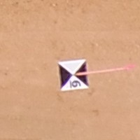
Text on target¶ |
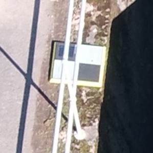
Target below guard rails¶ |
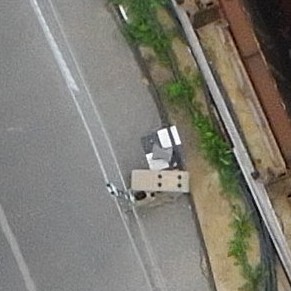
Objects on target¶ |
Troubleshooting
Below are some things to check when there are problems with AutoGCPs.
Processing must always be done within the
if __name__ == "__main__"clause, or hard-to-debug issues may appear.If no image marks are obtained using supported targets, most likely the coordinate systems are not set correctly. Make sure that the CP and output coordinate systems are the same, and that they are correct.
Make sure that the coordinate system settings are applied before running the initial calibration task. This ensures that the settings are correctly taken into account and applied to the outputs.
When image georeferencing is poor, or when CP targets are close to each other, users should pay special attention to the configuration of the georeferencing uncertainty in
Config. Currently, the handling of different coordinate systems byCPMarkeris rather primitive. The uncertainty options thus have, by default, always the same numerical value regardless of the coordinate system length units in use (e.g., meters, feet,… ). This implies that, in the challenging situations mentioned above, the default value may be too large if metric units are in use, or too small if imperial units are used. In these cases, more reliable results are obtained by making sure that uncertainty is manually set to realistic values, taking into account the length units used in the project.If CP targets are too close to each other, i.e. at a distance smaller or comparable to the image georeferencing uncertainty, the algorithm may incorrectly assign some image marks to the wrong CP target.